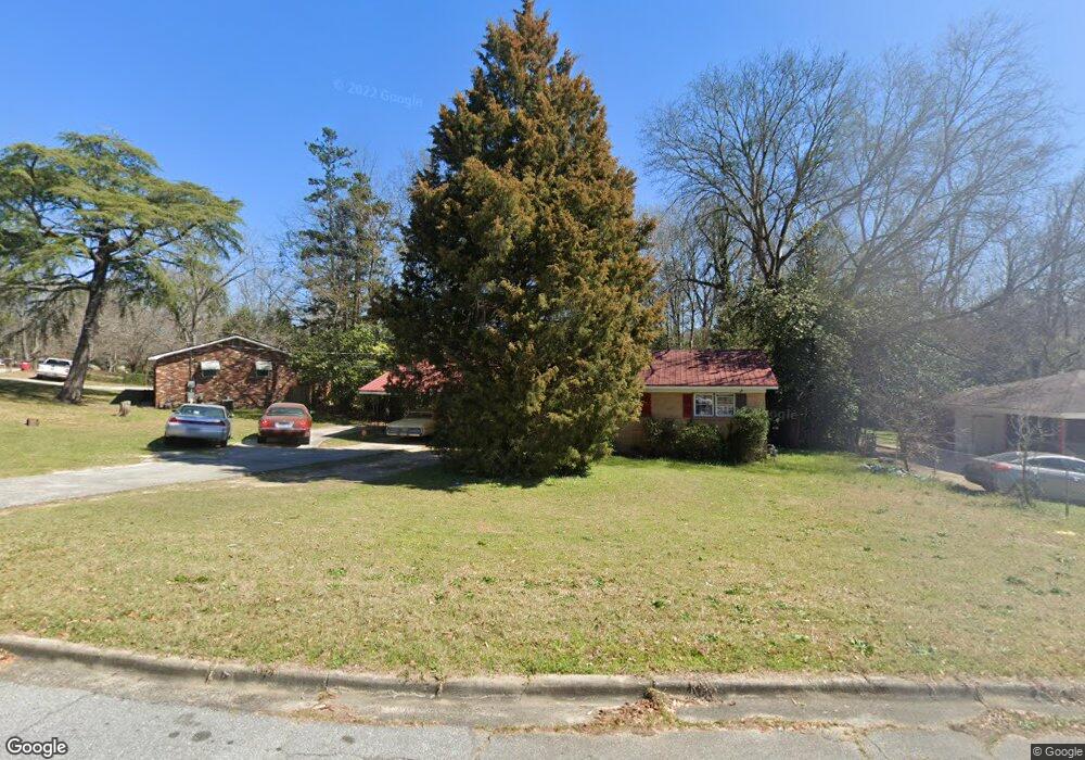
2511 Derrell Dr Macon, GA 31217
Estimated Value: $112,544 - $143,000
3
Beds
2
Baths
1,370
Sq Ft
$90/Sq Ft
Est. Value
About This Home
This home is located at 2511 Derrell Dr, Macon, GA 31217 and is currently estimated at $123,636, approximately $90 per square foot. 2511 Derrell Dr is a home located in Bibb County with nearby schools including Martin Luther King Jr. Elementary School, Appling Middle School, and Northeast High School.
Ownership History
Date
Name
Owned For
Owner Type
Purchase Details
Closed on
Jan 27, 2023
Sold by
Lunsford Family Properties Llc
Bought by
Greenflower 23A Llc
Current Estimated Value
Home Financials for this Owner
Home Financials are based on the most recent Mortgage that was taken out on this home.
Original Mortgage
$5,434,000
Outstanding Balance
$4,260,507
Interest Rate
6.27%
Mortgage Type
New Conventional
Estimated Equity
-$4,136,871
Purchase Details
Closed on
Dec 18, 2014
Sold by
Morgan Pamela L
Bought by
Gray Vestors Llc
Purchase Details
Closed on
Dec 4, 2014
Sold by
Morgan Pamela Lee and Hubbard Joan M
Bought by
Morgan Pamela Lee
Purchase Details
Closed on
Sep 9, 2014
Sold by
Hubbard Thomas W By Admin
Bought by
Hubbard Joan M
Purchase Details
Closed on
May 7, 1996
Sold by
Taylor Deborah L
Bought by
Hubbard Thomas W and Hubbard Joan M
Create a Home Valuation Report for This Property
The Home Valuation Report is an in-depth analysis detailing your home's value as well as a comparison with similar homes in the area
Home Values in the Area
Average Home Value in this Area
Purchase History
| Date | Buyer | Sale Price | Title Company |
|---|---|---|---|
| Greenflower 23A Llc | -- | -- | |
| Gray Vestors Llc | $18,000 | -- | |
| Morgan Pamela Lee | -- | None Available | |
| Hubbard Joan M | -- | -- | |
| Hubbard Thomas W | $62,500 | -- |
Source: Public Records
Mortgage History
| Date | Status | Borrower | Loan Amount |
|---|---|---|---|
| Open | Greenflower 23A Llc | $5,434,000 |
Source: Public Records
Tax History Compared to Growth
Tax History
| Year | Tax Paid | Tax Assessment Tax Assessment Total Assessment is a certain percentage of the fair market value that is determined by local assessors to be the total taxable value of land and additions on the property. | Land | Improvement |
|---|---|---|---|---|
| 2025 | $900 | $36,624 | $2,820 | $33,804 |
| 2024 | $930 | $36,624 | $2,820 | $33,804 |
| 2023 | $852 | $33,563 | $2,820 | $30,743 |
| 2022 | $859 | $24,814 | $2,619 | $22,195 |
| 2021 | $695 | $18,293 | $1,746 | $16,547 |
| 2020 | $608 | $15,656 | $1,455 | $14,201 |
| 2019 | $613 | $15,656 | $1,455 | $14,201 |
| 2018 | $1,119 | $15,656 | $1,455 | $14,201 |
| 2017 | $587 | $15,656 | $1,455 | $14,201 |
| 2016 | $542 | $15,656 | $1,455 | $14,201 |
| 2015 | $353 | $16,141 | $1,940 | $14,201 |
| 2014 | $582 | $16,409 | $2,910 | $13,499 |
Source: Public Records
Map
Nearby Homes
- 2792 Skyline Dr
- 2229 New Clinton Rd
- 2630 Pauladale Dr
- 2954 Tyler Place
- 3048 Bethune Ave
- 2458 Tredway Dr
- 2146 Melton Ave
- 2815 New Clinton Rd
- 2130 New Clinton Rd
- 3128 Commodore Dr
- 2371 Kensington Rd
- 3154 Bethune Ave
- 2940 Shurling Dr
- 3145 Pasadena Dr
- 2066 Melton Ave
- 240 Neptune Ct
- 2557 Hyde Park Rd
- 2720 Jordan Ave
- 2499 Clearwater Cir
- 2525 Derrell Dr
- 2487 Clearwater Cir
- 2461 Derrell Dr
- 2512 Derrell Dr
- 2539 Derrell Dr
- 2520 Derrell Dr
- 2528 Derrell Dr
- 2453 Derrell Dr
- 2475 Clearwater Cir
- 2442 Derrell Dr
- 2551 Willis Dr
- 2557 Derrell Dr
- 2559 Willis Dr
- 2448 Donald Ave
- 2360 Holiday Dr
- 2543 Willis Dr
- 2445 Derrell Dr
- 2511 Willis Dr
- 2352 Holiday Dr