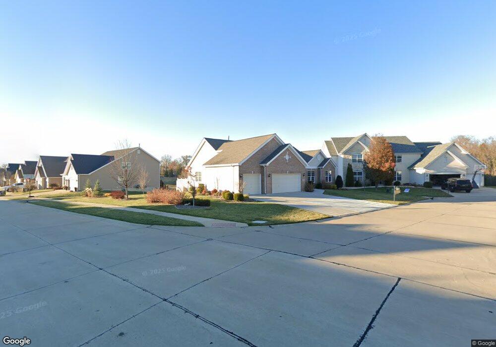
2511 Devonhurst Cir Unit 46 Saint Louis, MO 63129
Estimated Value: $558,000 - $650,000
3
Beds
2
Baths
2,664
Sq Ft
$224/Sq Ft
Est. Value
About This Home
This home is located at 2511 Devonhurst Cir Unit 46, Saint Louis, MO 63129 and is currently estimated at $598,025, approximately $224 per square foot. 2511 Devonhurst Cir Unit 46 is a home located in St. Louis County with nearby schools including Point Elementary School, Oakville Middle School, and Oakville Senior High School.
Ownership History
Date
Name
Owned For
Owner Type
Purchase Details
Closed on
May 17, 2013
Sold by
Proehl Richard C and Proehl Helen R
Bought by
Fralicx Rodney D and Franlicx Marcia J
Current Estimated Value
Purchase Details
Closed on
Sep 23, 2011
Sold by
Mcbride & Son Homes Inc
Bought by
Proehl Richard C and Proehl Helen R
Home Financials for this Owner
Home Financials are based on the most recent Mortgage that was taken out on this home.
Original Mortgage
$240,000
Interest Rate
4.24%
Mortgage Type
New Conventional
Create a Home Valuation Report for This Property
The Home Valuation Report is an in-depth analysis detailing your home's value as well as a comparison with similar homes in the area
Home Values in the Area
Average Home Value in this Area
Purchase History
| Date | Buyer | Sale Price | Title Company |
|---|---|---|---|
| Fralicx Rodney D | $345,000 | Us Title Main | |
| Proehl Richard C | $353,520 | Multiple |
Source: Public Records
Mortgage History
| Date | Status | Borrower | Loan Amount |
|---|---|---|---|
| Previous Owner | Proehl Richard C | $240,000 |
Source: Public Records
Tax History Compared to Growth
Tax History
| Year | Tax Paid | Tax Assessment Tax Assessment Total Assessment is a certain percentage of the fair market value that is determined by local assessors to be the total taxable value of land and additions on the property. | Land | Improvement |
|---|---|---|---|---|
| 2025 | $6,923 | $91,040 | $18,920 | $72,120 |
| 2024 | $6,923 | $103,410 | $18,920 | $84,490 |
| 2023 | $6,834 | $103,410 | $18,920 | $84,490 |
| 2022 | $5,043 | $76,610 | $11,420 | $65,190 |
| 2021 | $4,880 | $76,610 | $11,420 | $65,190 |
| 2020 | $5,552 | $82,960 | $14,480 | $68,480 |
| 2019 | $5,535 | $82,960 | $14,480 | $68,480 |
| 2018 | $4,844 | $65,510 | $9,630 | $55,880 |
| 2017 | $4,837 | $65,510 | $9,630 | $55,880 |
| 2016 | $4,798 | $62,340 | $9,630 | $52,710 |
| 2015 | $4,403 | $62,340 | $9,630 | $52,710 |
| 2014 | $3,892 | $54,510 | $9,750 | $44,760 |
Source: Public Records
Map
Nearby Homes
- 6568 Devonhurst Dr
- 120 River Breeze Way
- 100 River Breeze Way
- 6766 Dry Mill Ct
- 2771 Cliffwood Trail
- 160 River Breeze Way
- 315 Buford Landing
- 6116 Arbor Green Dr
- 6834 Black Water Dr
- 6841 River Bow Ct
- 2680 Cripple Creek Dr
- 156 Tori Pines Dr Unit 55
- 2943 Marchbanks Place
- 2634 Brantley Ct
- 2995 Point Dr
- 5842 Rabbit Run Dr
- 6018 Gatling Dr
- 116 Pioneer Dr
- 2581 Christopher Oaks Ct
- 5810 Flaming Leaf Ct
- 2511 Devonhurst Cir
- 6551 Devon Hurst Dr
- 2507 Devonhurst Cir
- 6527 Devonhurst Dr
- 6520 Devonhurst Dr
- 6524 Devonhurst Dr
- 2502 Devon Hurst Cir
- 6516 Devonhurst Dr
- 6531 Devonhurst Dr
- 2506 Devonhurst Cir
- 6528 Devonhurst Dr
- 6515 Devonhurst Dr
- 6532 Devon Hurst Dr
- 6535 Devonhurst Dr
- 6527 Christopher Dr
- 6511 Devonhurst Dr
- 6536 Devonhurst Dr
- 6539 Devon Hurst Dr
- 6540 Devon Hurst Dr
- 6507 Devonhurst Dr