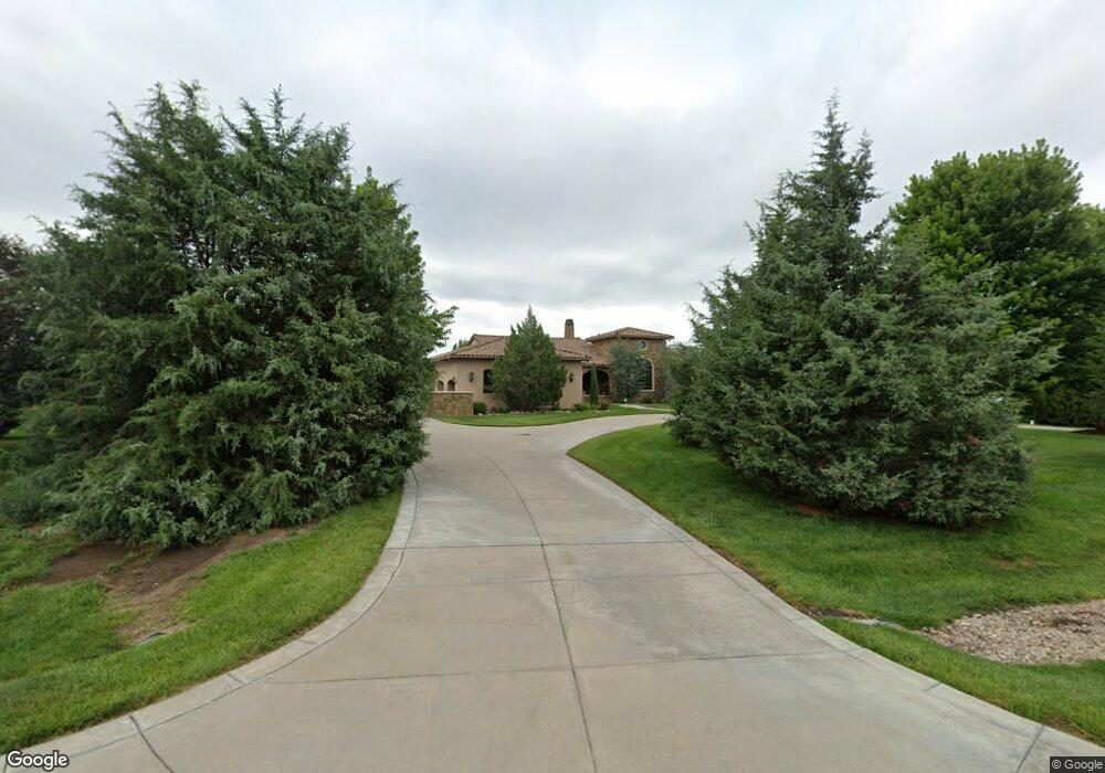
2511 E Flint Hills National Pkwy Andover, KS 67002
Estimated Value: $306,000 - $1,530,000
4
Beds
6
Baths
4,641
Sq Ft
$232/Sq Ft
Est. Value
About This Home
This home is located at 2511 E Flint Hills National Pkwy, Andover, KS 67002 and is currently estimated at $1,076,611, approximately $231 per square foot. 2511 E Flint Hills National Pkwy is a home located in Butler County with nearby schools including Prairie Creek Elementary School, Andover Central Middle School, and Andover Central High School.
Ownership History
Date
Name
Owned For
Owner Type
Purchase Details
Closed on
Sep 9, 2025
Sold by
Donald D Sbarra Revocable Trust and Sbarra Susana
Bought by
Donald D Sbarra Marital Trust and Donald D Sbarra Revocable Trust
Current Estimated Value
Purchase Details
Closed on
Sep 24, 2007
Sold by
Flint Hills Company Lc
Bought by
Sbarra Donald D
Purchase Details
Closed on
Sep 20, 2007
Sold by
Flint Hills Company Lc
Bought by
Sbarra Donald D
Create a Home Valuation Report for This Property
The Home Valuation Report is an in-depth analysis detailing your home's value as well as a comparison with similar homes in the area
Home Values in the Area
Average Home Value in this Area
Purchase History
| Date | Buyer | Sale Price | Title Company |
|---|---|---|---|
| Donald D Sbarra Marital Trust | -- | None Listed On Document | |
| Donald D Sbarra Marital Trust | -- | None Listed On Document | |
| Sbarra Donald D | -- | -- | |
| Sbarra Donald D | -- | -- |
Source: Public Records
Tax History Compared to Growth
Tax History
| Year | Tax Paid | Tax Assessment Tax Assessment Total Assessment is a certain percentage of the fair market value that is determined by local assessors to be the total taxable value of land and additions on the property. | Land | Improvement |
|---|---|---|---|---|
| 2025 | $279 | $195,052 | $25,990 | $169,062 |
| 2024 | $279 | $182,200 | $20,240 | $161,960 |
| 2023 | $26,949 | $176,893 | $20,240 | $156,653 |
| 2022 | $26,814 | $166,129 | $21,275 | $144,854 |
| 2021 | $28,083 | $150,925 | $21,275 | $129,650 |
| 2020 | $27,116 | $154,015 | $21,275 | $132,740 |
| 2019 | $30,006 | $170,309 | $21,275 | $149,034 |
| 2018 | $28,222 | $160,207 | $21,275 | $138,932 |
| 2017 | $28,968 | $164,818 | $21,275 | $143,543 |
| 2014 | -- | $1,198,600 | $185,000 | $1,013,600 |
Source: Public Records
Map
Nearby Homes
- 1302 E Bluestem Ct
- 1412 E Juniper Crest Ct
- 1402 E Bluesage Ct
- 1408 E Bluesage Ct
- 1524 E Flint Hills National Pkwy
- 1406 E Flint Hills National Pkwy
- 103 E Prairie Point Ct
- 1219 E Flint Hills National Pkwy
- 1218 E Flint Hills National Pkwy
- 1033 E Flint Hills National Pkwy
- 1101 E Flint Hills National Pkwy
- 1133 E Flint Hills National Pkwy
- 320 E Flint Hills National Ct
- 1102 E Flint Hills National Pkwy
- 123 E Pine Meadow Ct
- Churchill Plan at Flint Hills National
- 211 Cedar Ridge Ct
- 12203 SW Valleyview Rd
- 14151 SW Quentin Rd
- 12241 SW Mockingbird Rd
- 2511 E Flint Hills National Pkwy
- 2605 E Flint Hills National Pkwy
- 1401 E Bluestem Ct
- 2627 E Flint Hills National Pkwy
- 1307 E Bluestem Ct
- 2418 E Flint Hills National Pkwy
- 1416 E Bluestem Ct
- 1117 E Bluestem Ct
- 2715 E Flint Hills National Pkwy
- 1318 E Bluestem Ct
- 15103 SW 130th St
- 1212 E Bluestem Ct
- 2308 E Flint Hills National Pkwy
- 1116 E Bluestem Ct
- 2801 E Flint Hills National Pkwy
- 1021 E Bluestem Ct
- 2801 E Flint Hills National Pkwy
- 2230 E Flint Hills National Pkwy
- 1425 E Juniper Crest Ct
- 0 SW 130th St