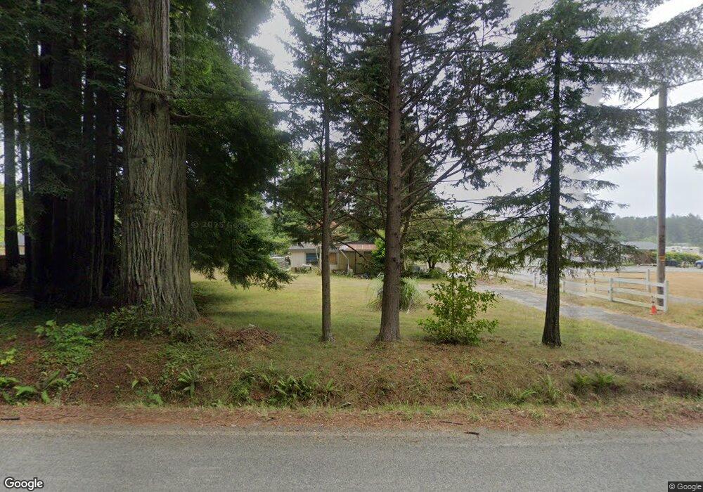
2511 Moorehead Rd Crescent City, CA 95531
Estimated Value: $112,068 - $293,000
2
Beds
1
Bath
1,044
Sq Ft
$197/Sq Ft
Est. Value
About This Home
This home is located at 2511 Moorehead Rd, Crescent City, CA 95531 and is currently estimated at $206,017, approximately $197 per square foot. 2511 Moorehead Rd is a home located in Del Norte County with nearby schools including Redwood Elementary School, Crescent Elk Middle School, and Del Norte High School.
Ownership History
Date
Name
Owned For
Owner Type
Purchase Details
Closed on
Apr 20, 2023
Sold by
Hamilton Lise
Bought by
Hamilton Lise
Current Estimated Value
Purchase Details
Closed on
Aug 24, 2021
Sold by
Vargas Gilbert A and Vargas Candice A
Bought by
Vargas Gil Anthony and Elorza Vargas Candice
Purchase Details
Closed on
Jul 23, 2018
Sold by
Mcclaftin Tamara
Bought by
Vargas Gilbert A and Vargas Candice A E
Purchase Details
Closed on
Jun 21, 2008
Sold by
Reynolds April D
Bought by
Cushman Bonnie and Bonnie Cushman Living Trust
Create a Home Valuation Report for This Property
The Home Valuation Report is an in-depth analysis detailing your home's value as well as a comparison with similar homes in the area
Home Values in the Area
Average Home Value in this Area
Purchase History
| Date | Buyer | Sale Price | Title Company |
|---|---|---|---|
| Hamilton Lise | -- | None Listed On Document | |
| Vargas Gil Anthony | -- | None Available | |
| Vargas Gilbert A | $55,000 | Crescent Land Title | |
| Cushman Bonnie | -- | None Available |
Source: Public Records
Tax History Compared to Growth
Tax History
| Year | Tax Paid | Tax Assessment Tax Assessment Total Assessment is a certain percentage of the fair market value that is determined by local assessors to be the total taxable value of land and additions on the property. | Land | Improvement |
|---|---|---|---|---|
| 2025 | $647 | $61,350 | $55,774 | $5,576 |
| 2024 | $647 | $60,148 | $54,681 | $5,467 |
| 2023 | $633 | $58,969 | $53,609 | $5,360 |
| 2022 | $611 | $57,813 | $52,558 | $5,255 |
| 2021 | $608 | $56,680 | $51,528 | $5,152 |
| 2020 | $674 | $62,779 | $48,709 | $14,070 |
| 2019 | $663 | $61,549 | $47,754 | $13,795 |
| 2018 | $650 | $60,343 | $46,818 | $13,525 |
| 2017 | $639 | $59,160 | $45,900 | $13,260 |
| 2016 | $617 | $56,952 | $46,598 | $10,354 |
| 2015 | $603 | $56,098 | $45,899 | $10,199 |
| 2014 | $597 | $55,249 | $45,204 | $10,045 |
Source: Public Records
Map
Nearby Homes
- 000 Cody Ln
- 185 Quail Ln
- 140 Red Robin Place
- 124 Red Hawk Ln
- 6701 Us Highway 101 N Unit 305
- 6251 Kings Valley Rd
- 185 Boomer Ln
- 27 Skookum Ln
- 100 Skookum Ln
- 300 Cedar Lodge Ln
- 320 Cedar Lodge Ln
- 221 Mud Hen
- 0 Bailey Rd Unit 12127801
- 0 Bailey Rd Unit 250113
- 205 Staley Ln
- 5481 Lake Earl Dr
- 200 Bareggi Ln
- 106 Hillside Dr
- 140 Nadine Ln
- 5881 S Bank Rd
- 2511 Morehead Rd
- 2521 Moorehead Rd
- 2501 Morehead Rd
- 2549 Moorehead Rd
- 2550 Morehead Rd Unit Tomasini
- 2485 Morehead Rd
- 2575 Moorehead Rd
- 2555 Morehead Rd
- 6640 Lake Earl Dr
- 6650 Lake Earl Dr
- 6550 Lake Earl Dr
- 6666 Lake Earl Dr
- 6630 Lake Earl Dr
- 18 Skinny's
- 6655 Lake Earl Dr
- 6661 Lake Earl Dr
- 6750 Lake Earl Dr
- 6659 Lake Earl Dr
- 6740 Lake Earl Dr
- 6688 Kings Valley Rd
