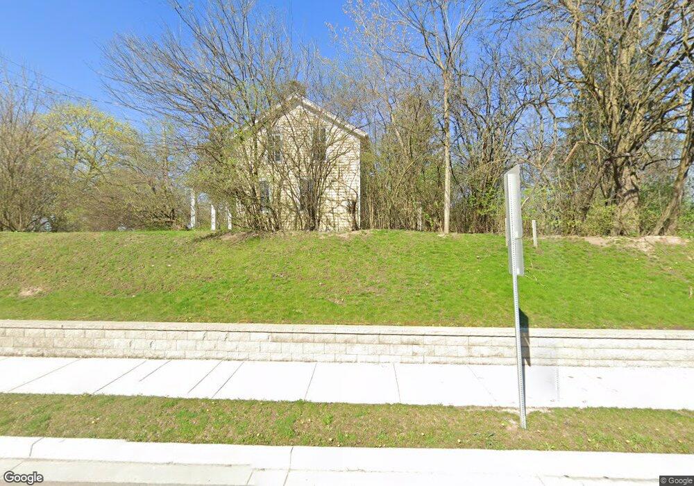
2511 Pontiac Trail Ann Arbor, MI 48105
Northern Ann Arbor NeighborhoodEstimated Value: $451,436 - $533,000
3
Beds
2
Baths
1,692
Sq Ft
$284/Sq Ft
Est. Value
About This Home
This home is located at 2511 Pontiac Trail, Ann Arbor, MI 48105 and is currently estimated at $479,859, approximately $283 per square foot. 2511 Pontiac Trail is a home located in Washtenaw County with nearby schools including Ann Arbor STEAM at Northside, Clague Middle School, and Skyline High School.
Ownership History
Date
Name
Owned For
Owner Type
Purchase Details
Closed on
Jan 13, 2006
Sold by
Forshee Virginia A
Bought by
Siekmeier Jessie E and Jessie E Siekmeier Revocable Living Tr
Current Estimated Value
Purchase Details
Closed on
Sep 21, 2005
Sold by
Scott Dorothy Forshee and Scott Verne H
Bought by
Mw Land Llc
Purchase Details
Closed on
Aug 28, 2003
Sold by
Forshee Virginia A
Bought by
Forshee Virginia A
Create a Home Valuation Report for This Property
The Home Valuation Report is an in-depth analysis detailing your home's value as well as a comparison with similar homes in the area
Home Values in the Area
Average Home Value in this Area
Purchase History
| Date | Buyer | Sale Price | Title Company |
|---|---|---|---|
| Siekmeier Jessie E | $202,200 | None Available | |
| Mw Land Llc | -- | -- | |
| Forshee Virginia A | -- | -- | |
| Forshee Virginia A | -- | -- | |
| Forshee Virginia A | -- | -- |
Source: Public Records
Tax History Compared to Growth
Tax History
| Year | Tax Paid | Tax Assessment Tax Assessment Total Assessment is a certain percentage of the fair market value that is determined by local assessors to be the total taxable value of land and additions on the property. | Land | Improvement |
|---|---|---|---|---|
| 2025 | $2,409 | $220,300 | $0 | $0 |
| 2024 | $4,271 | $214,700 | $0 | $0 |
| 2023 | $4,074 | $176,000 | $0 | $0 |
| 2022 | $6,198 | $166,600 | $0 | $0 |
| 2021 | $6,015 | $161,900 | $0 | $0 |
| 2020 | $6,009 | $150,330 | $0 | $0 |
| 2019 | $5,688 | $147,990 | $147,990 | $0 |
| 2018 | $5,591 | $146,570 | $69,370 | $77,200 |
| 2017 | $5,353 | $113,010 | $0 | $0 |
| 2016 | $3,328 | $103,403 | $0 | $0 |
| 2015 | -- | $103,094 | $0 | $0 |
| 2014 | -- | $99,874 | $0 | $0 |
| 2013 | -- | $99,874 | $0 | $0 |
Source: Public Records
Map
Nearby Homes
- 2757 Polson St
- The Keswick End Walkout Plan at Bristol Ridge Townhomes
- The Highbridge Plan at Bristol Ridge Townhomes
- The Keswick Interior Walkout Plan at Bristol Ridge Townhomes
- The Keswick End Viewout Plan at Bristol Ridge Townhomes
- 2778 Bristol Ridge Dr Unit 38
- The Keswick Interior Viewout Plan at Bristol Ridge Townhomes
- 2768 Bristol Ridge Dr Unit 33
- 2776 Bristol Ridge Dr Unit 37
- 2772 Bristol Ridge Dr Unit 35
- 2774 Bristol Ridge Dr Unit 36
- 634 Manor Dr
- 2865 Dillon Dr
- 352 Manor Dr
- 2678 S Knightsbridge Cir Unit 24
- 359 Brookside Dr
- 822 Starwick Dr
- 144 Barton Dr
- 1713 Pontiac Trail
- Morenci Plan at Barton Ridge
- 2419 Pontiac Trail
- 619 Skydale Dr
- 2520 Pontiac Trail
- 605 Skydale Dr
- 549 Skydale Dr
- 632 Skydale Dr
- 535 Skydale Dr
- 612 Skydale Dr
- 2387 Pontiac Trail
- 2600 Pontiac Trail
- 521 Skydale Dr
- 684 Cloverdale St
- 536 Skydale Dr
- 507 Skydale Dr
- 672 Cloverdale St
- 681 Cloverdale St
- 2363 Pontiac Trail
- 473 Skydale Dr
- 514 Skydale Dr
- 667 Cloverdale St