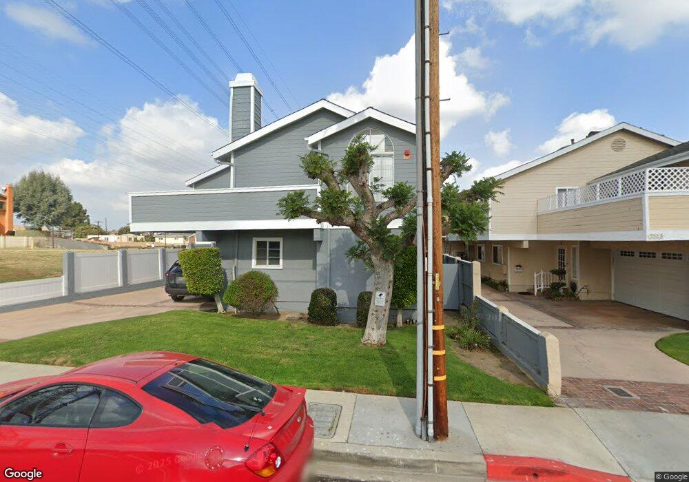
2511 Rockefeller Ln Unit 1 Redondo Beach, CA 90278
North Redondo Beach NeighborhoodEstimated Value: $1,079,307 - $1,269,000
3
Beds
3
Baths
1,641
Sq Ft
$693/Sq Ft
Est. Value
About This Home
This home is located at 2511 Rockefeller Ln Unit 1, Redondo Beach, CA 90278 and is currently estimated at $1,136,577, approximately $692 per square foot. 2511 Rockefeller Ln Unit 1 is a home located in Los Angeles County with nearby schools including Washington Elementary School, Adams Middle School, and Redondo Union High School.
Ownership History
Date
Name
Owned For
Owner Type
Purchase Details
Closed on
Mar 24, 2016
Sold by
Umehira Todd E and Mcguinness Tiffany Maureen
Bought by
Umehira Mcguinness Family Trust
Current Estimated Value
Home Financials for this Owner
Home Financials are based on the most recent Mortgage that was taken out on this home.
Original Mortgage
$517,000
Outstanding Balance
$409,203
Interest Rate
3.65%
Mortgage Type
New Conventional
Estimated Equity
$727,374
Purchase Details
Closed on
Jul 17, 2015
Sold by
Umehira Todd and Mcguinness Tiffany Maureen
Bought by
The Umehira Mcguinness Family Trust
Purchase Details
Closed on
Nov 14, 2013
Sold by
Umehira Todd
Bought by
Umehira Todd and Mcguinness Tiffany Maureen
Home Financials for this Owner
Home Financials are based on the most recent Mortgage that was taken out on this home.
Original Mortgage
$535,000
Interest Rate
4.18%
Mortgage Type
New Conventional
Purchase Details
Closed on
Nov 13, 2013
Sold by
Narasaki Joni and Umehira Joni
Bought by
Umehira Todd
Home Financials for this Owner
Home Financials are based on the most recent Mortgage that was taken out on this home.
Original Mortgage
$535,000
Interest Rate
4.18%
Mortgage Type
New Conventional
Purchase Details
Closed on
Jul 5, 2007
Sold by
Jones Michelle L
Bought by
Umehira Todd and Umehira Joni
Home Financials for this Owner
Home Financials are based on the most recent Mortgage that was taken out on this home.
Original Mortgage
$471,200
Interest Rate
6.12%
Mortgage Type
Purchase Money Mortgage
Purchase Details
Closed on
Jan 2, 2002
Sold by
Jones Michelle and Murray Denis R
Bought by
Jones Michelle L
Purchase Details
Closed on
Aug 7, 1995
Sold by
Wells R Jeffrey and Wais Mary E
Bought by
Torri Theresa and Jones Michelle L
Home Financials for this Owner
Home Financials are based on the most recent Mortgage that was taken out on this home.
Original Mortgage
$155,000
Interest Rate
7.88%
Create a Home Valuation Report for This Property
The Home Valuation Report is an in-depth analysis detailing your home's value as well as a comparison with similar homes in the area
Home Values in the Area
Average Home Value in this Area
Purchase History
| Date | Buyer | Sale Price | Title Company |
|---|---|---|---|
| Umehira Mcguinness Family Trust | -- | Nextitle | |
| Umehira Todd E | -- | Nextitle | |
| The Umehira Mcguinness Family Trust | -- | None Available | |
| Umehira Todd | -- | Wfg Title Company Of Ca | |
| Umehira Todd | -- | Wfg Title Company Of Ca | |
| Umehira Todd | $589,000 | Southland Title | |
| Jones Michelle L | -- | -- | |
| Torri Theresa | $184,590 | Guardian Title Company |
Source: Public Records
Mortgage History
| Date | Status | Borrower | Loan Amount |
|---|---|---|---|
| Open | Umehira Todd E | $517,000 | |
| Closed | Umehira Todd | $535,000 | |
| Closed | Umehira Todd | $471,200 | |
| Previous Owner | Torri Theresa | $155,000 |
Source: Public Records
Tax History Compared to Growth
Tax History
| Year | Tax Paid | Tax Assessment Tax Assessment Total Assessment is a certain percentage of the fair market value that is determined by local assessors to be the total taxable value of land and additions on the property. | Land | Improvement |
|---|---|---|---|---|
| 2025 | $9,162 | $773,644 | $511,213 | $262,431 |
| 2024 | $9,162 | $758,476 | $501,190 | $257,286 |
| 2023 | $8,998 | $743,605 | $491,363 | $252,242 |
| 2022 | $8,834 | $729,026 | $481,729 | $247,297 |
| 2021 | $8,593 | $714,733 | $472,284 | $242,449 |
| 2019 | $8,384 | $693,535 | $458,277 | $235,258 |
| 2018 | $8,143 | $679,938 | $449,292 | $230,646 |
| 2016 | $7,878 | $653,538 | $431,847 | $221,691 |
| 2015 | $7,736 | $643,722 | $425,361 | $218,361 |
| 2014 | $7,624 | $631,113 | $417,029 | $214,084 |
Source: Public Records
Map
Nearby Homes
- 2602 Carnegie Ln
- 2607 Grant Ave Unit A
- 2615 Rockefeller Ln
- 2604 Grant Ave Unit A
- 2604 Grant Ave Unit C
- 2604 Grant Ave Unit B
- 2517 Huntington Ln Unit B
- 2609 Vanderbilt Ln Unit 4
- 2607 Huntington Ln
- 2706 Grant Ave Unit A
- 2005 Phelan Ln
- 2719 Grant Ave Unit C
- 2317 Carnegie Ln Unit B
- 2405 Mathews Ave Unit C
- 2405 Mathews Ave Unit B
- 2750 Artesia Blvd Unit 341
- 2750 Artesia Blvd Unit 364
- 2750 Artesia Blvd Unit 110
- 2603 Nelson Ave Unit B
- 2321 Clark Ln Unit B
- 2511 Rockefeller Ln Unit 3
- 2511 Rockefeller Ln Unit 2
- 2513 Rockefeller Ln Unit 3
- 2513 Rockefeller Ln Unit 2
- 2513 Rockefeller Ln Unit 1
- 2515 Rockefeller Ln
- 2515 Rockefeller Ln Unit C
- 2515 Rockefeller Ln Unit B
- 2515 Rockefeller Ln Unit A
- 2517 Rockefeller Ln Unit C
- 2517 Rockefeller Ln Unit B
- 2517 Rockefeller Ln Unit A
- 2510 Carnegie Ln Unit A
- 2510 Carnegie Ln Unit 2510 Carnegie Lane u
- 2510 Carnegie Ln
- 2512 Carnegie Ln
- 2514 Carnegie Ln
- 2514 Carnegie Ln Unit 5
- 2519 Rockefeller Ln Unit B
- 2519 Rockefeller Ln Unit C