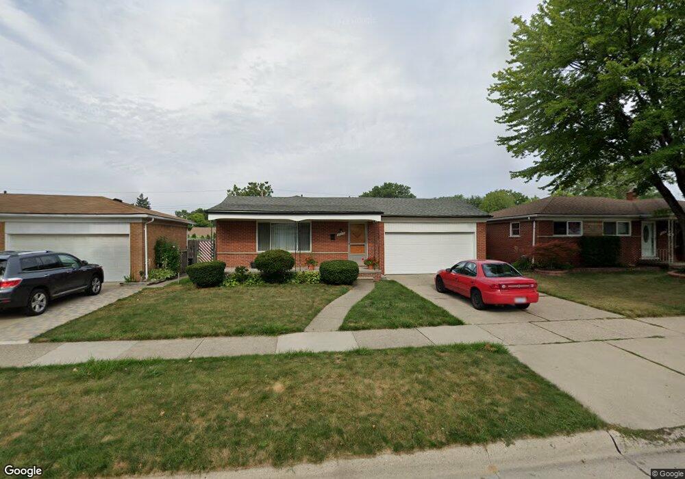
25115 Loretta Ave Unit Bldg-Unit Warren, MI 48091
Southwest Warren NeighborhoodEstimated Value: $217,000 - $241,000
3
Beds
2
Baths
1,203
Sq Ft
$190/Sq Ft
Est. Value
About This Home
This home is located at 25115 Loretta Ave Unit Bldg-Unit, Warren, MI 48091 and is currently estimated at $228,684, approximately $190 per square foot. 25115 Loretta Ave Unit Bldg-Unit is a home located in Macomb County with nearby schools including Mark C. Roose Elementary School, Center Line High School, and Wolfe Middle School.
Ownership History
Date
Name
Owned For
Owner Type
Purchase Details
Closed on
Jan 16, 2026
Sold by
Islam Kazi Ebadul
Bought by
Islam Kazi Mufidul
Current Estimated Value
Home Financials for this Owner
Home Financials are based on the most recent Mortgage that was taken out on this home.
Original Mortgage
$148,000
Outstanding Balance
$147,858
Interest Rate
6.18%
Mortgage Type
New Conventional
Estimated Equity
$80,826
Purchase Details
Closed on
Dec 11, 2017
Sold by
Lemanski Anthony and Lemanski Mary Anne
Bought by
Islam Kazi and Islam Kazi Ebadul
Home Financials for this Owner
Home Financials are based on the most recent Mortgage that was taken out on this home.
Original Mortgage
$90,000
Interest Rate
3.94%
Mortgage Type
New Conventional
Purchase Details
Closed on
Jun 29, 2016
Sold by
Lemanski Anthony and Lemanski Mary Anne
Bought by
Lemanski Anthony and Lemanski Mary Anne
Create a Home Valuation Report for This Property
The Home Valuation Report is an in-depth analysis detailing your home's value as well as a comparison with similar homes in the area
Home Values in the Area
Average Home Value in this Area
Purchase History
| Date | Buyer | Sale Price | Title Company |
|---|---|---|---|
| Islam Kazi Mufidul | $238,000 | Vanguard Title | |
| Islam Kazi | $120,000 | Visionary Title Agency Llc | |
| Lemanski Anthony | -- | None Available |
Source: Public Records
Mortgage History
| Date | Status | Borrower | Loan Amount |
|---|---|---|---|
| Open | Islam Kazi Mufidul | $148,000 | |
| Previous Owner | Islam Kazi | $90,000 |
Source: Public Records
Tax History
| Year | Tax Paid | Tax Assessment Tax Assessment Total Assessment is a certain percentage of the fair market value that is determined by local assessors to be the total taxable value of land and additions on the property. | Land | Improvement |
|---|---|---|---|---|
| 2025 | $5,124 | $104,740 | $0 | $0 |
| 2024 | $50 | $94,760 | $0 | $0 |
| 2023 | $4,651 | $82,460 | $0 | $0 |
| 2022 | $4,529 | $74,030 | $0 | $0 |
| 2021 | $4,428 | $70,460 | $0 | $0 |
| 2020 | $4,437 | $67,410 | $0 | $0 |
| 2019 | $4,134 | $65,910 | $0 | $0 |
| 2018 | $4,147 | $52,340 | $0 | $0 |
| 2017 | $2,105 | $45,920 | $6,140 | $39,780 |
| 2016 | $2,088 | $45,920 | $0 | $0 |
| 2015 | -- | $36,330 | $0 | $0 |
| 2013 | $4,459 | $35,480 | $0 | $0 |
Source: Public Records
Map
Nearby Homes
- 4949 E 10 Mile Rd
- 4973 E 10 Mile Rd Unit 8
- 4925 E 10 Mile Rd Unit 1
- 24955 Beierman Ave
- 4225 Kiefer Ave
- 4510 Marr Ave
- 4245 Kiefer Ave
- 24609 Eureka Ave
- 24906 Patricia Ave
- 24756 Hill Ave
- 4320 Frazho Rd
- 25808 Ryan Rd
- 4251 Dolores Ave
- 26112 Cunningham Dr
- 4715 Shell Ct
- 3440 E 10 Mile Rd
- 24134 Loretta Ave
- 24245 Patricia Ave
- 5442 Stanford Ct
- 24025 Cunningham Ave
- 25115 Loretta Ave
- 25127 Loretta Ave
- 25103 Loretta Ave
- 25077 Loretta Ave
- 25139 Loretta Ave
- 25116 Cunningham Ave
- 25104 Cunningham Ave
- 25128 Cunningham Ave
- 25065 Loretta Ave
- 25151 Loretta Ave
- 25082 Cunningham Ave
- 25140 Cunningham Ave
- 25116 Loretta Ave Unit Bldg-Unit
- 25116 Loretta Ave
- 25070 Cunningham Ave
- 25104 Loretta Ave
- 25128 Loretta Ave
- 25053 Loretta Ave
- 25163 Loretta Ave
- 25152 Cunningham Ave
Your Personal Tour Guide
Ask me questions while you tour the home.