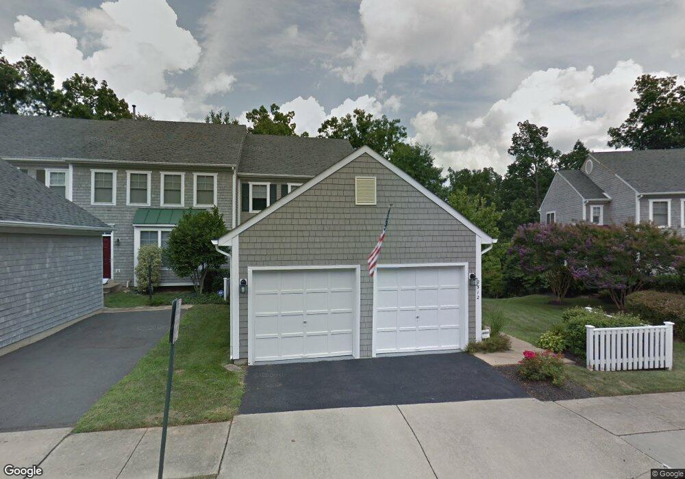
2512 Brenton Point Dr Reston, VA 20191
Estimated Value: $996,000 - $1,049,948
3
Beds
4
Baths
2,206
Sq Ft
$463/Sq Ft
Est. Value
About This Home
This home is located at 2512 Brenton Point Dr, Reston, VA 20191 and is currently estimated at $1,020,737, approximately $462 per square foot. 2512 Brenton Point Dr is a home located in Fairfax County with nearby schools including Terraset Elementary, Langston Hughes Middle School, and South Lakes High School.
Ownership History
Date
Name
Owned For
Owner Type
Purchase Details
Closed on
Dec 15, 1998
Sold by
Brenton Cove Assoc L C
Bought by
Loman Johan G
Current Estimated Value
Home Financials for this Owner
Home Financials are based on the most recent Mortgage that was taken out on this home.
Original Mortgage
$210,000
Outstanding Balance
$47,990
Interest Rate
6.85%
Estimated Equity
$972,747
Create a Home Valuation Report for This Property
The Home Valuation Report is an in-depth analysis detailing your home's value as well as a comparison with similar homes in the area
Home Values in the Area
Average Home Value in this Area
Purchase History
| Date | Buyer | Sale Price | Title Company |
|---|---|---|---|
| Loman Johan G | $338,774 | -- |
Source: Public Records
Mortgage History
| Date | Status | Borrower | Loan Amount |
|---|---|---|---|
| Open | Loman Johan G | $210,000 |
Source: Public Records
Tax History Compared to Growth
Tax History
| Year | Tax Paid | Tax Assessment Tax Assessment Total Assessment is a certain percentage of the fair market value that is determined by local assessors to be the total taxable value of land and additions on the property. | Land | Improvement |
|---|---|---|---|---|
| 2025 | $10,357 | $940,110 | $297,000 | $643,110 |
| 2024 | $10,357 | $859,150 | $283,000 | $576,150 |
| 2023 | $9,665 | $822,170 | $269,000 | $553,170 |
| 2022 | $9,223 | $774,730 | $262,000 | $512,730 |
| 2021 | $9,819 | $804,470 | $262,000 | $542,470 |
| 2020 | $9,076 | $737,620 | $228,000 | $509,620 |
| 2019 | $9,064 | $736,620 | $227,000 | $509,620 |
| 2018 | $8,652 | $752,380 | $227,000 | $525,380 |
| 2017 | $8,629 | $714,360 | $214,000 | $500,360 |
| 2016 | $8,682 | $720,170 | $214,000 | $506,170 |
| 2015 | $8,204 | $705,430 | $214,000 | $491,430 |
| 2014 | $8,187 | $705,430 | $214,000 | $491,430 |
Source: Public Records
Map
Nearby Homes
- 11142 Beaver Trail Ct
- 11116 Beaver Trail Ct Unit 11116
- 11200 Silentwood Ln
- 11184 Silentwood Ln
- 11186 Silentwood Ln
- 2180 Whisperwood Glen Ln
- 1951 Sagewood Ln Unit 315
- 11110 Lakespray Way
- 1933 Lakeport Way
- 2218 Wakerobin Ln
- 2202 Jester Ct
- 10947 Lawyers Rd
- 11234 Hunting Horn Ln
- 10900 Hunter Station Rd
- 11604 Ivystone Ct Unit 6
- 2029 Wethersfield Ct
- 2118 Green Watch Way Unit 10/201C
- 2045 Winged Foot Ct
- 2015 Wethersfield Ct
- 2082 Hunters Crest Way
- 2514 Brenton Point Dr
- 2516 Brenton Point Dr
- 2508 Brenton Point Dr
- 2518 Brenton Point Dr
- 2506 Brenton Point Dr
- 2504 Brenton Point Dr
- 2522 Brenton Point Dr
- 2502 Brenton Point Dr
- 2524 Brenton Point Dr
- 11117 Little Compton Dr
- 11121 Little Compton Dr
- 11119 Little Compton Dr
- 2500 Brenton Point Dr
- 11115 Little Compton Dr
- 11113 Little Compton Dr
- 2526 Brenton Point Dr
- 2539 Brenton Point Dr
- 2528 Brenton Point Dr
- 11125 Little Compton Dr
- 2530 Brenton Point Dr