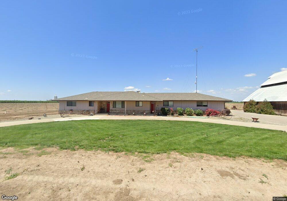
2513 Pear Ave Crows Landing, CA 95313
Estimated Value: $669,000 - $1,246,353
3
Beds
1
Bath
2,064
Sq Ft
$434/Sq Ft
Est. Value
About This Home
This home is located at 2513 Pear Ave, Crows Landing, CA 95313 and is currently estimated at $895,451, approximately $433 per square foot. 2513 Pear Ave is a home located in Stanislaus County with nearby schools including Orestimba High School.
Ownership History
Date
Name
Owned For
Owner Type
Purchase Details
Closed on
Sep 23, 2025
Sold by
Nunes Anthony F and Nunes Tony
Bought by
Nunes Mary Ann
Current Estimated Value
Purchase Details
Closed on
Sep 6, 2018
Sold by
Nunes Thomas F and Nunes Anthony F
Bought by
Nunes Thomas F
Purchase Details
Closed on
Jul 16, 2012
Sold by
Nunes Ernest F
Bought by
Nunes Ernest F and Nunes Thomas F
Purchase Details
Closed on
Apr 15, 2008
Sold by
Robinson Richard A and Robinson Minnie F
Bought by
Robinson Richard A and Robinson Minnie F
Create a Home Valuation Report for This Property
The Home Valuation Report is an in-depth analysis detailing your home's value as well as a comparison with similar homes in the area
Purchase History
| Date | Buyer | Sale Price | Title Company |
|---|---|---|---|
| Nunes Mary Ann | -- | None Listed On Document | |
| Nunes Thomas F | -- | None Available | |
| Nunes Thomas F | -- | None Available | |
| Nunes Ernest F | -- | None Available | |
| Robinson Richard A | -- | None Available |
Source: Public Records
Tax History
| Year | Tax Paid | Tax Assessment Tax Assessment Total Assessment is a certain percentage of the fair market value that is determined by local assessors to be the total taxable value of land and additions on the property. | Land | Improvement |
|---|---|---|---|---|
| 2025 | $6,937 | $564,698 | $297,253 | $267,445 |
| 2024 | $2,657 | $223,847 | $106,959 | $116,888 |
| 2023 | $2,584 | $219,707 | $104,862 | $114,845 |
| 2022 | $2,529 | $214,646 | $102,806 | $111,840 |
| 2021 | $2,477 | $210,164 | $100,791 | $109,373 |
| 2020 | $2,434 | $208,649 | $99,758 | $108,891 |
| 2019 | $2,461 | $204,752 | $97,802 | $106,950 |
| 2018 | $2,290 | $201,049 | $95,885 | $105,164 |
| 2017 | $2,485 | $197,418 | $94,005 | $103,413 |
| 2016 | $2,211 | $193,859 | $92,162 | $101,697 |
| 2015 | $2,280 | $191,186 | $90,778 | $100,408 |
| 2014 | $2,254 | $187,162 | $89,000 | $98,162 |
Source: Public Records
Map
Nearby Homes
- 24 Armstrong Rd
- 13807 Carpenter Rd
- 1137 Apricot Ave
- 19054 California 33
- 16719 Hickory Ave
- 18401 Davis Rd
- 1290 Orange Ave
- 16012 Sycamore Ave
- 0 Anderson Rd
- 449 D Arpino Ct
- 0 Orange Ave
- 1407 E Las Palmas Ave
- 538 Chesterfield Dr
- 600 Sears Dr
- 604 Kinshire Way
- 559 S Del Puerto Ave
- 250 E Las Palmas Ave Unit 47
- 250 E Las Palmas Ave Unit 13
- 517 Nordell Place
- 548 Hansen Ct
- 20618 Alfalfa Rd
- 2019 Pear Ave
- 0 Alfalfa Rd
- 20230 Tulip Ave
- 20860 Alfalfa Rd
- 2425 Marshall Rd
- 21051 Alfalfa Rd
- 2624 Marshall Rd
- 2303 Marshall Rd
- 2161 Marshall Rd
- 20861 Alfalfa Rd
- 1912 Pear Ave
- 20863 Alfalfa Rd
- 2425 E Marshall Rd
- 3007 Moran Rd
- 1961 Marshall Rd
- 1864 Pear Ave
- 21139 Alfalfa Rd
- 2860 Marshall Rd
- 2012 Apple Ave
Your Personal Tour Guide
Ask me questions while you tour the home.