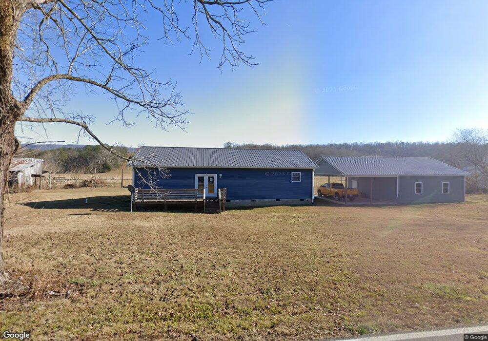
25139 Us 127 Dunlap, TN 37327
Estimated Value: $316,000 - $464,000
3
Beds
2
Baths
1,680
Sq Ft
$219/Sq Ft
Est. Value
About This Home
This home is located at 25139 Us 127, Dunlap, TN 37327 and is currently estimated at $367,648, approximately $218 per square foot. 25139 Us 127 is a home located in Bledsoe County with nearby schools including Bledsoe County High School.
Ownership History
Date
Name
Owned For
Owner Type
Purchase Details
Closed on
Jan 12, 2021
Sold by
Boring Robert and Boring Joann
Bought by
Reppert Raymond J and Reppert Raymond Raymie
Current Estimated Value
Home Financials for this Owner
Home Financials are based on the most recent Mortgage that was taken out on this home.
Original Mortgage
$183,150
Outstanding Balance
$163,087
Interest Rate
2.71%
Mortgage Type
New Conventional
Estimated Equity
$204,561
Purchase Details
Closed on
Mar 31, 2017
Sold by
Smith Dennis J
Bought by
Freeman Joann
Create a Home Valuation Report for This Property
The Home Valuation Report is an in-depth analysis detailing your home's value as well as a comparison with similar homes in the area
Home Values in the Area
Average Home Value in this Area
Purchase History
| Date | Buyer | Sale Price | Title Company |
|---|---|---|---|
| Reppert Raymond J | $203,500 | None Available | |
| Freeman Joann | $25,000 | None Available |
Source: Public Records
Mortgage History
| Date | Status | Borrower | Loan Amount |
|---|---|---|---|
| Open | Reppert Raymond J | $183,150 |
Source: Public Records
Tax History Compared to Growth
Tax History
| Year | Tax Paid | Tax Assessment Tax Assessment Total Assessment is a certain percentage of the fair market value that is determined by local assessors to be the total taxable value of land and additions on the property. | Land | Improvement |
|---|---|---|---|---|
| 2025 | $1,138 | $55,150 | $0 | $0 |
| 2024 | $1,138 | $55,150 | $11,825 | $43,325 |
| 2023 | $1,138 | $55,150 | $11,825 | $43,325 |
| 2022 | $1,033 | $55,150 | $11,825 | $43,325 |
| 2021 | $966 | $40,475 | $4,800 | $35,675 |
| 2020 | $966 | $40,475 | $4,800 | $35,675 |
| 2019 | $966 | $40,475 | $4,800 | $35,675 |
| 2018 | $328 | $40,475 | $4,800 | $35,675 |
| 2017 | $327 | $14,850 | $4,800 | $10,050 |
| 2016 | $368 | $16,250 | $8,450 | $7,800 |
| 2015 | $360 | $16,250 | $8,450 | $7,800 |
| 2014 | $360 | $16,250 | $8,450 | $7,800 |
Source: Public Records
Map
Nearby Homes
- 25066 US 127
- 459 Pope Rd
- 18 Old State Highway 28
- 280 Chapman Rd
- 3 Lusk Loop Rd
- 0 Old State Highway 28
- 442 Billingsley Rd
- 2604 Lower East Valley Rd
- 91 Lightning Ln
- 91 Hidden View Dr
- 500 Old Highway 28
- 16 Old State Hwy 28
- 19 Lower Brow Rd
- 515 Old Us Highway 28
- 1 Old Highway 28
- 0 Harwood Ln Unit RTC2987060
- 0 Bill Pope Dr
- 844 Big Cedar Dr
- 0 Bowater Rd S Unit 1517780
- 0 Bowater Rd S Unit 221838
- 25139 U S 127
- 3868 Old State Highway 28
- 3906 Old State Highway 28
- 3873 Old State Highway 28
- 64 Penny Ln
- 4009 Old State Highway 28
- 84 Penny Ln
- 4093 Old State Highway 28
- 25000 Us 127
- 25002 Us 127
- 25358 Us 127
- 219 Penny Ln
- 25132 Us 127
- 4151 Old State Highway 28
- 273 Mariah Farms Ln
- 239 Penny Ln
- 24892 Us Hwy 127
- 24892 Us 127
- 238 Penny Ln
- 124 Songer Ln