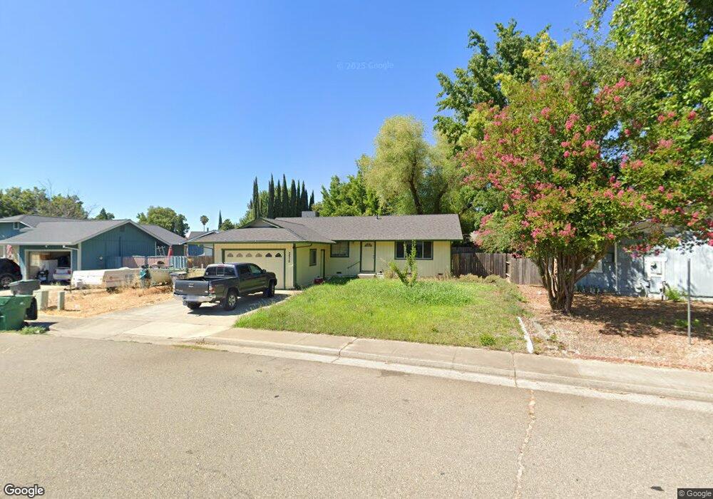
2515 Toyon St Anderson, CA 96007
Balls Ferry Road NeighborhoodEstimated Value: $295,000 - $297,000
3
Beds
2
Baths
1,100
Sq Ft
$269/Sq Ft
Est. Value
About This Home
This home is located at 2515 Toyon St, Anderson, CA 96007 and is currently estimated at $296,123, approximately $269 per square foot. 2515 Toyon St is a home located in Shasta County with nearby schools including Meadow Lane Elementary School, Anderson Heights Elementary School, and Anderson Middle School.
Ownership History
Date
Name
Owned For
Owner Type
Purchase Details
Closed on
Sep 21, 2021
Sold by
Wilson Robert M and Wilson Patricia A
Bought by
Wilson Robert M H
Current Estimated Value
Home Financials for this Owner
Home Financials are based on the most recent Mortgage that was taken out on this home.
Original Mortgage
$235,800
Outstanding Balance
$214,560
Interest Rate
2.8%
Mortgage Type
New Conventional
Estimated Equity
$81,563
Purchase Details
Closed on
Jun 13, 2012
Sold by
Wilson Robert M and Wilson Patricia A
Bought by
Wilson Robert M and Wilson Patricia A
Home Financials for this Owner
Home Financials are based on the most recent Mortgage that was taken out on this home.
Original Mortgage
$175,500
Interest Rate
3.9%
Mortgage Type
New Conventional
Purchase Details
Closed on
Apr 27, 2012
Sold by
Wilson Robert M and Wilson Patricia
Bought by
Wilson Robert M and Wilson Patricia A
Home Financials for this Owner
Home Financials are based on the most recent Mortgage that was taken out on this home.
Original Mortgage
$175,500
Interest Rate
3.9%
Mortgage Type
New Conventional
Purchase Details
Closed on
Nov 7, 2006
Sold by
Wilson Robert M and Wilson Patricia A
Bought by
Wilson Robert M and Wilson Patricia
Home Financials for this Owner
Home Financials are based on the most recent Mortgage that was taken out on this home.
Original Mortgage
$181,400
Interest Rate
6.3%
Mortgage Type
Stand Alone Refi Refinance Of Original Loan
Purchase Details
Closed on
Apr 7, 2004
Sold by
Wilson Robert M and Wilson Patricia Ann
Bought by
Wilson Robert M and Wilson Patricia A
Purchase Details
Closed on
Jan 23, 2004
Sold by
Wilson Robert M
Bought by
Wilson Robert M and Wilson Patricia Ann
Home Financials for this Owner
Home Financials are based on the most recent Mortgage that was taken out on this home.
Original Mortgage
$119,200
Interest Rate
5.79%
Mortgage Type
Stand Alone Refi Refinance Of Original Loan
Purchase Details
Closed on
Mar 5, 2001
Sold by
Massey Patricia A and Massey Patricia A
Bought by
Wilson Robert M
Create a Home Valuation Report for This Property
The Home Valuation Report is an in-depth analysis detailing your home's value as well as a comparison with similar homes in the area
Home Values in the Area
Average Home Value in this Area
Purchase History
| Date | Buyer | Sale Price | Title Company |
|---|---|---|---|
| Wilson Robert M H | $262,000 | Fidelity Natl Ttl Co Of Ca | |
| Wilson Robert M | -- | Placer Title Company | |
| Wilson Robert M | -- | Placer Title Company | |
| Wilson Robert M | -- | Alliance Title Company | |
| Wilson Robert M | -- | -- | |
| Wilson Robert M | -- | Chicago Title Co | |
| Wilson Robert M | -- | Placer Title Company |
Source: Public Records
Mortgage History
| Date | Status | Borrower | Loan Amount |
|---|---|---|---|
| Open | Wilson Robert M H | $235,800 | |
| Previous Owner | Wilson Robert M | $175,500 | |
| Previous Owner | Wilson Robert M | $181,400 | |
| Previous Owner | Wilson Robert M | $119,200 |
Source: Public Records
Tax History Compared to Growth
Tax History
| Year | Tax Paid | Tax Assessment Tax Assessment Total Assessment is a certain percentage of the fair market value that is determined by local assessors to be the total taxable value of land and additions on the property. | Land | Improvement |
|---|---|---|---|---|
| 2025 | $3,331 | $278,035 | $42,448 | $235,587 |
| 2024 | $3,268 | $272,584 | $41,616 | $230,968 |
| 2023 | $3,268 | $267,240 | $40,800 | $226,440 |
| 2022 | $3,159 | $262,000 | $40,000 | $222,000 |
| 2021 | $1,427 | $97,364 | $27,039 | $70,325 |
| 2020 | $1,491 | $96,366 | $26,762 | $69,604 |
| 2019 | $1,573 | $94,478 | $26,238 | $68,240 |
| 2018 | $1,493 | $92,626 | $25,724 | $66,902 |
| 2017 | $1,421 | $90,811 | $25,220 | $65,591 |
| 2016 | $1,323 | $89,031 | $24,726 | $64,305 |
| 2015 | $1,327 | $87,695 | $24,355 | $63,340 |
| 2014 | $1,514 | $85,978 | $23,878 | $62,100 |
Source: Public Records
Map
Nearby Homes
- 2345 Shenandoah Dr
- 0 Shady Ln Unit 25-1204
- 2827 Stingy Ln
- 2867 Pinto Ln
- 3100 Driftstone Dr
- 3081 Sharon Ave
- 2648 Tremonto Rd
- 21118 Merrill Ln
- 15.79 Stingy Ln
- 0 Stingy Ln
- 3006 Joyce Dr
- 3244 Sharon Ave
- 2325 North St
- 2785 North St
- 21133 Ronald St
- 21077 Dodson Ln
- 3262 Camellia St
- 3371 Bardick Rd
- 3252 Daisy St
- 0000 Frontier Trail