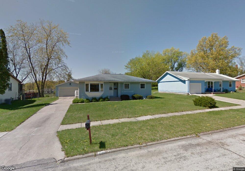
2516 Newport Dr SW Cedar Rapids, IA 52404
Estimated Value: $200,471 - $218,000
3
Beds
2
Baths
1,090
Sq Ft
$190/Sq Ft
Est. Value
About This Home
This home is located at 2516 Newport Dr SW, Cedar Rapids, IA 52404 and is currently estimated at $206,868, approximately $189 per square foot. 2516 Newport Dr SW is a home located in Linn County with nearby schools including Junction City Elementary School, Perryville Elementary School, and Van Buren Elementary School.
Ownership History
Date
Name
Owned For
Owner Type
Purchase Details
Closed on
Jan 9, 2020
Sold by
C & S Properties Of Linn County Llc
Bought by
Votroubek Tyler and Coffield Katrina
Current Estimated Value
Home Financials for this Owner
Home Financials are based on the most recent Mortgage that was taken out on this home.
Original Mortgage
$128,000
Outstanding Balance
$112,873
Interest Rate
3.5%
Mortgage Type
New Conventional
Estimated Equity
$93,995
Purchase Details
Closed on
Feb 5, 2019
Sold by
Loesche Christopher A
Bought by
C & S Properties Of Linn County Llc
Home Financials for this Owner
Home Financials are based on the most recent Mortgage that was taken out on this home.
Original Mortgage
$96,000
Interest Rate
4.5%
Mortgage Type
Future Advance Clause Open End Mortgage
Create a Home Valuation Report for This Property
The Home Valuation Report is an in-depth analysis detailing your home's value as well as a comparison with similar homes in the area
Home Values in the Area
Average Home Value in this Area
Purchase History
| Date | Buyer | Sale Price | Title Company |
|---|---|---|---|
| Votroubek Tyler | $160,000 | None Available | |
| C & S Properties Of Linn County Llc | $96,000 | None Available |
Source: Public Records
Mortgage History
| Date | Status | Borrower | Loan Amount |
|---|---|---|---|
| Open | Votroubek Tyler | $128,000 | |
| Previous Owner | C & S Properties Of Linn County Llc | $96,000 |
Source: Public Records
Tax History Compared to Growth
Tax History
| Year | Tax Paid | Tax Assessment Tax Assessment Total Assessment is a certain percentage of the fair market value that is determined by local assessors to be the total taxable value of land and additions on the property. | Land | Improvement |
|---|---|---|---|---|
| 2025 | $2,868 | $200,300 | $49,200 | $151,100 |
| 2024 | $3,042 | $195,600 | $49,200 | $146,400 |
| 2023 | $3,042 | $172,500 | $41,700 | $130,800 |
| 2022 | $2,810 | $153,100 | $41,700 | $111,400 |
| 2021 | $2,900 | $144,600 | $37,900 | $106,700 |
| 2020 | $2,900 | $140,000 | $34,100 | $105,900 |
| 2019 | $2,458 | $122,600 | $34,100 | $88,500 |
| 2018 | $2,386 | $122,600 | $34,100 | $88,500 |
| 2017 | $2,364 | $117,100 | $34,100 | $83,000 |
| 2016 | $2,489 | $117,100 | $34,100 | $83,000 |
| 2015 | $2,551 | $119,929 | $34,088 | $85,841 |
| 2014 | $2,366 | $119,929 | $34,088 | $85,841 |
| 2013 | $2,312 | $119,929 | $34,088 | $85,841 |
Source: Public Records
Map
Nearby Homes
- 2126 Snapdragon Cir SW
- 2420 Lori Dr SW
- 2105 Milligan Ct SW
- 2150 Rockford Rd SW
- 2825 18th St SW
- 2025 18th St SW
- 2207 Shady Grove Rd SW
- 2404 25th St SW
- 1960 Rockford Rd SW Unit 45
- 1801 Shady Grove Rd SW
- 2812 29th Ave SW
- 2521 Radcliffe Ct SW
- 3000 Wilson Ave SW Unit A11
- 3000 Wilson Ave SW
- Remington - Cedar Rapids Plan at Whispering Pines
- Copeland Plan at Whispering Pines
- Meadowbrook - Cedar Rapids Plan at Stags Leap Estates
- Caldwell Plan at Stags Leap Estates
- Concord - Cedar Rapids Plan at Stags Leap Estates
- Yuma Expanded Plan at Whispering Pines
- 2524 Newport Dr SW
- 2508 Newport Dr SW
- 2500 Newport Dr SW
- 2517 Newport Dr SW
- 2525 Newport Dr SW
- 2509 Newport Dr SW
- 2440 Newport Dr SW
- 2501 Newport Dr SW
- 2432 Newport Dr SW
- 2508 Snapdragon Cir SW
- 2502 Snapdragon Cir SW
- 2514 Snapdragon Cir SW
- 2416 Snapdragon Cir SW
- 2416 Snapdragon Cir SW
- 2433 Newport Dr SW
- 2520 Snapdragon Cir SW
- 2412 Snapdragon Cir SW
- 2424 Newport Dr SW
- 2536 Snapdragon Cir SW
- 2406 Snapdragon Cir SW