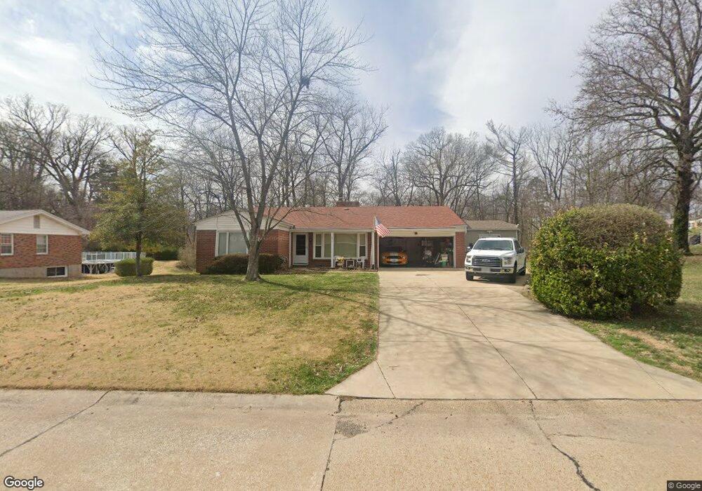
2517 Fox Hills Dr Saint Louis, MO 63114
Estimated Value: $260,000 - $288,000
2
Beds
2
Baths
1,655
Sq Ft
$166/Sq Ft
Est. Value
About This Home
This home is located at 2517 Fox Hills Dr, Saint Louis, MO 63114 and is currently estimated at $275,016, approximately $166 per square foot. 2517 Fox Hills Dr is a home located in St. Louis County with nearby schools including Marion Elementary School, Ritenour Middle School, and Ritenour Senior High School.
Ownership History
Date
Name
Owned For
Owner Type
Purchase Details
Closed on
Aug 30, 2012
Sold by
Larson David A and Larson Karen
Bought by
Larson David A and Larson Karen
Current Estimated Value
Purchase Details
Closed on
Apr 13, 2006
Sold by
Moore Alta M
Bought by
Larson David A and Larson Karen
Home Financials for this Owner
Home Financials are based on the most recent Mortgage that was taken out on this home.
Original Mortgage
$100,000
Outstanding Balance
$57,334
Interest Rate
6.32%
Mortgage Type
Fannie Mae Freddie Mac
Estimated Equity
$217,682
Create a Home Valuation Report for This Property
The Home Valuation Report is an in-depth analysis detailing your home's value as well as a comparison with similar homes in the area
Home Values in the Area
Average Home Value in this Area
Purchase History
| Date | Buyer | Sale Price | Title Company |
|---|---|---|---|
| Larson David A | -- | None Available | |
| Larson David A | $177,000 | None Available |
Source: Public Records
Mortgage History
| Date | Status | Borrower | Loan Amount |
|---|---|---|---|
| Open | Larson David A | $100,000 |
Source: Public Records
Tax History Compared to Growth
Tax History
| Year | Tax Paid | Tax Assessment Tax Assessment Total Assessment is a certain percentage of the fair market value that is determined by local assessors to be the total taxable value of land and additions on the property. | Land | Improvement |
|---|---|---|---|---|
| 2025 | $3,251 | $43,510 | $9,800 | $33,710 |
| 2024 | $3,251 | $38,110 | $4,100 | $34,010 |
| 2023 | $3,179 | $38,110 | $4,100 | $34,010 |
| 2022 | $2,867 | $30,130 | $5,870 | $24,260 |
| 2021 | $2,867 | $30,130 | $5,870 | $24,260 |
| 2020 | $2,820 | $27,340 | $4,370 | $22,970 |
| 2019 | $2,789 | $27,340 | $4,370 | $22,970 |
| 2018 | $2,832 | $25,000 | $3,970 | $21,030 |
| 2017 | $2,701 | $25,000 | $3,970 | $21,030 |
| 2016 | $2,903 | $27,420 | $3,230 | $24,190 |
| 2015 | $2,971 | $27,420 | $3,230 | $24,190 |
| 2014 | $2,566 | $24,050 | $3,340 | $20,710 |
Source: Public Records
Map
Nearby Homes
- 10235 Midland Blvd
- 2703 Ashby Rd
- 10490 Canter Way
- 10301 Niblic Dr
- 2412 Silkwood Dr
- 2450 Fowler Ave
- 10111 Niblic Dr
- 10107 Niblic Dr
- 2454 Prouhet Ave
- 9911 Dennison Ave
- 2430 Prouhet Ave
- 3000 Ashby Rd
- 10627 Canter Way
- 3001 Ashby Rd
- 10222 Driver Ave
- 10515 Clarendon Ave
- 3005 Ashby Rd
- 9922 Carlyle Ave
- 10110 Lackland Rd
- 10651 Thorpe Ave
- 2513 Fox Hills Dr
- 2525 Fox Hills Dr
- 2512 Fox Hills Dr
- 2509 Fox Hills Dr
- 2508 Fox Hills Dr
- 2520 Fox Hills Dr
- 10132 Midland Blvd
- 2505 Fox Hills Dr
- 2500 Fox Hills Dr
- 10145 Pebble Beach Dr
- 10128 Midland Blvd
- 10223 Midland Blvd
- 10219 Midland Blvd
- 10227 Midland Blvd
- 10215 Midland Blvd
- 10231 Midland Blvd
- 10141 Pebble Beach Dr
- 10211 Midland Blvd
- 10207 Midland Blvd
- 2415 Pebble Beach Dr