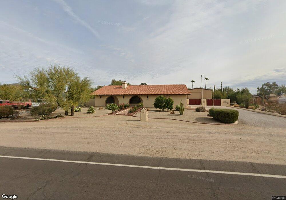
2517 N Sossaman Rd Mesa, AZ 85207
Desert Uplands NeighborhoodEstimated Value: $510,768 - $622,000
--
Bed
2
Baths
1,782
Sq Ft
$325/Sq Ft
Est. Value
About This Home
This home is located at 2517 N Sossaman Rd, Mesa, AZ 85207 and is currently estimated at $579,442, approximately $325 per square foot. 2517 N Sossaman Rd is a home located in Maricopa County with nearby schools including Franklin at Brimhall Elementary School, Las Sendas Elementary School, and Franklin West Elementary School.
Ownership History
Date
Name
Owned For
Owner Type
Purchase Details
Closed on
Mar 21, 2025
Sold by
Mawby Ingrid E and Snyder Kit L
Bought by
Kit L Snyder Family Living Trust and Snyder
Current Estimated Value
Purchase Details
Closed on
Jun 29, 2009
Sold by
Snyder Kit L and Mawby Ingrid E
Bought by
Snyder Kit L and Mawby Ingrid E
Home Financials for this Owner
Home Financials are based on the most recent Mortgage that was taken out on this home.
Original Mortgage
$78,500
Interest Rate
4.83%
Mortgage Type
Stand Alone Refi Refinance Of Original Loan
Purchase Details
Closed on
Aug 2, 2000
Sold by
Kramer Richard A and Kramer Laurie A
Bought by
Snyder Kit L and Mawby Snyder Ingrid E
Home Financials for this Owner
Home Financials are based on the most recent Mortgage that was taken out on this home.
Original Mortgage
$100,000
Interest Rate
8.15%
Mortgage Type
New Conventional
Create a Home Valuation Report for This Property
The Home Valuation Report is an in-depth analysis detailing your home's value as well as a comparison with similar homes in the area
Home Values in the Area
Average Home Value in this Area
Purchase History
| Date | Buyer | Sale Price | Title Company |
|---|---|---|---|
| Kit L Snyder Family Living Trust | -- | None Listed On Document | |
| Snyder Kit L | -- | Grand Canyon Title Agency In | |
| Snyder Kit L | $183,000 | Security Title Agency |
Source: Public Records
Mortgage History
| Date | Status | Borrower | Loan Amount |
|---|---|---|---|
| Previous Owner | Snyder Kit L | $78,500 | |
| Previous Owner | Snyder Kit L | $100,000 |
Source: Public Records
Tax History Compared to Growth
Tax History
| Year | Tax Paid | Tax Assessment Tax Assessment Total Assessment is a certain percentage of the fair market value that is determined by local assessors to be the total taxable value of land and additions on the property. | Land | Improvement |
|---|---|---|---|---|
| 2025 | $1,664 | $22,351 | -- | -- |
| 2024 | $1,702 | $21,286 | -- | -- |
| 2023 | $1,702 | $44,950 | $8,990 | $35,960 |
| 2022 | $1,658 | $32,870 | $6,570 | $26,300 |
| 2021 | $1,677 | $30,170 | $6,030 | $24,140 |
| 2020 | $1,665 | $27,150 | $5,430 | $21,720 |
| 2019 | $1,525 | $24,030 | $4,800 | $19,230 |
| 2018 | $1,483 | $21,980 | $4,390 | $17,590 |
| 2017 | $1,428 | $19,930 | $3,980 | $15,950 |
| 2016 | $1,398 | $18,850 | $3,770 | $15,080 |
| 2015 | $1,311 | $18,070 | $3,610 | $14,460 |
Source: Public Records
Map
Nearby Homes
- 7630 E Culver (Approx) St
- 7420 E Mallory St
- 7555 E Laurel St
- 7447 E Norwood St
- 7560 E Leland Cir
- 7860 E Mawson Rd
- 2758 N Sterling
- 7325 E Minton Cir
- 7342 E Norwood St
- 2225 N 76th Place
- 7301 E Hermosa Vista Dr
- 7824 E Leland Cir
- 7302 E Minton Cir
- 7304 E Northridge Cir
- 7840 E Leland Cir
- 7261 E Norland St
- 7258 E Norland St
- 2847 N Rowen Cir
- 7227 E Northridge St
- 2935 N Avoca Cir
- 2529 N Sossaman Rd
- 7602 E Minton Place
- 2542 N 76th Place
- 7614 E Minton Place
- 7634 E Minton Place
- 7601 E Culver St
- 7613 E Culver St
- 2546 N Sossaman Rd
- 7646 E Minton Place
- 2526 N Sossaman Rd
- 2541 N 76th Place
- 7601 E Minton Place
- 7611 E Minton Place
- 2504 N 76th St
- 2504 N Sossaman Rd
- 2504 N Sossaman (76th St) Rd
- 2545 N 76th Place
- 2556 N Sossaman Rd
- 7625 E Minton Place
- 7633 E Minton Place