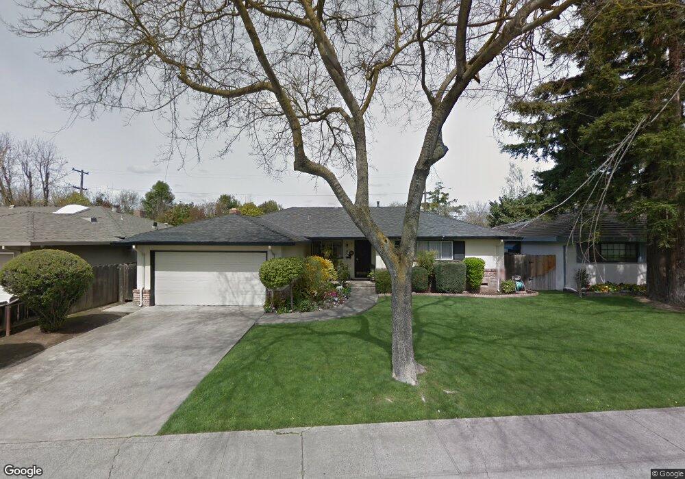
2517 W Swain Rd Stockton, CA 95207
Lincoln Village NeighborhoodEstimated Value: $400,988 - $454,000
3
Beds
2
Baths
1,386
Sq Ft
$311/Sq Ft
Est. Value
About This Home
This home is located at 2517 W Swain Rd, Stockton, CA 95207 and is currently estimated at $430,747, approximately $310 per square foot. 2517 W Swain Rd is a home located in San Joaquin County with nearby schools including Tully C. Knoles School, Sierra Middle School, and Lincoln High School.
Ownership History
Date
Name
Owned For
Owner Type
Purchase Details
Closed on
Apr 12, 2024
Sold by
Costa Donna L
Bought by
Donna L Costa Revocable Trust and Costa
Current Estimated Value
Purchase Details
Closed on
Sep 23, 2021
Sold by
William Kushner Walter
Bought by
Walter And Marijean Kushner Trust
Home Financials for this Owner
Home Financials are based on the most recent Mortgage that was taken out on this home.
Original Mortgage
$304,000
Interest Rate
2.8%
Mortgage Type
New Conventional
Purchase Details
Closed on
Sep 21, 2021
Sold by
Kushner Marjean and Walter And Marjiean Kushner Tr
Bought by
Costa Thomas and Costa Donna L
Home Financials for this Owner
Home Financials are based on the most recent Mortgage that was taken out on this home.
Original Mortgage
$304,000
Interest Rate
2.8%
Mortgage Type
New Conventional
Purchase Details
Closed on
Aug 7, 2003
Sold by
Sedillo Melody Tennant and Tennant Melody
Bought by
Tennant Melody and The Melody Tennant Trust
Create a Home Valuation Report for This Property
The Home Valuation Report is an in-depth analysis detailing your home's value as well as a comparison with similar homes in the area
Home Values in the Area
Average Home Value in this Area
Purchase History
| Date | Buyer | Sale Price | Title Company |
|---|---|---|---|
| Donna L Costa Revocable Trust | -- | None Listed On Document | |
| Walter And Marijean Kushner Trust | -- | -- | |
| Costa Thomas | $380,000 | Chicago Title Company | |
| Tennant Melody | -- | -- |
Source: Public Records
Mortgage History
| Date | Status | Borrower | Loan Amount |
|---|---|---|---|
| Previous Owner | Costa Thomas | $304,000 |
Source: Public Records
Tax History Compared to Growth
Tax History
| Year | Tax Paid | Tax Assessment Tax Assessment Total Assessment is a certain percentage of the fair market value that is determined by local assessors to be the total taxable value of land and additions on the property. | Land | Improvement |
|---|---|---|---|---|
| 2025 | $3,851 | $144,034 | $53,344 | $90,690 |
| 2024 | $3,728 | $141,211 | $52,299 | $88,912 |
| 2023 | $3,636 | $138,443 | $51,274 | $87,169 |
| 2022 | $3,437 | $135,729 | $50,269 | $85,460 |
| 2021 | $3,375 | $133,069 | $49,284 | $83,785 |
| 2020 | $3,341 | $131,705 | $48,779 | $82,926 |
| 2019 | $3,317 | $129,123 | $47,823 | $81,300 |
| 2018 | $3,239 | $126,592 | $46,886 | $79,706 |
| 2017 | $3,207 | $124,111 | $45,967 | $78,144 |
| 2016 | $2,978 | $121,678 | $45,066 | $76,612 |
| 2014 | $3,008 | $117,504 | $43,520 | $73,984 |
Source: Public Records
Map
Nearby Homes
- 2447 Calhoun Way
- 2252 Canyon Creek Dr
- 2421 Meadow Lake Dr
- 5734 Turtle Valley Dr
- 2128 Canyon Creek Dr
- 2914 Prentiss Ct
- 2252 W Benjamin Holt Dr
- 2922 Prentiss Ct
- 6415 Plymouth Rd
- 5713 Turtle Valley Dr
- 2935 Prentiss Ct Unit 1844
- 5522 Teal Ct
- 2014 Douglas Rd
- 2433 Pheasant Run Cir
- 2921 Rutledge Ct
- 2009 Cedar Ridge Dr
- 1929 W Swain Rd
- 2005 Cedar Ridge Dr
- 2039 W Benjamin Holt Dr
- 5633 Brush Creek Dr
- 2527 W Swain Rd
- 2505 W Swain Rd
- 2518 Porter Way
- 2528 Porter Way
- 2537 W Swain Rd
- 2506 Porter Way
- 2516 W Swain Rd
- 2540 Porter Way
- 2524 W Swain Rd
- 2504 W Swain Rd
- 2547 W Swain Rd
- 2468 W Swain Rd
- 2451 W Swain Rd
- 2550 Porter Way
- 2458 W Swain Rd
- 2456 Porter Way
- 2534 W Swain Rd
- 2517 Porter Way
- 2527 Porter Way
- 2560 Porter Way