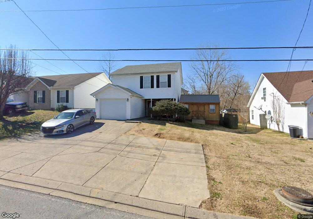
252 Bill Stewart Blvd La Vergne, TN 37086
Estimated Value: $280,053 - $307,000
--
Bed
3
Baths
1,060
Sq Ft
$276/Sq Ft
Est. Value
About This Home
This home is located at 252 Bill Stewart Blvd, La Vergne, TN 37086 and is currently estimated at $293,013, approximately $276 per square foot. 252 Bill Stewart Blvd is a home located in Rutherford County with nearby schools including Roy L. Waldron Elementary School, Lavergne Primary School, and La Vergne Middle School.
Ownership History
Date
Name
Owned For
Owner Type
Purchase Details
Closed on
Mar 22, 2006
Sold by
Lee Mccarty Richard
Bought by
Russell Jeremy V and Russell Tanna M
Current Estimated Value
Purchase Details
Closed on
May 21, 2002
Sold by
Ole South Properties Inc
Bought by
Mccarty Richard L and Mccarty Tanna
Home Financials for this Owner
Home Financials are based on the most recent Mortgage that was taken out on this home.
Original Mortgage
$98,444
Interest Rate
6.92%
Create a Home Valuation Report for This Property
The Home Valuation Report is an in-depth analysis detailing your home's value as well as a comparison with similar homes in the area
Home Values in the Area
Average Home Value in this Area
Purchase History
| Date | Buyer | Sale Price | Title Company |
|---|---|---|---|
| Russell Jeremy V | -- | -- | |
| Russell Jeremy V | -- | -- | |
| Mccarty Richard L | $99,990 | -- |
Source: Public Records
Mortgage History
| Date | Status | Borrower | Loan Amount |
|---|---|---|---|
| Previous Owner | Mccarty Richard L | $98,444 |
Source: Public Records
Tax History Compared to Growth
Tax History
| Year | Tax Paid | Tax Assessment Tax Assessment Total Assessment is a certain percentage of the fair market value that is determined by local assessors to be the total taxable value of land and additions on the property. | Land | Improvement |
|---|---|---|---|---|
| 2025 | $1,412 | $58,525 | $13,750 | $44,775 |
| 2024 | $1,412 | $58,525 | $13,750 | $44,775 |
| 2023 | $1,098 | $58,525 | $13,750 | $44,775 |
| 2022 | $946 | $58,525 | $13,750 | $44,775 |
| 2021 | $853 | $38,425 | $10,000 | $28,425 |
| 2020 | $853 | $38,425 | $10,000 | $28,425 |
| 2019 | $853 | $38,425 | $10,000 | $28,425 |
| 2018 | $1,080 | $38,425 | $0 | $0 |
| 2017 | $916 | $25,225 | $0 | $0 |
| 2016 | $916 | $25,225 | $0 | $0 |
| 2015 | $922 | $25,225 | $0 | $0 |
| 2014 | $627 | $25,225 | $0 | $0 |
| 2013 | -- | $26,200 | $0 | $0 |
Source: Public Records
Map
Nearby Homes
- 104 Moshe Yaalon Dr
- 1201 Elisha Ct
- 1216 Elisha Ct
- 103 Hook and Ladder Ln
- 1321 Tonya Dr
- 259 Hollandale Rd
- 605 Nixon Way
- 601 Nixon Way
- 109 David Bolin Dr
- 1114 Phelissa Dr
- 108 Ofner Dr
- 151 Ofner Dr
- 8108 Logan Dr
- 8074 Logan Dr
- 333 David Bolin Dr
- 221 Quiet Ln
- 6038 Cullen Dr
- 6024 Cullen Dr
- 8007 Logan Dr
- 4020 Cody Dr
- 254 Bill Stewart Blvd
- 250 Bill Stewart Blvd
- 1561 James Gafford Dr
- 256 Bill Stewart Blvd
- 248 Bill Stewart Blvd
- 2 2 Moshe Yaalon Dr
- 2 Moshe Yaalon Dr
- 1556 James Gafford Dr
- 1309 E Nir Shreibman Blvd
- 1559 James Gafford Dr
- 255 Bill Stewart Blvd
- 258 Bill Stewart Blvd
- 246 Bill Stewart Blvd
- 253 Bill Stewart Blvd
- 1554 James Gafford Dr
- 1307 E Nir Shreibman Blvd
- 251 Bill Stewart Blvd
- 1311 E Nir Shreibman Blvd
- 257 Bill Stewart Blvd
- 1557 James Gafford Dr