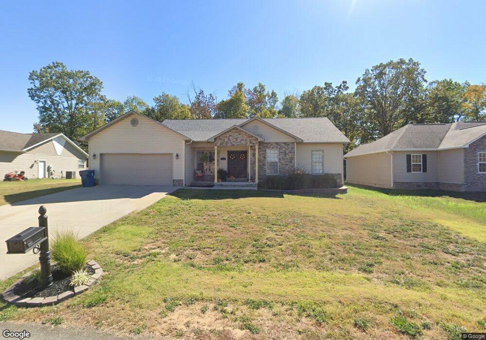
252 Boulder Trail Dr Poplar Bluff, MO 63901
Estimated Value: $242,000 - $308,000
Studio
--
Bath
2,085
Sq Ft
$129/Sq Ft
Est. Value
About This Home
This home is located at 252 Boulder Trail Dr, Poplar Bluff, MO 63901 and is currently estimated at $268,407, approximately $128 per square foot. 252 Boulder Trail Dr is a home with nearby schools including Oak Grove Elementary School, Poplar Bluff Fifth & Sixth Grade Center, and Poplar Bluff Junior High School.
Ownership History
Date
Name
Owned For
Owner Type
Purchase Details
Closed on
Apr 26, 2021
Sold by
Haynes Joshua D
Bought by
Jennings Brande L
Current Estimated Value
Purchase Details
Closed on
Sep 8, 2014
Sold by
Robertson Thomas
Bought by
Haynes Joshua D and Jennings Brande L
Home Financials for this Owner
Home Financials are based on the most recent Mortgage that was taken out on this home.
Original Mortgage
$147,600
Interest Rate
4.15%
Mortgage Type
Future Advance Clause Open End Mortgage
Create a Home Valuation Report for This Property
The Home Valuation Report is an in-depth analysis detailing your home's value as well as a comparison with similar homes in the area
Home Values in the Area
Average Home Value in this Area
Purchase History
| Date | Buyer | Sale Price | Title Company |
|---|---|---|---|
| Jennings Brande L | -- | None Available | |
| Jennings Brande L | -- | None Listed On Document | |
| Haynes Joshua D | -- | None Available |
Source: Public Records
Mortgage History
| Date | Status | Borrower | Loan Amount |
|---|---|---|---|
| Previous Owner | Haynes Joshua D | $147,600 |
Source: Public Records
Tax History
| Year | Tax Paid | Tax Assessment Tax Assessment Total Assessment is a certain percentage of the fair market value that is determined by local assessors to be the total taxable value of land and additions on the property. | Land | Improvement |
|---|---|---|---|---|
| 2024 | $15 | $32,950 | $0 | $0 |
| 2023 | $1,467 | $32,950 | $0 | $0 |
| 2022 | $1,420 | $31,950 | $0 | $0 |
| 2021 | $1,421 | $31,950 | $0 | $0 |
| 2020 | $1,443 | $31,950 | $0 | $0 |
| 2019 | $1,441 | $31,950 | $0 | $0 |
| 2018 | $1,441 | $31,950 | $0 | $0 |
| 2017 | -- | $31,950 | $0 | $0 |
| 2016 | -- | $31,950 | $0 | $0 |
| 2015 | -- | $31,950 | $0 | $0 |
| 2014 | -- | $3,950 | $0 | $0 |
| 2012 | -- | $3,950 | $0 | $0 |
Source: Public Records
Map
Nearby Homes
- 16 Boulder Trail
- 0 Boulder Trail
- 319 Pintail Ln
- 6708 Brown Ln
- 8102 Woodland Meadow Dr
- 3031 Saddlebrook Trail
- 2184 J Bird Dr
- 205 Batson Lake Ln
- 3841 County Road 441
- 192 Bruce
- 0 Brownwood Trails #18 Unit MIS25061746
- 306 Timberwolf Dr
- 0 W Hwy Unit MIS25082730
- 5502 Misty Meadow Rd Unit A-D
- 3401 Normandy Rd
- 2911 Oak Grove Rd
- 66 County Road 445
- 148 County Road 4421
- 3603 Mclane Dr
- Lot 11 Timber Way Dr
- 262 Boulder Trail Dr
- 242 Boulder Trail Dr
- 242 Boulder Trail
- 247 Boulder Trail Dr
- 257 Boulder Trail Dr
- 237 Boulder Trail
- 233 Boulder Trail Dr
- 233 Boulder Trail Dr
- 267 Boulder Trail Dr
- 218 Boulder Trail Dr
- 218 Boulder Trail
- 282 Boulder Trail
- 282 Boulder Trail Dr
- 306 Cardinal Dr
- 217 Boulder Trail
- 210 Boulder Trail
- 220 Boulder Trail
- 290 Boulder Trail
- 290 Boulder Trail Dr
- 3230 Scarlet Dr
Your Personal Tour Guide
Ask me questions while you tour the home.