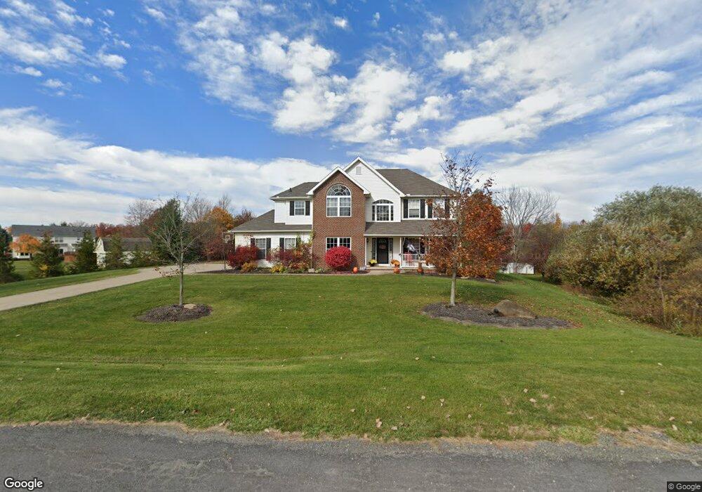
252 Newport Cir Brunswick, OH 44212
Estimated Value: $521,317 - $564,000
5
Beds
3
Baths
2,709
Sq Ft
$203/Sq Ft
Est. Value
About This Home
This home is located at 252 Newport Cir, Brunswick, OH 44212 and is currently estimated at $548,579, approximately $202 per square foot. 252 Newport Cir is a home located in Medina County with nearby schools including Brunswick Memorial Elementary School, Willets Middle School, and Brunswick High School.
Ownership History
Date
Name
Owned For
Owner Type
Purchase Details
Closed on
Jun 30, 2005
Sold by
Sweet Briar Homes Inc
Bought by
Must Raymond J and Must Jennifer
Current Estimated Value
Home Financials for this Owner
Home Financials are based on the most recent Mortgage that was taken out on this home.
Original Mortgage
$244,331
Outstanding Balance
$119,972
Interest Rate
4.75%
Mortgage Type
Fannie Mae Freddie Mac
Estimated Equity
$428,607
Purchase Details
Closed on
Jul 9, 2004
Sold by
J F Development Iii Llc
Bought by
Sweet Briar Homes Inc
Home Financials for this Owner
Home Financials are based on the most recent Mortgage that was taken out on this home.
Original Mortgage
$296,250
Interest Rate
6.37%
Mortgage Type
Purchase Money Mortgage
Create a Home Valuation Report for This Property
The Home Valuation Report is an in-depth analysis detailing your home's value as well as a comparison with similar homes in the area
Home Values in the Area
Average Home Value in this Area
Purchase History
| Date | Buyer | Sale Price | Title Company |
|---|---|---|---|
| Must Raymond J | $305,500 | -- | |
| Sweet Briar Homes Inc | $395,000 | -- |
Source: Public Records
Mortgage History
| Date | Status | Borrower | Loan Amount |
|---|---|---|---|
| Open | Must Raymond J | $244,331 | |
| Previous Owner | Sweet Briar Homes Inc | $296,250 | |
| Closed | Must Raymond J | $45,812 |
Source: Public Records
Tax History Compared to Growth
Tax History
| Year | Tax Paid | Tax Assessment Tax Assessment Total Assessment is a certain percentage of the fair market value that is determined by local assessors to be the total taxable value of land and additions on the property. | Land | Improvement |
|---|---|---|---|---|
| 2024 | $7,649 | $135,520 | $41,710 | $93,810 |
| 2023 | $7,649 | $135,520 | $41,710 | $93,810 |
| 2022 | $7,265 | $135,520 | $41,710 | $93,810 |
| 2021 | $6,451 | $105,870 | $32,580 | $73,290 |
| 2020 | $5,860 | $105,870 | $32,580 | $73,290 |
| 2019 | $5,861 | $105,870 | $32,580 | $73,290 |
| 2018 | $5,860 | $101,860 | $32,360 | $69,500 |
| 2017 | $5,868 | $101,860 | $32,360 | $69,500 |
| 2016 | $5,864 | $101,860 | $32,360 | $69,500 |
| 2015 | $5,408 | $94,310 | $29,960 | $64,350 |
| 2014 | $5,395 | $94,310 | $29,960 | $64,350 |
| 2013 | $5,405 | $94,310 | $29,960 | $64,350 |
Source: Public Records
Map
Nearby Homes
- 4893 Grafton Rd
- 5045 Grafton Rd
- 4626 Ruby Ln
- 642 Topaz Ln
- 261 Marlee Ct
- 4630 Brookstone Ct
- 5255 Cheyney Ln
- 573 Oakhurst Dr
- 4949 Orchard Dr
- 626 Juniper Ln
- 480 Bridge Pointe Ln
- 5277 Spruce Pointe Ln
- 4723 Baywood Dr
- 4913 Fallen Leaf Trail
- 660 Marsh Way
- 4910 Fallen Leaf Trail
- 786 Pepperwood Dr
- 5046 Forestland Ct
- 833 Substation Rd
- 19292 Charter Ln
- 238 Newport Cir
- 4989 Cessna Ave
- 4955 Cessna Ave
- 4977 Cessna Ave
- 247 Newport Cir
- 241 Newport Cir
- 4927 Cessna Ave
- 4905 Cessna Ave
- 5001 Cheyney Ln
- 220 Substation Rd
- 67 Slate Rd
- 282 Substation Rd
- 4960 Cessna Ave
- 5008 Cheyney Ln
- 298 Substation Rd
- 4948 Cessna Ave
- 4934 Cessna Ave
- 176 Substation Rd
- 5017 Cheyney Ln
- 247 Substation Rd