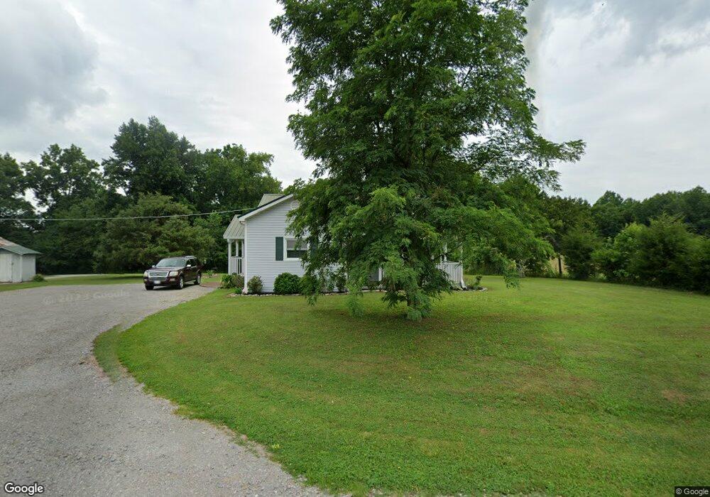
252 Powell Chapel Rd Pulaski, TN 38478
Estimated Value: $145,013 - $232,000
Studio
2
Baths
1,476
Sq Ft
$133/Sq Ft
Est. Value
About This Home
This home is located at 252 Powell Chapel Rd, Pulaski, TN 38478 and is currently estimated at $195,753, approximately $132 per square foot. 252 Powell Chapel Rd is a home located in Giles County with nearby schools including Pulaski Elementary School, Southside Elementary School, and Bridgeforth Middle School.
Ownership History
Date
Name
Owned For
Owner Type
Purchase Details
Closed on
Nov 6, 2008
Bought by
Citifinancial Inc Tn Corp 1111 Northpoint Dr
Current Estimated Value
Purchase Details
Closed on
Aug 17, 2001
Bought by
Robert Poling P and Robert Bryant
Purchase Details
Closed on
Feb 4, 1998
Sold by
White Guy
Bought by
White Bobby A and White Terry
Purchase Details
Closed on
Mar 23, 1985
Bought by
White Mable Ruth
Purchase Details
Closed on
Nov 1, 1969
Create a Home Valuation Report for This Property
The Home Valuation Report is an in-depth analysis detailing your home's value as well as a comparison with similar homes in the area
Purchase History
| Date | Buyer | Sale Price | Title Company |
|---|---|---|---|
| Citifinancial Inc Tn Corp 1111 Northpoint Dr | $33,200 | -- | |
| Robert Poling P | $33,800 | -- | |
| White Bobby A | $4,400 | -- | |
| White Mable Ruth | -- | -- | |
| -- | -- | -- |
Source: Public Records
Tax History
| Year | Tax Paid | Tax Assessment Tax Assessment Total Assessment is a certain percentage of the fair market value that is determined by local assessors to be the total taxable value of land and additions on the property. | Land | Improvement |
|---|---|---|---|---|
| 2025 | $702 | $30,450 | $4,125 | $26,325 |
| 2024 | $702 | $30,450 | $4,125 | $26,325 |
| 2023 | $605 | $30,450 | $4,125 | $26,325 |
| 2022 | $605 | $30,450 | $4,125 | $26,325 |
| 2021 | $554 | $19,625 | $1,925 | $17,700 |
| 2020 | $554 | $19,625 | $1,925 | $17,700 |
| 2019 | $430 | $19,625 | $1,925 | $17,700 |
| 2018 | $430 | $15,225 | $1,925 | $13,300 |
| 2017 | $430 | $15,225 | $1,925 | $13,300 |
| 2016 | $466 | $15,700 | $2,025 | $13,675 |
| 2015 | $435 | $15,700 | $2,025 | $13,675 |
| 2014 | $435 | $15,683 | $0 | $0 |
Source: Public Records
Map
Nearby Homes
- 0 Lewisburg Hwy Unit RTC3130421
- 0 Lewisburg Hwy Unit RTC2811267
- 600 Blooming Grove Rd
- 790 Blooming Grove Rd
- 155 Poling Dr
- 220 Poling Dr
- 159 Poling Dr
- 153 Poling Dr
- 129 Poling Dr
- 123 Timber Ridge Dr
- 190 Reece Ln
- 4768 Lewisburg Hwy
- 5251 Lewisburg Hwy
- 1580 Ragsdale Ln
- 1400 Ragsdale Ln
- 1301 Riley Hill Rd
- 365 Glendale Dr
- 151 Oak Ln
- 300 Longview Dr
- 310 Glendale Dr
- 248 Powell Chapel Rd
- 287 Powell Chapel Rd
- 264 Powell Chapel Rd
- 319 Powell Chapel Rd
- 343 Powell Chapel Rd
- 331 Powell Chapel Rd
- 324 Powell Chapel Rd
- 335 Powell Chapel Rd
- 339 Powell Chapel Rd
- 200 Powell Chapel Rd
- 205 Rose Ln
- 245 Rose Ln
- 225 Rose Ln
- 0 Rose Ln
- 340 Powell Chapel Rd
- 351 Powell Chapel Rd
- 369 Powell Chapel Rd
- 211 Powell Chapel Rd
- 240 Rose Ln
- 209 Powell Chapel Rd
Your Personal Tour Guide
Ask me questions while you tour the home.