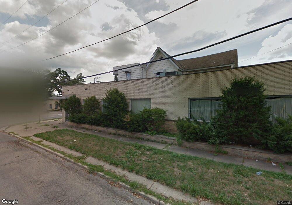
252 S State St Elgin, IL 60123
Near West Elgin Neighborhood
Studio
--
Bath
--
Sq Ft
--
Built
About This Home
This home is located at 252 S State St, Elgin, IL 60123. 252 S State St is a home located in Kane County with nearby schools including Lowrie Elementary School, Abbott Middle School, and Larkin High School.
Ownership History
Date
Name
Owned For
Owner Type
Purchase Details
Closed on
Aug 30, 2012
Sold by
The National Republic Bank Of Chicago
Bought by
Aga Properties Llc
Home Financials for this Owner
Home Financials are based on the most recent Mortgage that was taken out on this home.
Original Mortgage
$133,000
Interest Rate
3.48%
Mortgage Type
Commercial
Purchase Details
Closed on
Sep 13, 2010
Sold by
Carillo Eliseo
Bought by
National Republic Bank Of Chicago
Purchase Details
Closed on
Aug 13, 2003
Sold by
Madison Yerry L and Madison Virginia A
Bought by
Carillo Eliseo
Home Financials for this Owner
Home Financials are based on the most recent Mortgage that was taken out on this home.
Original Mortgage
$492,000
Interest Rate
7.5%
Mortgage Type
Commercial
Create a Home Valuation Report for This Property
The Home Valuation Report is an in-depth analysis detailing your home's value as well as a comparison with similar homes in the area
Home Values in the Area
Average Home Value in this Area
Purchase History
| Date | Buyer | Sale Price | Title Company |
|---|---|---|---|
| Aga Properties Llc | $190,000 | Chicago Title Insurance Comp | |
| National Republic Bank Of Chicago | -- | None Available | |
| Carillo Eliseo | $615,000 | Chicago Title Insurance Co |
Source: Public Records
Mortgage History
| Date | Status | Borrower | Loan Amount |
|---|---|---|---|
| Closed | Aga Properties Llc | $133,000 | |
| Previous Owner | Carillo Eliseo | $492,000 |
Source: Public Records
Tax History
| Year | Tax Paid | Tax Assessment Tax Assessment Total Assessment is a certain percentage of the fair market value that is determined by local assessors to be the total taxable value of land and additions on the property. | Land | Improvement |
|---|---|---|---|---|
| 2024 | $2,867 | $35,823 | $35,823 | -- |
| 2023 | $2,759 | $32,363 | $32,363 | -- |
| 2022 | $2,559 | $29,509 | $29,509 | $0 |
| 2021 | $2,461 | $27,589 | $27,589 | $0 |
| 2020 | $2,402 | $26,338 | $26,338 | $0 |
| 2019 | $2,343 | $25,089 | $25,089 | $0 |
| 2018 | $2,337 | $23,635 | $23,635 | $0 |
| 2017 | $2,471 | $24,026 | $24,026 | $0 |
| 2016 | $2,584 | $24,228 | $24,228 | $0 |
| 2015 | -- | $22,207 | $22,207 | $0 |
| 2014 | -- | $40,539 | $22,519 | $18,020 |
| 2013 | -- | $60,104 | $23,113 | $36,991 |
Source: Public Records
Map
Nearby Homes
- 3 National St Unit 3
- 7 National St Unit 7
- 162 Festival Ct
- 96 S Crystal St
- 211 Prairie St
- 208 Moseley St
- 216 Prairie St
- 331 Orange St
- 462 Ashland Ave
- 277 Gifford Place
- 552 Walnut Ave
- 262 Bartlett Place
- 286 Villa St
- 9 N Jackson St
- 332-334 St Charles St
- 532 South St
- 518 Raymond St
- 483 Barrett St
- 315 Vandalia St
- 50 Sheridan St
- 210 Walnut Ave
- 221 Standish St
- 245 S State St
- 243 S State St
- 230 S State St
- 257 S State St
- 241 S State St Unit 2
- 241 S State St
- 267 S State St
- 225 Standish St
- 271 S State St Unit 2SW
- 271 S State St Unit 1SW
- 271 S State St
- 250 Walnut Ave
- 269 S State St
- 105 Standish Ct
- 6 National St Unit 1
- 6 National St Unit 2
- 6 National St Unit 3
- 6 National St Unit 6
Your Personal Tour Guide
Ask me questions while you tour the home.