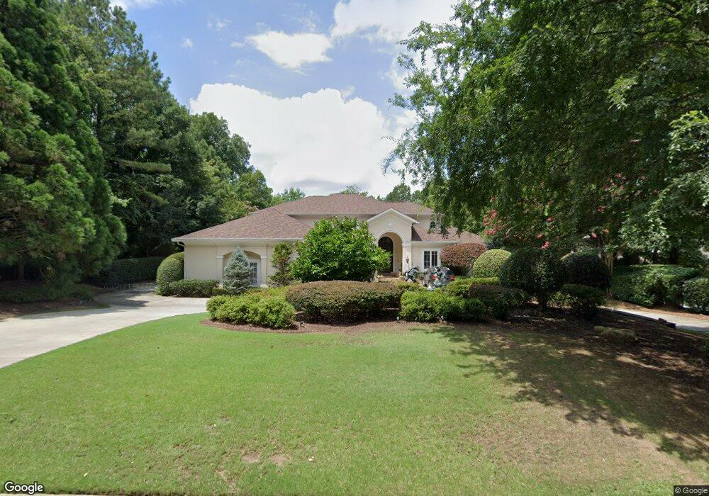
252 Smokerise Trace Peachtree City, GA 30269
Estimated Value: $1,189,000 - $1,566,000
--
Bed
1
Bath
5,123
Sq Ft
$261/Sq Ft
Est. Value
About This Home
This home is located at 252 Smokerise Trace, Peachtree City, GA 30269 and is currently estimated at $1,338,995, approximately $261 per square foot. 252 Smokerise Trace is a home located in Fayette County with nearby schools including Crabapple Lane Elementary School, Booth Middle School, and McIntosh High School.
Ownership History
Date
Name
Owned For
Owner Type
Purchase Details
Closed on
Oct 14, 2005
Sold by
Derodes Robert P and Derodes Bernadette
Bought by
Jones John H
Current Estimated Value
Home Financials for this Owner
Home Financials are based on the most recent Mortgage that was taken out on this home.
Original Mortgage
$800,000
Outstanding Balance
$417,620
Interest Rate
5.37%
Mortgage Type
Stand Alone Second
Estimated Equity
$921,375
Purchase Details
Closed on
Aug 10, 1999
Sold by
Fleming Vernon and Fleming Michelle
Bought by
Derodes Robert P and Derodes Bernadett D
Home Financials for this Owner
Home Financials are based on the most recent Mortgage that was taken out on this home.
Original Mortgage
$650,000
Interest Rate
6%
Mortgage Type
New Conventional
Create a Home Valuation Report for This Property
The Home Valuation Report is an in-depth analysis detailing your home's value as well as a comparison with similar homes in the area
Home Values in the Area
Average Home Value in this Area
Purchase History
| Date | Buyer | Sale Price | Title Company |
|---|---|---|---|
| Jones John H | $1,295,000 | -- | |
| Derodes Robert P | $815,000 | -- |
Source: Public Records
Mortgage History
| Date | Status | Borrower | Loan Amount |
|---|---|---|---|
| Open | Jones John H | $800,000 | |
| Previous Owner | Derodes Robert P | $650,000 |
Source: Public Records
Tax History Compared to Growth
Tax History
| Year | Tax Paid | Tax Assessment Tax Assessment Total Assessment is a certain percentage of the fair market value that is determined by local assessors to be the total taxable value of land and additions on the property. | Land | Improvement |
|---|---|---|---|---|
| 2024 | $9,058 | $560,000 | $85,500 | $474,500 |
| 2023 | $8,751 | $684,820 | $85,500 | $599,320 |
| 2022 | $8,756 | $437,300 | $85,500 | $351,800 |
| 2021 | $8,607 | $437,300 | $85,500 | $351,800 |
| 2020 | $8,065 | $455,580 | $85,500 | $370,080 |
| 2019 | $9,077 | $431,380 | $85,500 | $345,880 |
| 2018 | $8,508 | $397,980 | $85,500 | $312,480 |
| 2017 | $8,592 | $397,980 | $85,500 | $312,480 |
| 2016 | $8,041 | $417,300 | $85,500 | $331,800 |
| 2015 | $7,816 | $398,980 | $85,500 | $313,480 |
| 2014 | $8,914 | $378,540 | $85,500 | $293,040 |
| 2013 | -- | $374,500 | $0 | $0 |
Source: Public Records
Map
Nearby Homes
- 806 Smokey Way
- 230 Smokerise Trace
- 602 Embassy Ct
- 100 Smokerise Trace
- 1133 Astoria Ln
- 504 Telfair Park
- 301 Abercorn Square
- 104 Hidden Springs Ln
- 110 Twin Branch Walk
- 117 N Cove Dr
- 125 Seymour Place
- 115 Seymour Place
- 110 Old Mill Crossing
- 109 Peninsula Dr
- 159 Sims Rd
- 155 Aspen Way
- 216 Redding Ridge
- 101 Parkway Dr
- 802 Shallowford Ln
- 100 Old Plantation Way
- 250 Smokerise Trace
- 254 Smokerise Trace
- 256 Smokerise Trace
- 248 Smokerise Trace
- 255 Smokerise Trace
- 251 Smokerise Trace
- 258 Smokerise Trace
- 257 Smokerise Trace
- 246 Smokerise Trace Unit 1
- 246 Smokerise Trace
- 901 Emerald Ct
- 260 Smokerise Trace
- 261 Smokerise Trace
- 244 Smokerise Trace
- 245 Smokerise Trace
- 401 Loyd Rd
- 802 Smokey Way
- 262 Smokerise Trace
- 807 Smokey Way
- 804 Smokey Way