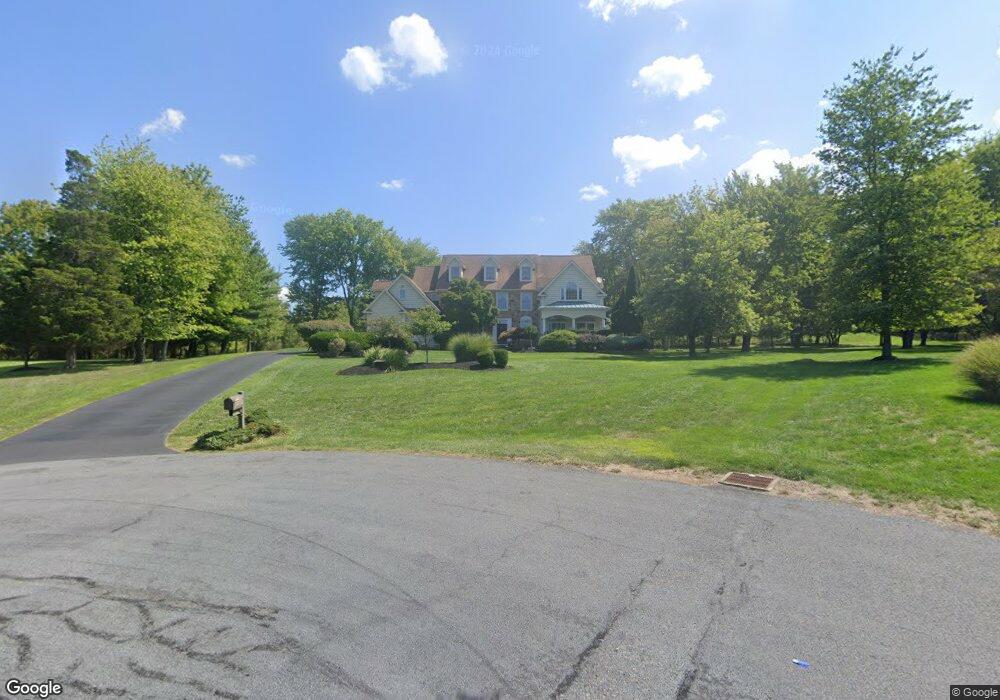
252 Woodland Rd Newtown, PA 18940
Estimated Value: $1,293,000 - $1,383,938
4
Beds
5
Baths
4,750
Sq Ft
$283/Sq Ft
Est. Value
About This Home
This home is located at 252 Woodland Rd, Newtown, PA 18940 and is currently estimated at $1,345,235, approximately $283 per square foot. 252 Woodland Rd is a home located in Bucks County with nearby schools including Wrightstown Elementary School, Newtown Middle School, and Council Rock High School North.
Ownership History
Date
Name
Owned For
Owner Type
Purchase Details
Closed on
Oct 25, 2004
Sold by
Weir David G and Weir Janice R
Bought by
Harrod Laurence and Harrod Christine
Current Estimated Value
Home Financials for this Owner
Home Financials are based on the most recent Mortgage that was taken out on this home.
Original Mortgage
$333,700
Outstanding Balance
$166,194
Interest Rate
5.75%
Mortgage Type
Fannie Mae Freddie Mac
Estimated Equity
$1,179,041
Purchase Details
Closed on
Aug 15, 1996
Sold by
New Kings Ranch Ii
Bought by
Weir David G and Weir Janice R
Home Financials for this Owner
Home Financials are based on the most recent Mortgage that was taken out on this home.
Original Mortgage
$346,300
Interest Rate
5.99%
Create a Home Valuation Report for This Property
The Home Valuation Report is an in-depth analysis detailing your home's value as well as a comparison with similar homes in the area
Home Values in the Area
Average Home Value in this Area
Purchase History
| Date | Buyer | Sale Price | Title Company |
|---|---|---|---|
| Harrod Laurence | $750,000 | -- | |
| Weir David G | $103,250 | -- |
Source: Public Records
Mortgage History
| Date | Status | Borrower | Loan Amount |
|---|---|---|---|
| Open | Harrod Laurence | $333,700 | |
| Previous Owner | Weir David G | $346,300 | |
| Closed | Harrod Laurence | $66,300 |
Source: Public Records
Tax History Compared to Growth
Tax History
| Year | Tax Paid | Tax Assessment Tax Assessment Total Assessment is a certain percentage of the fair market value that is determined by local assessors to be the total taxable value of land and additions on the property. | Land | Improvement |
|---|---|---|---|---|
| 2025 | $12,278 | $69,520 | $13,360 | $56,160 |
| 2024 | $12,278 | $69,520 | $13,360 | $56,160 |
| 2023 | $11,759 | $69,520 | $13,360 | $56,160 |
| 2022 | $11,644 | $69,520 | $13,360 | $56,160 |
| 2021 | $11,464 | $69,520 | $13,360 | $56,160 |
| 2020 | $11,191 | $69,520 | $13,360 | $56,160 |
| 2019 | $10,935 | $69,520 | $13,360 | $56,160 |
| 2018 | $10,733 | $69,520 | $13,360 | $56,160 |
| 2017 | $10,310 | $69,520 | $13,360 | $56,160 |
| 2016 | -- | $69,520 | $13,360 | $56,160 |
| 2015 | -- | $69,520 | $13,360 | $56,160 |
| 2014 | -- | $69,520 | $13,360 | $56,160 |
Source: Public Records
Map
Nearby Homes
- 309 Matthews Ln
- 313 Matthews Ln
- 632 Durham Rd
- 2535 Second Street Pike
- 2692 Windy Bush Rd
- 925 Park Ave
- 40 Hallowell Dr
- 288 Jane Chapman Dr E Unit E
- 439 Brownsburg Rd Unit W
- 274 Pineville Rd
- 457 Brownsburg Rd Unit W
- 101 Laurel Cir
- 401 Society Place Unit A1
- 2204 Society Place Unit B2
- Rollins Plan at Lyondale Meadows
- Laney Plan at Lyondale Meadows
- Kingswood Plan at Lyondale Meadows
- Raintree Plan at Lyondale Meadows
- Mayweather Plan at Lyondale Meadows
- Cloverfield Plan at Lyondale Meadows