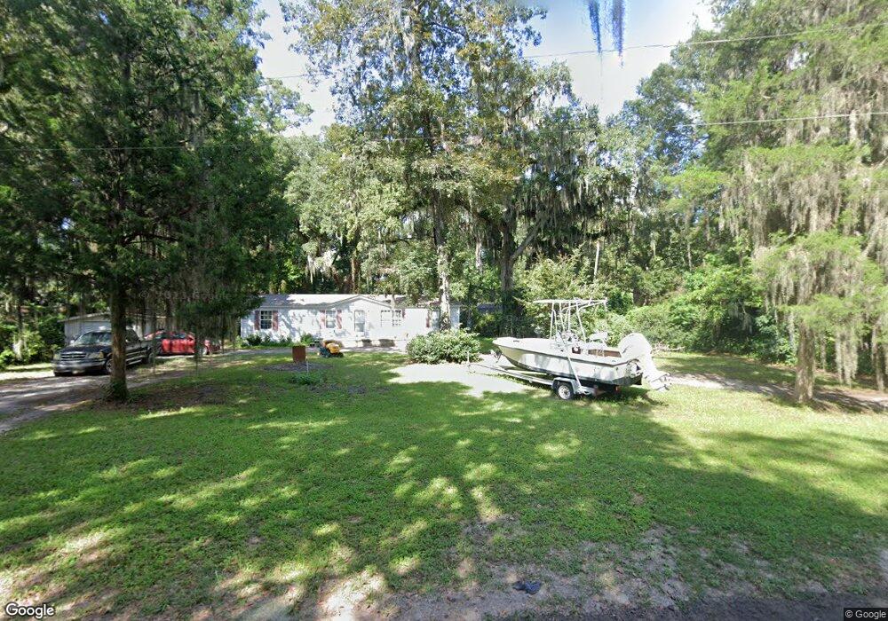
252 Wye Rd Midway, GA 31320
Estimated Value: $66,000 - $167,000
3
Beds
2
Baths
1,440
Sq Ft
$77/Sq Ft
Est. Value
About This Home
This home is located at 252 Wye Rd, Midway, GA 31320 and is currently estimated at $111,463, approximately $77 per square foot. 252 Wye Rd is a home located in Liberty County with nearby schools including Liberty Elementary School, Midway Middle School, and Liberty County High School.
Ownership History
Date
Name
Owned For
Owner Type
Purchase Details
Closed on
Jul 25, 2024
Sold by
Clark Michael
Bought by
Savannah Real Estate Management Llc
Current Estimated Value
Purchase Details
Closed on
Dec 6, 2010
Sold by
Crews Greg C
Bought by
Clark Michael
Purchase Details
Closed on
Mar 14, 1997
Sold by
Zess Jane
Bought by
Crews Greg C and Crews Pat P
Purchase Details
Closed on
Mar 30, 1993
Bought by
Zess Jane and John Tho
Create a Home Valuation Report for This Property
The Home Valuation Report is an in-depth analysis detailing your home's value as well as a comparison with similar homes in the area
Home Values in the Area
Average Home Value in this Area
Purchase History
| Date | Buyer | Sale Price | Title Company |
|---|---|---|---|
| Savannah Real Estate Management Llc | $60,000 | -- | |
| Clark Michael | $48,000 | -- | |
| Crews Greg C | $29,000 | -- | |
| Zess Jane | -- | -- | |
| Zess Jane | $16,500 | -- |
Source: Public Records
Tax History Compared to Growth
Tax History
| Year | Tax Paid | Tax Assessment Tax Assessment Total Assessment is a certain percentage of the fair market value that is determined by local assessors to be the total taxable value of land and additions on the property. | Land | Improvement |
|---|---|---|---|---|
| 2024 | $593 | $14,048 | $10,512 | $3,536 |
| 2023 | $541 | $14,048 | $10,512 | $3,536 |
| 2022 | $541 | $14,048 | $10,512 | $3,536 |
| 2021 | $394 | $10,282 | $6,728 | $3,554 |
| 2020 | $356 | $9,247 | $5,676 | $3,571 |
| 2019 | $347 | $9,265 | $5,676 | $3,589 |
| 2018 | $344 | $9,282 | $5,676 | $3,606 |
| 2017 | $434 | $13,176 | $9,552 | $3,624 |
| 2016 | $455 | $13,194 | $9,552 | $3,642 |
| 2015 | -- | $15,066 | $11,424 | $3,642 |
| 2014 | -- | $10,517 | $9,139 | $1,378 |
| 2013 | -- | $0 | $0 | $0 |
Source: Public Records
Map
Nearby Homes
- 1370 Lake Dr
- 1613 Lake Dr
- 967 Lake Dr
- lot 2 Oak Island Dr
- 454 Jerico Dr
- 0 Palm Island Dr Unit 160024
- 0 Palm Island Dr Unit 328180
- 132 River Rd
- 169 Blue Jay Dr
- 24 Jerico Marsh Lot 24 Rd
- 70 1st St
- 514 W 1st St
- 35/36 W 1st St Unit 35/36
- 545 Carlyene Dr
- 46 Outpost Trail
- 0 Tideland Dr Unit 163173
- 0 Tideland Dr Unit SA333584
- 260 W 1st St
- 221 Outpost Trail
- 170 Circle Rd