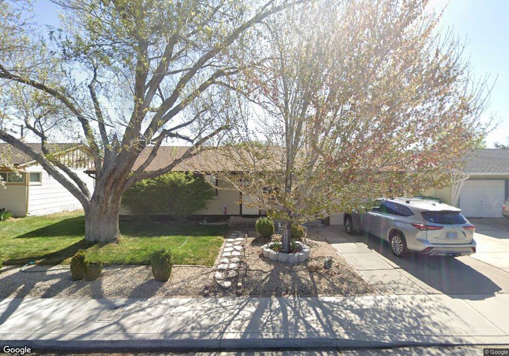
2520 Stine Way Sparks, NV 89431
McCarran Boulevard-Probasco NeighborhoodEstimated Value: $391,156 - $423,000
3
Beds
1
Bath
1,489
Sq Ft
$274/Sq Ft
Est. Value
About This Home
This home is located at 2520 Stine Way, Sparks, NV 89431 and is currently estimated at $407,289, approximately $273 per square foot. 2520 Stine Way is a home located in Washoe County with nearby schools including Florence Drake Elementary School, George L Dilworth Middle School, and Sparks High School.
Ownership History
Date
Name
Owned For
Owner Type
Purchase Details
Closed on
Jan 24, 2018
Sold by
Briscoe Robert D and Briscoe Jacquelyn D
Bought by
Briscoe Robert D and Briscoe Jacquelyn D
Current Estimated Value
Purchase Details
Closed on
Sep 28, 2012
Sold by
Briscoe Robert D and Briscoe Jacquelyn D
Bought by
Briscoe Robert D and Briscoe Jacquelyn D
Purchase Details
Closed on
Sep 6, 2005
Sold by
Ellis Gail W and Ellis Shirley A
Bought by
Briscoe Robert D and Briscoe Jacquelyn D
Home Financials for this Owner
Home Financials are based on the most recent Mortgage that was taken out on this home.
Original Mortgage
$150,000
Outstanding Balance
$82,256
Interest Rate
6.25%
Mortgage Type
New Conventional
Estimated Equity
$325,033
Create a Home Valuation Report for This Property
The Home Valuation Report is an in-depth analysis detailing your home's value as well as a comparison with similar homes in the area
Home Values in the Area
Average Home Value in this Area
Purchase History
| Date | Buyer | Sale Price | Title Company |
|---|---|---|---|
| Briscoe Robert D | -- | None Available | |
| Briscoe Robert D | -- | Western Title Company | |
| Briscoe Robert D | $250,000 | Western Title Incorporated |
Source: Public Records
Mortgage History
| Date | Status | Borrower | Loan Amount |
|---|---|---|---|
| Open | Briscoe Robert D | $150,000 |
Source: Public Records
Tax History Compared to Growth
Tax History
| Year | Tax Paid | Tax Assessment Tax Assessment Total Assessment is a certain percentage of the fair market value that is determined by local assessors to be the total taxable value of land and additions on the property. | Land | Improvement |
|---|---|---|---|---|
| 2025 | $959 | $54,521 | $33,565 | $20,956 |
| 2024 | $959 | $50,694 | $30,065 | $20,629 |
| 2023 | $931 | $50,423 | $31,325 | $19,098 |
| 2022 | $906 | $41,737 | $26,180 | $15,557 |
| 2021 | $881 | $33,103 | $17,955 | $15,148 |
| 2020 | $852 | $31,804 | $16,940 | $14,864 |
| 2019 | $825 | $29,961 | $15,890 | $14,071 |
| 2018 | $791 | $24,938 | $11,725 | $13,213 |
| 2017 | $768 | $24,092 | $10,395 | $13,697 |
| 2016 | $749 | $23,749 | $9,345 | $14,404 |
| 2015 | $748 | $22,731 | $7,700 | $15,031 |
| 2014 | $726 | $21,277 | $6,440 | $14,837 |
| 2013 | -- | $19,340 | $4,270 | $15,070 |
Source: Public Records
Map
Nearby Homes
- 465 Lenwood Dr
- 1945 4th St Unit 32
- 1945 4th St Unit 33
- 1945 4th St Unit 10
- 1940 4th St Unit 20
- 1940 4th St Unit 51
- 1023 Tyler Way
- 780 Emerson Way
- 119 Devere Way
- 1110 Xman Way
- 1125 Dodson Way
- 1705 9th St
- 1160 York Way
- 1003 Sbragia Way
- 3252 Holman Way
- 1345 Plymouth Way
- 10 Sheridan Way
- 1124 Sbragia Way
- 1703 1st St
- 3269 Valley Forge Way