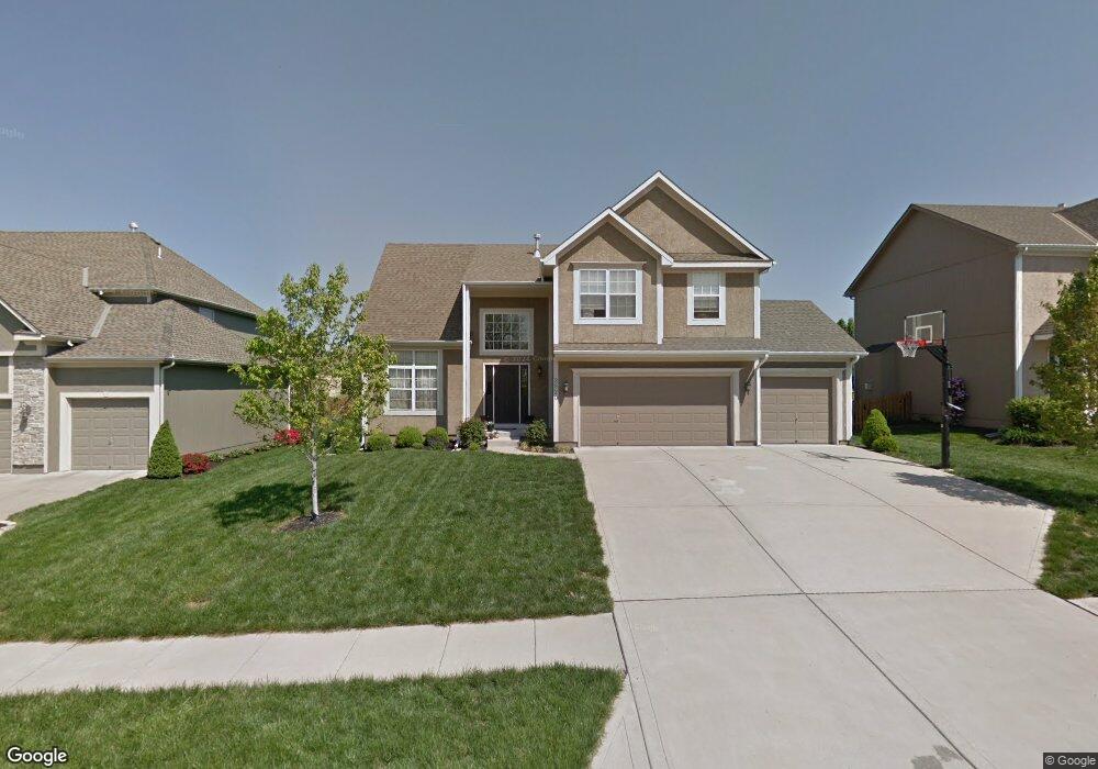
2520 SW Samuel Ln Lees Summit, MO 64081
Estimated Value: $452,000 - $527,000
4
Beds
3
Baths
2,275
Sq Ft
$213/Sq Ft
Est. Value
About This Home
This home is located at 2520 SW Samuel Ln, Lees Summit, MO 64081 and is currently estimated at $483,877, approximately $212 per square foot. 2520 SW Samuel Ln is a home located in Jackson County with nearby schools including Longview Farm Elementary School, Summit Lakes Middle School, and Lee's Summit West High School.
Ownership History
Date
Name
Owned For
Owner Type
Purchase Details
Closed on
Dec 30, 2020
Sold by
Murray Bryan J and Murray Julie A
Bought by
Murray Bryan J and Murray Julie A
Current Estimated Value
Purchase Details
Closed on
Jan 12, 2006
Sold by
Richard Mather Builders Inc
Bought by
Murray Bryan J and Murray Julie A
Home Financials for this Owner
Home Financials are based on the most recent Mortgage that was taken out on this home.
Original Mortgage
$180,000
Outstanding Balance
$101,054
Interest Rate
6.25%
Mortgage Type
Fannie Mae Freddie Mac
Estimated Equity
$382,823
Purchase Details
Closed on
Sep 19, 2005
Sold by
Bmw Communities Inc
Bought by
Richard Mather Builders Inc
Home Financials for this Owner
Home Financials are based on the most recent Mortgage that was taken out on this home.
Original Mortgage
$173,000
Interest Rate
5.88%
Mortgage Type
Purchase Money Mortgage
Create a Home Valuation Report for This Property
The Home Valuation Report is an in-depth analysis detailing your home's value as well as a comparison with similar homes in the area
Home Values in the Area
Average Home Value in this Area
Purchase History
| Date | Buyer | Sale Price | Title Company |
|---|---|---|---|
| Murray Bryan J | -- | None Available | |
| Murray Bryan J | -- | First American Title Ins Co | |
| Richard Mather Builders Inc | -- | 1St American Title |
Source: Public Records
Mortgage History
| Date | Status | Borrower | Loan Amount |
|---|---|---|---|
| Open | Murray Bryan J | $180,000 | |
| Previous Owner | Richard Mather Builders Inc | $173,000 |
Source: Public Records
Tax History
| Year | Tax Paid | Tax Assessment Tax Assessment Total Assessment is a certain percentage of the fair market value that is determined by local assessors to be the total taxable value of land and additions on the property. | Land | Improvement |
|---|---|---|---|---|
| 2025 | $4,684 | $70,859 | $11,455 | $59,404 |
| 2024 | $4,684 | $64,864 | $7,174 | $57,690 |
| 2023 | $4,650 | $64,864 | $9,669 | $55,195 |
| 2022 | $4,325 | $53,580 | $6,547 | $47,033 |
| 2021 | $4,415 | $53,580 | $6,547 | $47,033 |
| 2020 | $4,451 | $53,495 | $6,547 | $46,948 |
| 2019 | $4,330 | $53,495 | $6,547 | $46,948 |
| 2018 | $4,060 | $46,558 | $5,698 | $40,860 |
| 2016 | $3,862 | $43,833 | $7,258 | $36,575 |
Source: Public Records
Map
Nearby Homes
- 2513 SW 12th St
- 2717 SW 12 St
- 2765 SW 11th St
- 1216 SE Ranchland St
- 2787 SW 12th Terrace
- 2409 SW Lilly Dr
- 1100 SW Heather Dr
- 2762 SW 11th Terrace
- 2904 SW 13th St
- 1055 SW Corinthian Ln
- 2612 SW Wintercreek Dr
- 1528 SW Antiquity Dr
- 440 SW Wintergarden Dr
- 3036 SW Pergola View
- 704 SW Trailpark Ct
- 3108 SW Pergola Park Dr
- 3112 SW Pergola Park Dr
- 3116 SW Pergola View
- 3262 SW Pergola Park Dr
- 1025 SW Armie St
- 2516 SW Samuel Ln
- 2524 SW Samuel Ln
- 2528 SW Samuel Ln
- 2512 SW Samuel Ln
- 2521 SW 12th St
- 2525 SW 12th St
- 2521 SW Samuel Ln
- 2508 SW Samuel Ln
- 2517 SW 12th St
- 2525 SW Samuel Ln
- 2517 SW Samuel Ln
- 2513 SW Samuel Ln
- 2529 SW Samuel Ln
- 2532 SW Samuel Ln
- 2533 SW Samuel Ln
- 2509 SW 12th St
- 2537 SW Samuel Ln
- 2509 SW Samuel Ln
- 2512 SW 12th St
- 2516 SW 12th Cir
Your Personal Tour Guide
Ask me questions while you tour the home.