Estimated Value: $483,000 - $508,000
2
Beds
4
Baths
2,082
Sq Ft
$236/Sq Ft
Est. Value
About This Home
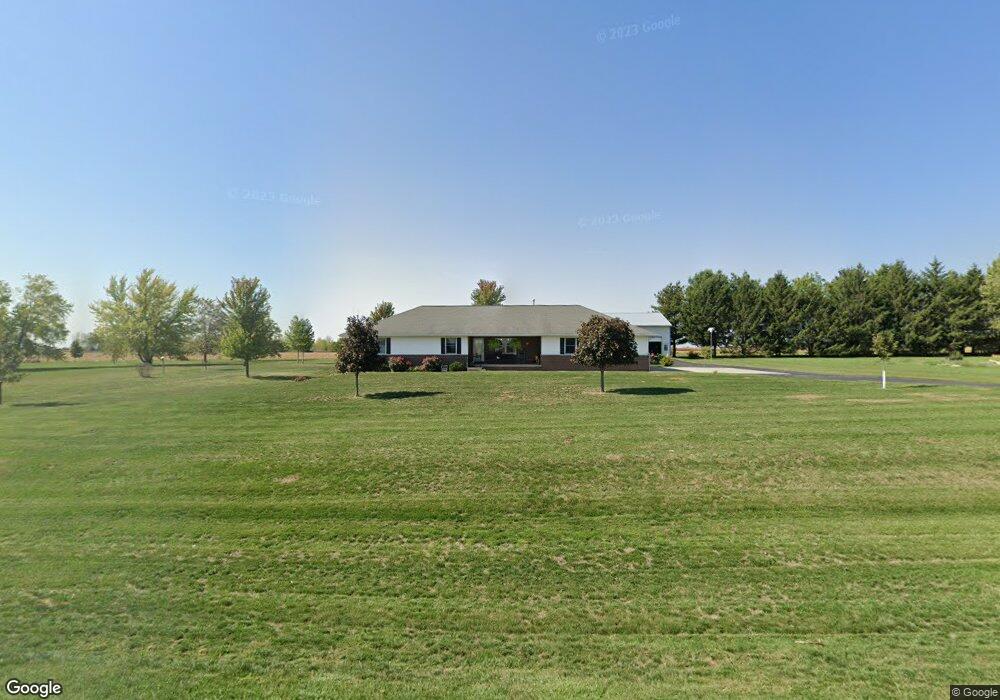
This home is located at 2520 Wooster Rd, Jesup, IA 50648 and is currently estimated at $491,512, approximately $236 per square foot. 2520 Wooster Rd is a home located in Black Hawk County with nearby schools including Jesup Elementary School, Jesup Middle School, and Jesup High School.
Ownership History
Date
Name
Owned For
Owner Type
Purchase Details
Closed on
Aug 28, 2015
Sold by
Steinbron David L and Steinbron Julie M
Bought by
Backes Richard and Backes Sheryle
Current Estimated Value
Create a Home Valuation Report for This Property
The Home Valuation Report is an in-depth analysis detailing your home's value as well as a comparison with similar homes in the area
Home Values in the Area
Average Home Value in this Area
Purchase History
| Date | Buyer | Sale Price | Title Company |
|---|---|---|---|
| Backes Richard | $340,000 | None Available |
Source: Public Records
Tax History Compared to Growth
Tax History
| Year | Tax Paid | Tax Assessment Tax Assessment Total Assessment is a certain percentage of the fair market value that is determined by local assessors to be the total taxable value of land and additions on the property. | Land | Improvement |
|---|---|---|---|---|
| 2024 | $4,636 | $402,880 | $54,000 | $348,880 |
| 2023 | $4,662 | $402,880 | $54,000 | $348,880 |
| 2022 | $4,562 | $340,320 | $43,200 | $297,120 |
| 2021 | $4,748 | $340,320 | $43,200 | $297,120 |
| 2020 | $4,708 | $333,720 | $36,600 | $297,120 |
| 2019 | $4,708 | $333,720 | $36,600 | $297,120 |
| 2018 | $4,504 | $314,280 | $36,600 | $277,680 |
| 2017 | $4,382 | $314,280 | $36,600 | $277,680 |
| 2016 | $3,540 | $314,280 | $36,600 | $277,680 |
| 2015 | $3,540 | $264,100 | $3,350 | $260,750 |
| 2014 | $3,644 | $268,960 | $5,360 | $263,600 |
Source: Public Records
Map
Nearby Homes
- Lot 4 Dalton St
- Lot 7 Dalton St
- Lot 6 Dalton St
- Lot 3 Dalton St
- Lot 5 Dalton St
- Lot 1 Dalton St
- 1555 Dalton St
- 1545 Dalton St
- 1615 Dalton St
- 1565 Dalton St
- Lot 4 Benson Shady Grove Ave
- Lot 2 Benson Shady Grove Ave
- Lot 1 Benson Shady Grove Ave
- 0 Benson Ridge Addition Unit Lot 7 20241370
- 0 Benson Ridge Addition Unit Lot 2 20224979
- 0 Benson Ridge Addition Unit Lot 1 20224978
- 1314 9th St
- 1217 220th St
- 1209 220th St
- 1124 3rd St
- 2432 Wooster Rd
- 2270 Black Hawk Buchanan Ave
- 2600 Wooster Rd
- 2414 Wooster Rd
- 2268 Black Hawk Buchanan Ave
- 444 Limerick Dr
- 414 Limerick Dr
- 354 Limerick Dr
- 314 Limerick Dr
- 2246 Black Hawk Buchanan Ave
- 254 Limerick Dr
- 1814 Killarney Dr
- 1815 Killarney Dr
- 244 Limerick Dr
- 1815 Fiona Ln
- 234 Limerick Dr
- 1744 Killarney Dr
- 1814 Fiona Ln
- 1745 Killarney Dr
- 1745 Fiona Ln