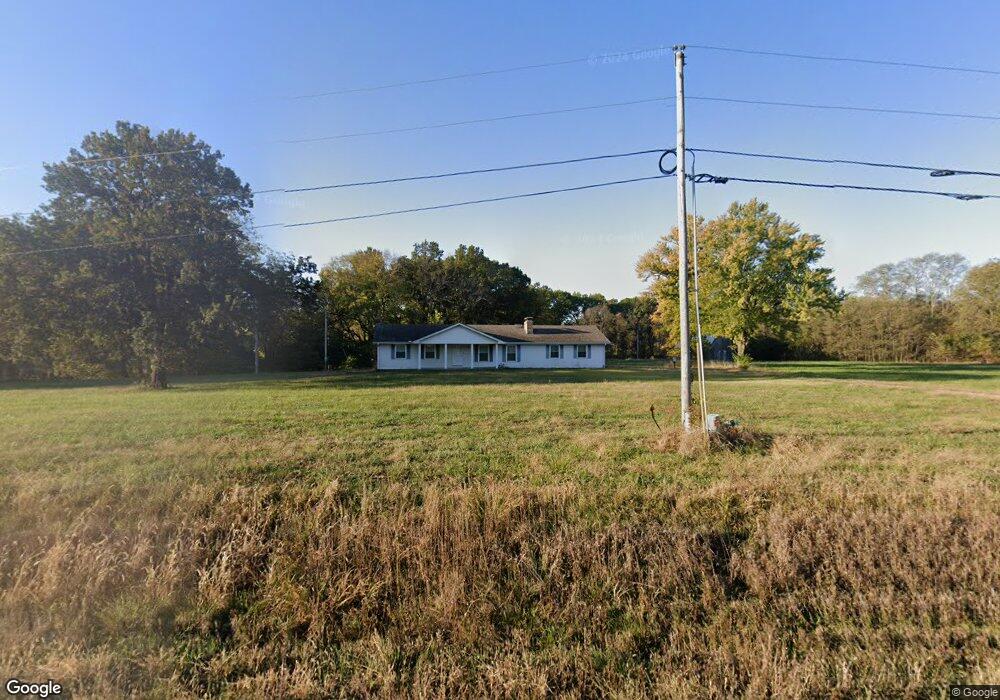
25217 State Route 92 Excelsior Springs, MO 64024
Estimated Value: $365,000 - $498,423
3
Beds
2
Baths
1,352
Sq Ft
$315/Sq Ft
Est. Value
About This Home
This home is located at 25217 State Route 92, Excelsior Springs, MO 64024 and is currently estimated at $426,141, approximately $315 per square foot. 25217 State Route 92 is a home located in Clay County with nearby schools including Excelsior Springs High School.
Ownership History
Date
Name
Owned For
Owner Type
Purchase Details
Closed on
Jul 23, 2025
Sold by
Whisman Frederick A and Marjorie Jean Whisman Trust
Bought by
Whisman Family Trust and Whisman
Current Estimated Value
Purchase Details
Closed on
Feb 21, 2022
Sold by
Jean Whisman Marjorie
Bought by
Marjorie Jean Whisman Trust
Create a Home Valuation Report for This Property
The Home Valuation Report is an in-depth analysis detailing your home's value as well as a comparison with similar homes in the area
Home Values in the Area
Average Home Value in this Area
Purchase History
| Date | Buyer | Sale Price | Title Company |
|---|---|---|---|
| Whisman Family Trust | -- | None Listed On Document | |
| Whisman Family Trust | -- | None Listed On Document | |
| Marjorie Jean Whisman Trust | -- | None Listed On Document | |
| Marjorie Jean Whisman Trust | -- | None Listed On Document |
Source: Public Records
Tax History Compared to Growth
Tax History
| Year | Tax Paid | Tax Assessment Tax Assessment Total Assessment is a certain percentage of the fair market value that is determined by local assessors to be the total taxable value of land and additions on the property. | Land | Improvement |
|---|---|---|---|---|
| 2025 | $2,819 | $46,580 | -- | -- |
| 2024 | $2,819 | $40,670 | -- | -- |
| 2023 | $2,810 | $40,670 | $0 | $0 |
| 2022 | $2,434 | $35,030 | $0 | $0 |
| 2021 | $2,390 | $36,309 | $11,362 | $24,947 |
| 2020 | $2,327 | $32,900 | $0 | $0 |
| 2019 | $2,313 | $32,900 | $0 | $0 |
| 2018 | $2,054 | $29,090 | $0 | $0 |
| 2017 | $2,003 | $29,100 | $6,660 | $22,440 |
| 2016 | $2,003 | $29,100 | $6,660 | $22,440 |
| 2015 | $2,023 | $29,100 | $6,660 | $22,440 |
| 2014 | $1,960 | $27,920 | $6,550 | $21,370 |
Source: Public Records
Map
Nearby Homes
- 25607 High Dr
- 1606 Lynn Rd
- 15617 Oakmont Dr
- 16210 Baxter Rd
- 609 Kimberly Dr
- 617 Lodwick Ln
- 2017 Karlton Way
- 2006 E Norma Ct
- 1908 Lesa Place
- 211 Carla St
- 112 Delores St
- 1318 Kristie Cir
- 2207 Ashford St
- 21619 NE 150th St
- 1999 Larkspur St
- 2081 Rock Bridge Pkwy
- 2017 Wornall Rd
- Lot 2 Wornall Rd
- 0 Meadowlark Ln
- 1018 Miss Belle St
- 25015 State Route 92
- 15509 Park Ln
- 15506 Park Ln
- 25010 State Route 92
- 15523 Park Ln
- 25606 State Route 92
- 15600 Park Ln
- 25611 Louisa Dr
- 25624 State Route 92
- 15614 Meadow Ln
- 24808 State Route 92
- 25606 Louisa Dr
- 25803 Louisa Dr
- 15619 Park Ln
- 25620 Louisa Dr
- 15703 Meadow Ln
- 15618 Meadow Ln
- 25815 Louisa Dr
- 24605 State Route 92
- 24605 State Route 92