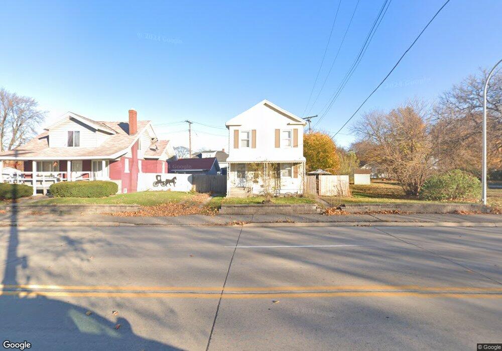
2526 10th St Port Huron, MI 48060
Estimated Value: $161,000 - $199,000
3
Beds
2
Baths
1,692
Sq Ft
$104/Sq Ft
Est. Value
About This Home
This home is located at 2526 10th St, Port Huron, MI 48060 and is currently estimated at $175,385, approximately $103 per square foot. 2526 10th St is a home located in St. Clair County with nearby schools including Woodrow Wilson Elementary School, Central Middle School, and Port Huron High School.
Ownership History
Date
Name
Owned For
Owner Type
Purchase Details
Closed on
Aug 17, 2016
Sold by
Sopha Rentals
Bought by
Kenney Michael and Meinhardt Richard
Current Estimated Value
Home Financials for this Owner
Home Financials are based on the most recent Mortgage that was taken out on this home.
Original Mortgage
$39,275
Outstanding Balance
$31,306
Interest Rate
3.45%
Estimated Equity
$144,079
Purchase Details
Closed on
Nov 24, 2009
Sold by
Sopha Richard B and Sopha Martha J
Bought by
Sopha Rentals Llc
Create a Home Valuation Report for This Property
The Home Valuation Report is an in-depth analysis detailing your home's value as well as a comparison with similar homes in the area
Home Values in the Area
Average Home Value in this Area
Purchase History
| Date | Buyer | Sale Price | Title Company |
|---|---|---|---|
| Kenney Michael | -- | -- | |
| Sopha Rentals Llc | -- | None Available |
Source: Public Records
Mortgage History
| Date | Status | Borrower | Loan Amount |
|---|---|---|---|
| Open | Kenney Michael | $39,275 | |
| Closed | Kenney Michael | -- |
Source: Public Records
Tax History Compared to Growth
Tax History
| Year | Tax Paid | Tax Assessment Tax Assessment Total Assessment is a certain percentage of the fair market value that is determined by local assessors to be the total taxable value of land and additions on the property. | Land | Improvement |
|---|---|---|---|---|
| 2025 | $2,065 | $72,200 | $0 | $0 |
| 2024 | $1,748 | $68,500 | $0 | $0 |
| 2023 | $1,651 | $60,900 | $0 | $0 |
| 2022 | $1,723 | $51,300 | $0 | $0 |
| 2021 | $1,589 | $46,800 | $0 | $0 |
| 2020 | $942 | $27,100 | $27,100 | $0 |
| 2019 | $926 | $19,200 | $0 | $0 |
| 2018 | $906 | $19,200 | $0 | $0 |
| 2017 | $810 | $18,100 | $0 | $0 |
| 2016 | $975 | $18,100 | $0 | $0 |
| 2015 | $1,007 | $18,100 | $18,100 | $0 |
| 2014 | $1,007 | $18,700 | $18,700 | $0 |
| 2013 | -- | $19,700 | $0 | $0 |
Source: Public Records
Map
Nearby Homes
- 2411 10th St
- 823 Beard St
- 2444 Military St
- 2430 Military St Unit 2434
- 2710 Electric Ave
- 2718 Electric Ave
- 2704 Military St
- 1403 Catherine McAuley Dr
- 2724 Military St
- 730 Jenkinson St
- 913 Tunnel St
- 1414 Beard St
- 2815 Military St
- 2109 Military St
- 831 Bancroft St
- 1112 Minnie St
- 1127 Minnie St
- 1815 8th St
- 1319 Minnie St
- 1322 Division St
- 2518 10th St
- 2538 10th St Unit Bldg-Unit
- 2538 10th St
- 2538 10th St Unit 2546 10th Street
- 1000 Vanderburgh Place
- 922 Vanderburgh Place
- 2546 10th St
- 2525 Electric Ave
- 925 Vanderburgh Place
- 2444 10th St
- 918 Vanderburgh Place
- 916 Vanderburgh Place
- 910 Vanderburgh Place
- 2440 10th St
- 921 Vanderburgh Place
- 917 Vanderburgh Place
- 2436 10th St
- 913 Vanderburgh Place
- 919 Vanderburgh Place
- 1020 Vanderburgh Place