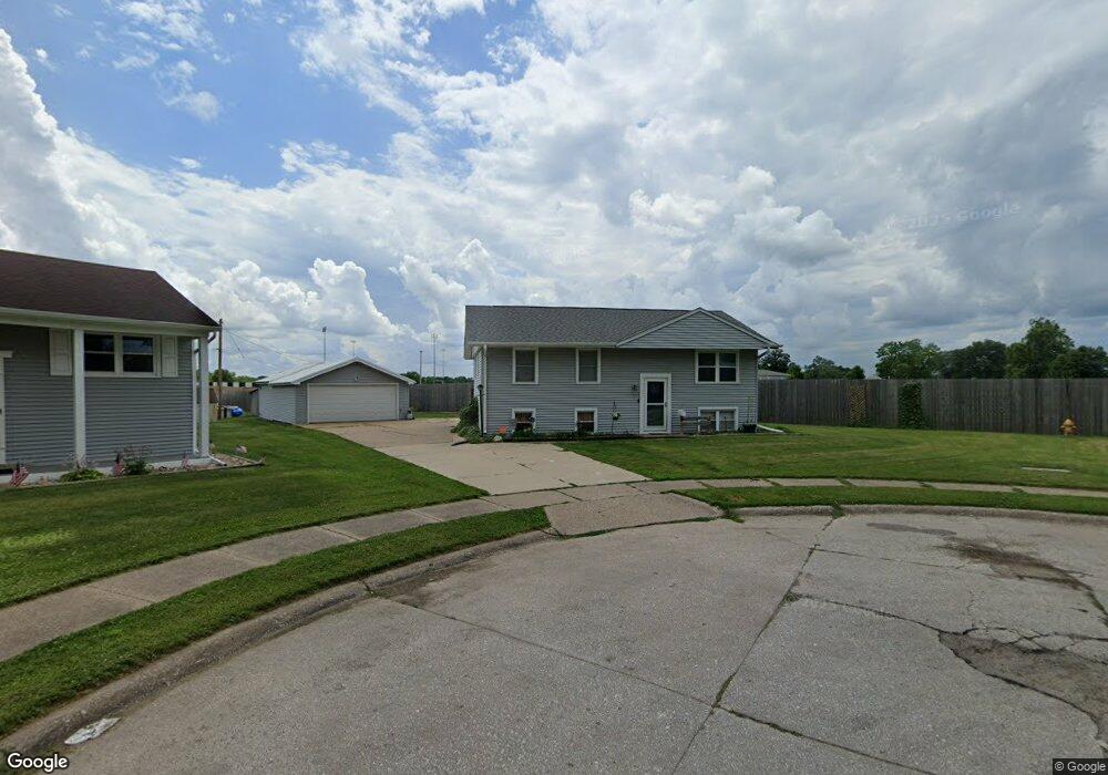
2527 W 18th St Davenport, IA 52804
Northwest Davenport NeighborhoodEstimated Value: $174,000 - $216,000
4
Beds
3
Baths
1,263
Sq Ft
$150/Sq Ft
Est. Value
About This Home
This home is located at 2527 W 18th St, Davenport, IA 52804 and is currently estimated at $188,917, approximately $149 per square foot. 2527 W 18th St is a home located in Scott County with nearby schools including Walnut Hill Elementary School, South Christian Elementary School, and Wilson Elementary School.
Ownership History
Date
Name
Owned For
Owner Type
Purchase Details
Closed on
Mar 31, 2008
Sold by
Siefers Jane F
Bought by
Brinkley Jason A
Current Estimated Value
Home Financials for this Owner
Home Financials are based on the most recent Mortgage that was taken out on this home.
Original Mortgage
$82,215
Outstanding Balance
$52,200
Interest Rate
6.1%
Mortgage Type
Purchase Money Mortgage
Estimated Equity
$136,717
Create a Home Valuation Report for This Property
The Home Valuation Report is an in-depth analysis detailing your home's value as well as a comparison with similar homes in the area
Home Values in the Area
Average Home Value in this Area
Purchase History
| Date | Buyer | Sale Price | Title Company |
|---|---|---|---|
| Brinkley Jason A | $90,000 | Gomez Title & Closing Co |
Source: Public Records
Mortgage History
| Date | Status | Borrower | Loan Amount |
|---|---|---|---|
| Open | Brinkley Jason A | $82,215 |
Source: Public Records
Tax History Compared to Growth
Tax History
| Year | Tax Paid | Tax Assessment Tax Assessment Total Assessment is a certain percentage of the fair market value that is determined by local assessors to be the total taxable value of land and additions on the property. | Land | Improvement |
|---|---|---|---|---|
| 2025 | $2,356 | $170,650 | $18,370 | $152,280 |
| 2024 | $2,296 | $142,100 | $18,370 | $123,730 |
| 2023 | $2,574 | $142,100 | $18,370 | $123,730 |
| 2022 | $2,742 | $129,400 | $16,330 | $113,070 |
| 2021 | $2,584 | $129,400 | $16,330 | $113,070 |
| 2020 | $2,430 | $120,620 | $16,330 | $104,290 |
| 2019 | $2,392 | $115,140 | $16,330 | $98,810 |
| 2018 | $2,338 | $115,140 | $16,330 | $98,810 |
| 2017 | $2,246 | $115,140 | $16,330 | $98,810 |
| 2016 | $2,160 | $107,320 | $0 | $0 |
| 2015 | $2,160 | $103,440 | $0 | $0 |
| 2014 | $2,104 | $103,440 | $0 | $0 |
| 2013 | $2,064 | $0 | $0 | $0 |
| 2012 | -- | $109,800 | $15,410 | $94,390 |
Source: Public Records
Map
Nearby Homes
- 2417 W 18th St
- 1922 N Pine St
- 2449 W 13th St
- 1203 N Thornwood Ave
- 1119 N Thornwood Ave
- 2926 W Lombard St
- 2223 W Lombard St
- 2102 W 17th St
- 1107 N Thornwood Ave
- 2314 N Birchwood Ave
- 2103 W High St
- 3430 W Locust St
- 926 Cimarron Dr
- 2012 N Ohio Ave
- 1215 Waverly Rd
- 3238 W Colorado St
- 1723 W Locust St
- 1145 Waverly Rd
- 1604 N Division St
- 2308 Wilkes Ave
- 2521 W 18th St
- 2526 W 18th St
- 2511 W 18th St
- 2520 W 18th St
- 2514 W 18th St
- 2505 W 18th St
- 2525 W Locust St
- 2506 W 18th St
- 2431 W 18th St
- 2515 W Locust St
- 2511 W Locust St
- 2432 W 18th St
- 2423 W 18th St
- 2503 W Locust St
- 2424 W 18th St
- 2433 W Locust St
- 2433 W Locust St Unit 35
- 2429 W Locust St
- 2418 W 18th St
- 2411 W 18th St