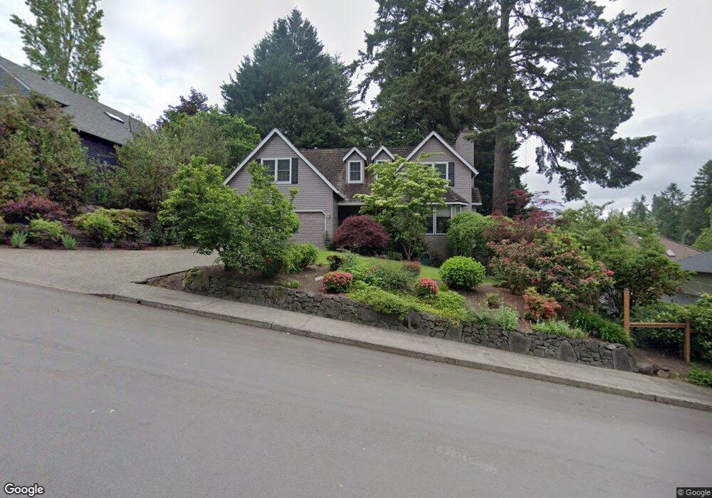
25290 Swiftshore Dr West Linn, OR 97068
Willamette NeighborhoodEstimated Value: $821,441 - $926,000
4
Beds
3
Baths
2,736
Sq Ft
$316/Sq Ft
Est. Value
About This Home
This home is located at 25290 Swiftshore Dr, West Linn, OR 97068 and is currently estimated at $864,610, approximately $316 per square foot. 25290 Swiftshore Dr is a home located in Clackamas County with nearby schools including Willamette Primary School, Athey Creek Middle School, and West Linn High School.
Ownership History
Date
Name
Owned For
Owner Type
Purchase Details
Closed on
Nov 14, 2005
Sold by
Quinn William J
Bought by
Lyons Beverly
Current Estimated Value
Purchase Details
Closed on
May 20, 2002
Sold by
Quinn William J and Quinn Mary Lee
Bought by
Quinn William J
Home Financials for this Owner
Home Financials are based on the most recent Mortgage that was taken out on this home.
Original Mortgage
$228,750
Interest Rate
8.62%
Create a Home Valuation Report for This Property
The Home Valuation Report is an in-depth analysis detailing your home's value as well as a comparison with similar homes in the area
Home Values in the Area
Average Home Value in this Area
Purchase History
| Date | Buyer | Sale Price | Title Company |
|---|---|---|---|
| Lyons Beverly | $450,000 | Transnation Title Agency Or | |
| Quinn William J | -- | Transnation Title Insurance |
Source: Public Records
Mortgage History
| Date | Status | Borrower | Loan Amount |
|---|---|---|---|
| Previous Owner | Quinn William J | $228,750 |
Source: Public Records
Tax History Compared to Growth
Tax History
| Year | Tax Paid | Tax Assessment Tax Assessment Total Assessment is a certain percentage of the fair market value that is determined by local assessors to be the total taxable value of land and additions on the property. | Land | Improvement |
|---|---|---|---|---|
| 2025 | $8,570 | $444,709 | -- | -- |
| 2024 | $8,250 | $431,757 | -- | -- |
| 2023 | $8,250 | $419,182 | $0 | $0 |
| 2022 | $7,786 | $406,973 | $0 | $0 |
| 2021 | $7,391 | $395,120 | $0 | $0 |
| 2020 | $7,442 | $383,612 | $0 | $0 |
| 2019 | $7,097 | $372,439 | $0 | $0 |
| 2018 | $6,780 | $361,591 | $0 | $0 |
| 2017 | $6,410 | $351,059 | $0 | $0 |
| 2016 | $6,226 | $340,834 | $0 | $0 |
| 2015 | $5,778 | $330,907 | $0 | $0 |
| 2014 | $5,531 | $321,269 | $0 | $0 |
Source: Public Records
Map
Nearby Homes
- 25545 Katherine Ct
- 1765 Ostman Rd
- 1690 16th St
- 1694 16th St
- 1075 Epperly Way
- 1721 Dollar St Unit 1721
- 1733 Jamie Cir
- 1931 13th St
- 1160 Blankenship Rd
- 1315 11th St
- 812 Wendy Ct
- 2250 River Heights Cir
- 2077 5th Ave
- 975 Springtree Ln
- 1101 Ryan Ct
- 880 Springtree Ln Unit 880
- 850 Springtree Ln Unit 850
- 640 Springtree Ln
- 24800 SW Big Fir Rd
- 1218 9th St Unit Lot 3
- 25270 Swiftshore Dr
- 25330 Swiftshore Dr
- 25410 Swiftshore Dr
- 1260 Swiftshore Cir
- 1240 Swiftshore Cir
- 25430 Swiftshore Dr
- 1170 Swiftshore Cir
- 25430 Swift Shore Dr
- 1130 Swiftshore Cir
- 1190 Swiftshore Cir
- 25315 Swiftshore Dr
- 1190 Swiftshore Dr
- 1170 Swift Shore Cir
- 1060 Rancho Lobo Ln
- 25345 Swiftshore Dr
- 1190 Swift Shore Cir
- 25450 Swiftshore Dr
- 1200 Swiftshore Cir
- 25375 Swift Shore Dr
- 25375 Swiftshore Dr