Estimated Value: $460,000 - $570,000
Studio
4
Baths
4,195
Sq Ft
$121/Sq Ft
Est. Value
About This Home
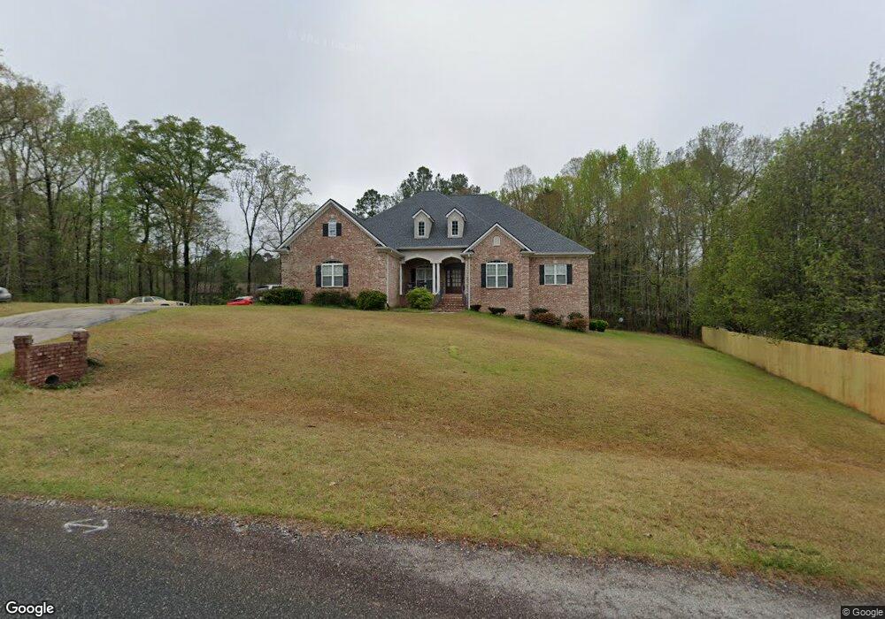
This home is located at 253 Stone Brooke Dr, Gray, GA 31032 and is currently estimated at $508,657, approximately $121 per square foot. 253 Stone Brooke Dr is a home located in Jones County with nearby schools including Gray Elementary School, Gray Station Middle School, and Jones County High School.
Ownership History
Date
Name
Owned For
Owner Type
Purchase Details
Closed on
Aug 7, 2008
Sold by
Newman Brett J
Bought by
Duval Thomas E
Current Estimated Value
Purchase Details
Closed on
Oct 20, 2006
Sold by
Not Provided
Bought by
Duval Thomas E
Home Financials for this Owner
Home Financials are based on the most recent Mortgage that was taken out on this home.
Original Mortgage
$281,600
Interest Rate
6.31%
Mortgage Type
New Conventional
Create a Home Valuation Report for This Property
The Home Valuation Report is an in-depth analysis detailing your home's value as well as a comparison with similar homes in the area
Home Values in the Area
Average Home Value in this Area
Purchase History
| Date | Buyer | Sale Price | Title Company |
|---|---|---|---|
| Duval Thomas E | $320,000 | -- | |
| Duval Thomas E | $32,000 | -- |
Source: Public Records
Mortgage History
| Date | Status | Borrower | Loan Amount |
|---|---|---|---|
| Previous Owner | Duval Thomas E | $281,600 |
Source: Public Records
Tax History
| Year | Tax Paid | Tax Assessment Tax Assessment Total Assessment is a certain percentage of the fair market value that is determined by local assessors to be the total taxable value of land and additions on the property. | Land | Improvement |
|---|---|---|---|---|
| 2025 | $9,790 | $240,715 | $14,560 | $226,155 |
| 2023 | $4,517 | $150,625 | $11,200 | $139,425 |
| 2022 | $5,179 | $150,289 | $10,864 | $139,425 |
| 2021 | $5,186 | $150,289 | $10,864 | $139,425 |
| 2020 | $5,188 | $150,289 | $10,864 | $139,425 |
| 2019 | $5,081 | $147,444 | $10,864 | $136,580 |
| 2018 | $5,081 | $147,444 | $10,864 | $136,580 |
| 2017 | $5,081 | $147,444 | $10,864 | $136,580 |
| 2016 | $5,081 | $147,444 | $10,864 | $136,580 |
| 2015 | $4,828 | $147,444 | $10,864 | $136,580 |
| 2014 | $4,446 | $147,444 | $10,864 | $136,580 |
Source: Public Records
Map
Nearby Homes
- 250 Stone Brooke Lot 133 Dr
- 250 Stone Brooke Dr Unit LOT 133
- 250 Stone Brooke Dr
- 1104 Boulder Dr
- 115 Oak Dr
- 122 Oak Dr
- 132 Oak Dr
- 0 Clinton Crossing Unit 10637924
- 184 Stone Brooke Dr
- 146 Lite N Tie Rd
- 266 Clinton Crossing Dr
- 1023 Boulder Lot 65 Dr
- 1023 Boulder Dr Unit LOT 65
- 1023 Boulder Dr
- 0 Clinton Crossing Dr Unit M181966
- 128 Clinton Crossing Dr
- 229 Lite N Tie Rd
- 0 Bill Conn Pkwy
- 203 Hidden Lakes Dr
- 236 Old Clinton Rd
- 257 Stone Brooke Dr
- 1082 Boulder Dr
- 247 Stone Brooke Dr
- 258 Stone Brooke Dr
- 1076 Boulder Dr
- 244 Stone Brooke Dr
- 1098 Boulder Dr
- 1098 Boulder Dr Unit 135
- 1072 Boulder Dr
- 119 Saint Paul Church Cir
- 119 St Paul Church Cir
- 1081 Boulder Dr
- 240 Stone Brooke Dr
- 1077 Boulder Dr Unit 110
- 1077 Boulder Dr
- 131 Saint Paul Church Cir
- 1068 Boulder Dr
- 1073 Boulder Dr Unit 111
- 1073 Boulder Dr
- 227 Stone Brooke Dr
Your Personal Tour Guide
Ask me questions while you tour the home.