Estimated Value: $74,277 - $137,000
--
Bed
1
Bath
1,308
Sq Ft
$83/Sq Ft
Est. Value
About This Home
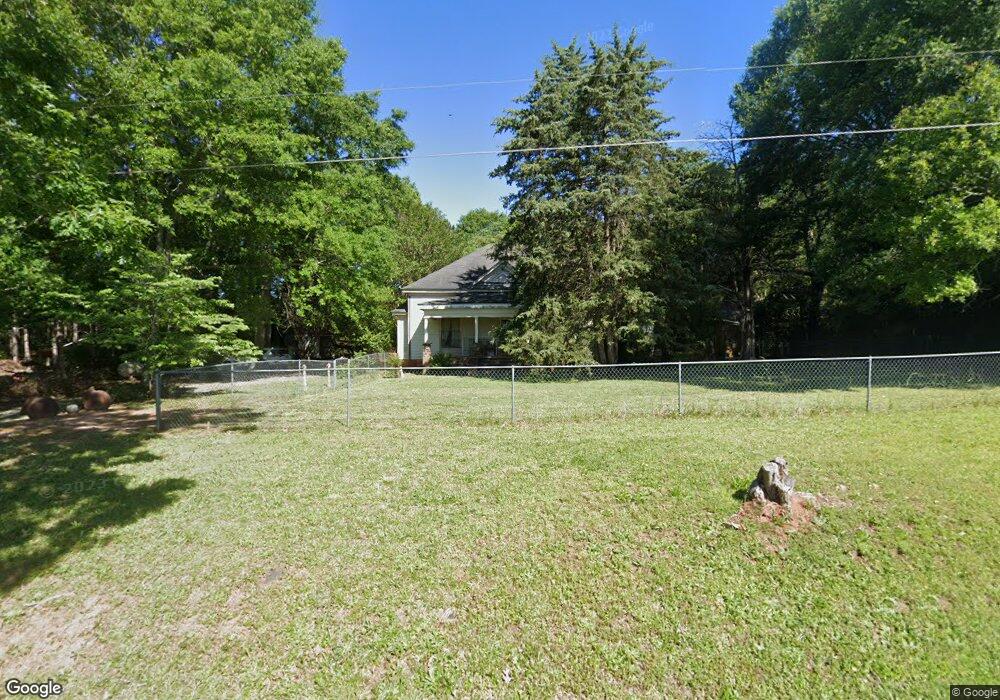
This home is located at 253 Thornton Rd, Gray, GA 31032 and is currently estimated at $108,069, approximately $82 per square foot. 253 Thornton Rd is a home located in Jones County with nearby schools including Gray Elementary School, Gray Station Middle School, and Jones County High School.
Ownership History
Date
Name
Owned For
Owner Type
Purchase Details
Closed on
Sep 28, 2017
Sold by
Methe Randolph C
Bought by
Methe Mary Elaine
Current Estimated Value
Purchase Details
Closed on
Aug 6, 2008
Sold by
Gordon Glenn
Bought by
Methe Randolph C and Methe Mary Elaine
Purchase Details
Closed on
Oct 24, 2007
Sold by
Not Provided
Bought by
Methe Randolph
Purchase Details
Closed on
Apr 5, 2007
Sold by
Not Provided
Bought by
Methe Randolph C and Methe Mary Elaine
Purchase Details
Closed on
Dec 5, 2006
Sold by
Not Provided
Bought by
Methe Randolph C and Methe Mary Elaine
Purchase Details
Closed on
Jun 6, 2002
Sold by
Gordon Ivey R
Bought by
Gordon Glenn R
Purchase Details
Closed on
Jun 11, 1992
Sold by
Greene Nell
Bought by
Gordon Ivey R
Create a Home Valuation Report for This Property
The Home Valuation Report is an in-depth analysis detailing your home's value as well as a comparison with similar homes in the area
Home Values in the Area
Average Home Value in this Area
Purchase History
| Date | Buyer | Sale Price | Title Company |
|---|---|---|---|
| Methe Mary Elaine | -- | -- | |
| Methe Randolph C | $25,000 | -- | |
| Methe Randolph | $28,400 | -- | |
| Methe Randolph C | $18,500 | -- | |
| Methe Randolph C | $18,000 | -- | |
| Gordon Glenn R | $10,000 | -- | |
| Gordon Ivey R | -- | -- |
Source: Public Records
Tax History Compared to Growth
Tax History
| Year | Tax Paid | Tax Assessment Tax Assessment Total Assessment is a certain percentage of the fair market value that is determined by local assessors to be the total taxable value of land and additions on the property. | Land | Improvement |
|---|---|---|---|---|
| 2023 | $409 | $11,389 | $5,620 | $5,769 |
| 2022 | $399 | $11,108 | $5,339 | $5,769 |
| 2021 | $399 | $11,108 | $5,339 | $5,769 |
| 2020 | $400 | $11,108 | $5,339 | $5,769 |
| 2019 | $400 | $11,108 | $5,339 | $5,769 |
| 2018 | $400 | $11,108 | $5,339 | $5,769 |
| 2017 | $400 | $11,108 | $5,339 | $5,769 |
| 2016 | $400 | $11,108 | $5,339 | $5,769 |
| 2015 | $378 | $11,108 | $5,339 | $5,769 |
| 2014 | -- | $11,108 | $5,339 | $5,769 |
Source: Public Records
Map
Nearby Homes
- 177 Patton Rd
- 136 Fortville Rd
- 166 Greene Shade Rd
- 00 Eatonton Hwy
- 0 Eatonton Hwy Unit 180360
- 0 Eatonton Hwy Unit 10557840
- 0 Eatonton Hwy Unit 10254433
- 0 Eatonton Hwy Unit 10557843
- 0 Eatonton Hwy Unit 23385714
- 247 Southern Walk Cir
- 000 Eatonton Hwy
- 232 North St
- 0 Sandra Dr Unit M179018
- 0 Sandra Dr Unit 52382
- 0 Sandra Dr Unit 10487926
- 0 Sandra Dr Unit 252106
- 106 Davis St
- 147 Savannah Dr
- 116 Pinewood Dr
- 5 Points Rd
- 242 Hungerford Rd
- 245 Hungerford Rd
- 239 Hungerford Rd
- 235 Hungerford Rd
- 232 Thornton Rd
- 227 Hungerford Rd
- 231 Hungerford Rd
- 125 Slocumb Rd
- 226 Thornton Rd
- 141 Slocumb Rd
- 124 Slocumb Rd
- 267 Hungerford Rd
- 267 Hungerford Rd
- 686 N Cross Rd
- 138 Slocumb Rd
- 114 Slocumb Rd
- 273 Hungerford Rd
- 116 Slocumb Rd
- 275 Hungerford Rd
- 281 Hungerford Rd