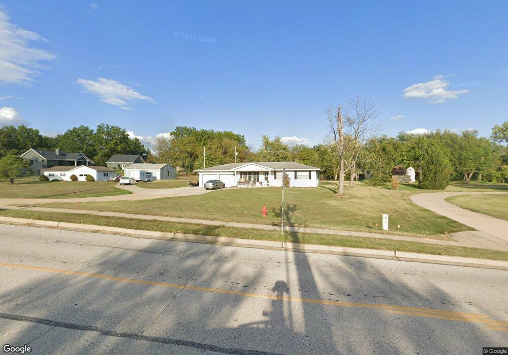
2530 Bates Rd O Fallon, MO 63368
Estimated Value: $266,000 - $360,000
About This Home
This home is located at 2530 Bates Rd, O Fallon, MO 63368 and is currently estimated at $303,768, approximately $271 per square foot. 2530 Bates Rd is a home located in St. Charles County with nearby schools including Twin Chimneys Elementary School, Fort Zumwalt West Middle School, and Fort Zumwalt West High School.
Ownership History
We collect this data history from publicly available records. To have your information removed, we recommend requesting removal directly through your county’s website.
Purchase Details
Purchase Details
Purchase Details
Purchase Details
Home Financials for this Owner
Home Financials are based on the most recent Mortgage that was taken out on this home.Home Values in the Area
Average Home Value in this Area
Purchase History
We collect this data history from publicly available records. To have your information removed, we recommend requesting removal directly through your county’s website.
| Date | Buyer | Sale Price | Title Company |
|---|---|---|---|
| -- | None Available | ||
| -- | None Available | ||
| $81,814 | Assured Title Co | ||
| -- | -- |
Mortgage History
We collect this data history from publicly available records. To have your information removed, we recommend requesting removal directly through your county’s website.
| Date | Status | Borrower | Loan Amount |
|---|---|---|---|
| Previous Owner | $90,000 |
Tax History
We collect this data history from publicly available records. To have your information removed, we recommend requesting removal directly through your county’s website.
| Year | Tax Paid | Tax Assessment Tax Assessment Total Assessment is a certain percentage of the fair market value that is determined by local assessors to be the total taxable value of land and additions on the property. | Land | Improvement |
|---|---|---|---|---|
| 2025 | $2,103 | $30,870 | -- | -- |
| 2023 | $2,101 | $33,521 | $0 | $0 |
| 2022 | $1,770 | $26,197 | $0 | $0 |
| 2021 | $1,769 | $26,197 | $0 | $0 |
| 2020 | $2,711 | $26,098 | $0 | $0 |
| 2019 | $2,705 | $26,098 | $0 | $0 |
| 2018 | $2,950 | $28,397 | $0 | $0 |
| 2017 | $2,940 | $28,397 | $0 | $0 |
| 2016 | $2,922 | $28,072 | $0 | $0 |
| 2015 | $2,749 | $28,072 | $0 | $0 |
| 2014 | $2,700 | $26,676 | $0 | $0 |
Map
- 706 Rolling Wind Dr
- 715 Rolling Wind Dr
- 1108 Hampton Meadows Dr
- 18 Wind Hill Ct
- 2622 Whitetail Ln
- 13 Macleod Ct
- 7357 Macleod Ln
- 0 Unknown Unit MIS22064590
- 0 Unknown Unit MIS25074879
- 0 Unknown Unit MIS22064605
- 0 Unknown Unit MIS22064597
- 7816 Wind Hill Dr
- 2457 Dunheath Ln
- 1 Dragonstone Ct
- 3 Dragonstone Ct
- 5 Dragonstone Ct
- 985 Rolling Thunder Dr
- 7 Dragonstone Ct
- 9 Dragonstone Ct
- 146 Boardwalk Gardens Dr
- 2542 Bates Rd
- 1166 Saint Theresa Ln
- 2518 Bates Rd
- 304 Chestnut Creek Cir
- 302 Chestnut Creek Cir
- 306 Chestnut Creek Cir
- 317 Heritage Commons Cir
- 317 Heritage Commons Cir Unit 210
- 315 Heritage Commons Cir
- 315 Heritage Commons Cir
- 315 Heritage Commons Cir Unit 209
- 311 Heritage Commons Cir
- 311 Heritage Commons Cir
- 311 Heritage Commons Cir Unit 208
- 321 Heritage Commons Cir
- 300 Chestnut Creek Cir
- 307 Heritage Commons Cir
- 300 Chestnut Creek Cir
- 323 Heritage Commons Cir
- 305 Heritage Commons Cir
Ask me questions while you tour the home.