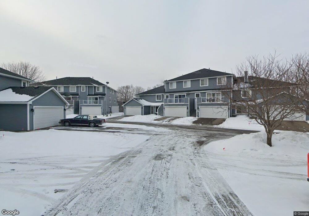
2531 E 117th St Burnsville, MN 55337
Estimated Value: $239,206 - $249,000
2
Beds
2
Baths
1,200
Sq Ft
$203/Sq Ft
Est. Value
About This Home
This home is located at 2531 E 117th St, Burnsville, MN 55337 and is currently estimated at $243,052, approximately $202 per square foot. 2531 E 117th St is a home located in Dakota County with nearby schools including Burnsville High School, Gateway STEM Academy, and Sunrise International Montessori School.
Ownership History
Date
Name
Owned For
Owner Type
Purchase Details
Closed on
Jul 16, 2025
Sold by
State Of Minnesota
Bought by
City Of Burnsville
Current Estimated Value
Purchase Details
Closed on
Aug 20, 2007
Sold by
Krusemark Cary L and Krusemark Kill
Bought by
Gerten Bradly Howard
Purchase Details
Closed on
May 15, 2002
Sold by
Wooton Michael W and Wooton Danielle Rae
Bought by
Krusemarl Cary L
Purchase Details
Closed on
Mar 27, 2001
Sold by
Lamb Todd W and Lambe Lena M
Bought by
Wooton Michael and Mamer Danielle
Purchase Details
Closed on
Nov 3, 1998
Sold by
Mikkonen Douglas A
Bought by
Lamb Todd W and Lamb Lena M
Purchase Details
Closed on
Mar 31, 1997
Sold by
Hush Richard E and Hush Ellen M
Bought by
Mikkonen Douglas A
Purchase Details
Closed on
Jul 12, 1996
Sold by
Finke Edward D
Bought by
Delta Development Inc
Create a Home Valuation Report for This Property
The Home Valuation Report is an in-depth analysis detailing your home's value as well as a comparison with similar homes in the area
Home Values in the Area
Average Home Value in this Area
Purchase History
| Date | Buyer | Sale Price | Title Company |
|---|---|---|---|
| City Of Burnsville | -- | None Listed On Document | |
| Gerten Bradly Howard | $166,000 | -- | |
| Krusemarl Cary L | $158,620 | -- | |
| Wooton Michael | $142,700 | -- | |
| Lamb Todd W | $99,500 | -- | |
| Mikkonen Douglas A | $91,750 | -- | |
| Delta Development Inc | $5,000 | -- | |
| Hussh Richard E | $85,340 | -- |
Source: Public Records
Tax History Compared to Growth
Tax History
| Year | Tax Paid | Tax Assessment Tax Assessment Total Assessment is a certain percentage of the fair market value that is determined by local assessors to be the total taxable value of land and additions on the property. | Land | Improvement |
|---|---|---|---|---|
| 2024 | $666 | $199,200 | $37,000 | $162,200 |
| 2023 | $666 | $213,300 | $37,100 | $176,200 |
| 2022 | $358 | $196,600 | $37,000 | $159,600 |
| 2021 | $1,744 | $183,200 | $32,200 | $151,000 |
| 2020 | $1,620 | $171,100 | $30,700 | $140,400 |
| 2019 | $1,612 | $155,900 | $29,200 | $126,700 |
| 2018 | $1,491 | $148,800 | $27,000 | $121,800 |
| 2017 | $1,442 | $136,000 | $25,000 | $111,000 |
| 2016 | $1,414 | $131,100 | $23,800 | $107,300 |
| 2015 | $1,252 | $99,010 | $18,297 | $80,713 |
| 2014 | -- | $90,726 | $16,770 | $73,956 |
| 2013 | -- | $80,262 | $14,370 | $65,892 |
Source: Public Records
Map
Nearby Homes
- 2329 Explorer Ct
- 3017 Mcleod St
- 2200 Horizon Rd
- 11900 Highland View Cir
- 11311 W River Hills Dr
- 2001 Woods Ln
- 11902 River Hills Cir
- 11921 Baypoint Dr
- 11036 27th Ave S
- 1601 Raleigh Dr
- 1853 Riverwood Dr Unit 4
- 1800 Riverwood Dr Unit 110
- 1800 Riverwood Dr Unit 323
- 11459 Galtier Dr
- 11017 27th Ave S
- 11115 Carver Ct
- 10934 Southview Dr
- 3309 Red Oak Cir N
- 4427 Cinnamon Ridge Cir
- 4425 Cinnamon Ridge Cir
- 2527 E 117th St Unit 5
- 2535 E 117th St Unit 7
- 2551 E 117th St Unit 2
- 2543 E 117th St
- 2555 E 117th St Unit 1
- 2539 E 117th St Unit 8
- 2433 E 117th St Unit 15
- 2429 E 117th St
- 2441 E 117th St
- 2441 E 117th St Unit 13
- 2517 E 117th St
- 2513 E 117th St
- 2513 E 117th St Unit 12
- 2437 E 117th St
- 2521 E 117th St Unit 18
- 2509 E 117th St Unit 11
- 2523 E 117th St
- 2523 E 117th St Unit 19
- 2505 E 117th St Unit 10
- 2501 E 117th St Unit 9