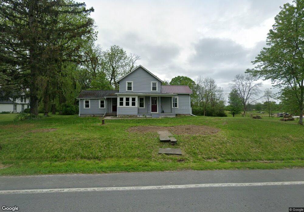
2531 State Route 34b Aurora, NY 13026
Estimated Value: $212,865 - $258,000
2
Beds
2
Baths
1,769
Sq Ft
$132/Sq Ft
Est. Value
About This Home
This home is located at 2531 State Route 34b, Aurora, NY 13026 and is currently estimated at $233,716, approximately $132 per square foot. 2531 State Route 34b is a home located in Cayuga County with nearby schools including Southern Cayuga High School Secondary School.
Ownership History
Date
Name
Owned For
Owner Type
Purchase Details
Closed on
Jun 27, 2022
Sold by
Kathleen Minde
Bought by
Kowalewski Gregory J
Current Estimated Value
Home Financials for this Owner
Home Financials are based on the most recent Mortgage that was taken out on this home.
Original Mortgage
$155,200
Outstanding Balance
$147,655
Interest Rate
5.09%
Mortgage Type
New Conventional
Estimated Equity
$86,061
Purchase Details
Closed on
Jun 29, 2007
Sold by
Minde Marshall
Bought by
Minde Kathleen
Purchase Details
Closed on
Jan 20, 1995
Sold by
Kuzma John and Kuzma Rebecca
Bought by
Minde Marshall and Minde Kathleen
Create a Home Valuation Report for This Property
The Home Valuation Report is an in-depth analysis detailing your home's value as well as a comparison with similar homes in the area
Home Values in the Area
Average Home Value in this Area
Purchase History
| Date | Buyer | Sale Price | Title Company |
|---|---|---|---|
| Kowalewski Gregory J | $160,000 | None Listed On Document | |
| Minde Kathleen | -- | Patricia Sciria | |
| Minde Marshall | $60,000 | -- |
Source: Public Records
Mortgage History
| Date | Status | Borrower | Loan Amount |
|---|---|---|---|
| Open | Kowalewski Gregory J | $155,200 |
Source: Public Records
Tax History Compared to Growth
Tax History
| Year | Tax Paid | Tax Assessment Tax Assessment Total Assessment is a certain percentage of the fair market value that is determined by local assessors to be the total taxable value of land and additions on the property. | Land | Improvement |
|---|---|---|---|---|
| 2024 | $3,605 | $160,000 | $25,500 | $134,500 |
| 2023 | $3,599 | $160,000 | $25,500 | $134,500 |
| 2022 | $2,539 | $88,760 | $18,000 | $70,760 |
| 2021 | $2,526 | $88,760 | $18,000 | $70,760 |
| 2020 | $2,142 | $88,760 | $18,000 | $70,760 |
| 2019 | $1,337 | $88,760 | $18,000 | $70,760 |
| 2018 | $2,073 | $88,760 | $18,000 | $70,760 |
| 2017 | $2,053 | $88,760 | $18,000 | $70,760 |
| 2016 | $2,048 | $88,760 | $18,000 | $70,760 |
| 2015 | -- | $72,000 | $18,200 | $53,800 |
| 2014 | -- | $72,000 | $18,200 | $53,800 |
Source: Public Records
Map
Nearby Homes
- 3387 State Route 34b
- 1695 Levanna Rd
- 2559 State Route 34
- 2259 Center Rd
- 901 Sherwood Rd
- 1580 Gray Rd
- 2173 State Route 90
- 1505 Gray Rd
- 2203 New York 90
- 30 Wells Rd
- 10 Woods End
- 110 Main St
- 110 Main - Lot 2 St
- 1366 Rafferty Rd
- 11 Wells Rd
- 246 Main St
- 3423 New York 34
- 237 Main St
- 245 Main St
- 326 Main St
- 2513 State Route 34b
- 2516 State Route 34b
- 0 New York 34b
- 2507 State Route 34b
- 2503 State Route 34b
- 2500 State Route 34b
- 2545 State Route 34b
- 1833 Poplar Ridge Rd
- 2486 State Route 34b
- 1823 Poplar Ridge Rd
- 2472 Rt 34b
- 1857 Poplar Ridge Rd
- 1805 Poplar Ridge Rd
- 1815 Poplar Ridge Rd
- 1865 Poplar Ridge Rd
- 2569 State Route 34b
- 1856 Poplar Ridge Rd
- 1875 Poplar Ridge Rd
- 1881 Poplar Ridge Rd
- 1799 Poplar Ridge Rd