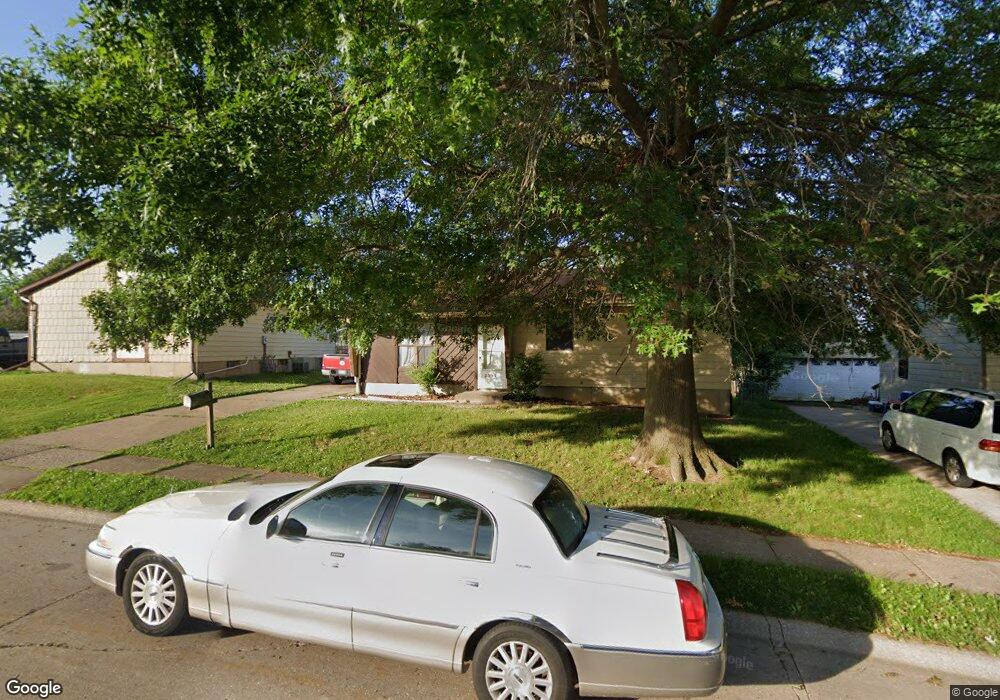
2531 W 55th St Davenport, IA 52806
North Side NeighborhoodEstimated Value: $150,062 - $157,000
3
Beds
1
Bath
904
Sq Ft
$170/Sq Ft
Est. Value
About This Home
This home is located at 2531 W 55th St, Davenport, IA 52806 and is currently estimated at $154,016, approximately $170 per square foot. 2531 W 55th St is a home located in Scott County with nearby schools including Truman Elementary School, Cumberland Hall School, and Academy Of Continuing Education.
Ownership History
Date
Name
Owned For
Owner Type
Purchase Details
Closed on
Jan 28, 2011
Sold by
Federal National Mortgage Association
Bought by
Agan Shawn L
Current Estimated Value
Purchase Details
Closed on
Dec 6, 2010
Sold by
Hart John and Grubb Ashley
Bought by
Federal National Mortgage Association
Purchase Details
Closed on
Jan 22, 2007
Sold by
Townsley George T
Bought by
Hart John and Grubb Ashley
Home Financials for this Owner
Home Financials are based on the most recent Mortgage that was taken out on this home.
Original Mortgage
$92,000
Interest Rate
6.19%
Mortgage Type
New Conventional
Create a Home Valuation Report for This Property
The Home Valuation Report is an in-depth analysis detailing your home's value as well as a comparison with similar homes in the area
Home Values in the Area
Average Home Value in this Area
Purchase History
| Date | Buyer | Sale Price | Title Company |
|---|---|---|---|
| Agan Shawn L | -- | None Available | |
| Federal National Mortgage Association | $107,839 | None Available | |
| Hart John | $92,000 | None Available |
Source: Public Records
Mortgage History
| Date | Status | Borrower | Loan Amount |
|---|---|---|---|
| Previous Owner | Hart John | $92,000 |
Source: Public Records
Tax History Compared to Growth
Tax History
| Year | Tax Paid | Tax Assessment Tax Assessment Total Assessment is a certain percentage of the fair market value that is determined by local assessors to be the total taxable value of land and additions on the property. | Land | Improvement |
|---|---|---|---|---|
| 2025 | $2,354 | $137,550 | $20,770 | $116,780 |
| 2024 | $2,298 | $131,710 | $20,770 | $110,940 |
| 2023 | $2,340 | $131,710 | $20,770 | $110,940 |
| 2022 | $2,350 | $109,550 | $16,880 | $92,670 |
| 2021 | $2,350 | $109,550 | $16,880 | $92,670 |
| 2020 | $2,196 | $101,120 | $16,880 | $84,240 |
| 2019 | $2,268 | $101,120 | $16,880 | $84,240 |
| 2018 | $2,166 | $101,120 | $16,880 | $84,240 |
| 2017 | $2,108 | $98,590 | $16,880 | $81,710 |
| 2016 | $2,030 | $92,700 | $0 | $0 |
| 2015 | $2,030 | $95,460 | $0 | $0 |
| 2014 | $2,120 | $95,460 | $0 | $0 |
| 2013 | $2,084 | $0 | $0 | $0 |
| 2012 | -- | $97,190 | $19,160 | $78,030 |
Source: Public Records
Map
Nearby Homes
- 2620 W 54th St
- 5556 N Thornwood Ave
- 5312 Hillandale Rd
- 5812 Hillandale Rd
- 2434 W 59th St
- 5824 Hillandale Rd
- 5109 N Pine St
- 5904 Hillandale Rd
- 2514 W 60th St
- 1927 W 55th St
- 2508 W 60th Place
- 2127 W 51st St
- 5026 N Dittmer St
- 6050 Hillandale Rd
- 28 W Village Cir
- 4849 Oakwood Ct
- 1729 Welshire Dr
- 5436 N Division St
- 5510 N Division St
- 3313 W 48th Place
- 2603 W 55th St
- 2525 W 55th St
- 2532 Sheffield Dr
- 2526 Sheffield Dr
- 2609 W 55th St
- 2604 Sheffield Dr
- 2530 W 55th St
- 2517 W 55th St
- 2517 W 55th St Unit 2519
- 2522 Sheffield Dr
- 2610 Sheffield Dr
- 2604 W 55th St
- 2615 W 55th St
- 5430 N Linwood Ave
- 2518 W 55th St
- 2610 W 55th St
- 2616 Sheffield Dr
- 5508 N Linwood Ave
- 5422 N Linwood Ave
- 2621 W 55th St