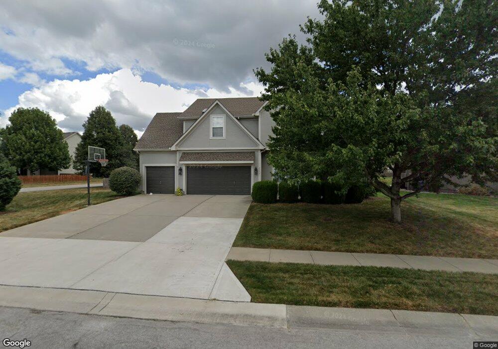
2532 SW Samuel Ln Lees Summit, MO 64081
Estimated Value: $473,886 - $581,000
4
Beds
5
Baths
2,412
Sq Ft
$213/Sq Ft
Est. Value
About This Home
This home is located at 2532 SW Samuel Ln, Lees Summit, MO 64081 and is currently estimated at $514,472, approximately $213 per square foot. 2532 SW Samuel Ln is a home located in Jackson County with nearby schools including Longview Farm Elementary School, Summit Lakes Middle School, and Lee's Summit West High School.
Ownership History
Date
Name
Owned For
Owner Type
Purchase Details
Closed on
Feb 6, 2009
Sold by
Eggers David M and Eggers Kathleen L
Bought by
Eggers David M and Eggers Kathleen L
Current Estimated Value
Purchase Details
Closed on
Aug 8, 2008
Sold by
Bailey Jeffrey B and Bailey Andrea
Bought by
Eggers David M and Eggers Kathleen L
Home Financials for this Owner
Home Financials are based on the most recent Mortgage that was taken out on this home.
Original Mortgage
$172,500
Outstanding Balance
$113,494
Interest Rate
6.38%
Mortgage Type
Purchase Money Mortgage
Estimated Equity
$400,978
Purchase Details
Closed on
Jan 8, 2007
Sold by
Perry Building Co
Bought by
Bailey Jeffrey B
Home Financials for this Owner
Home Financials are based on the most recent Mortgage that was taken out on this home.
Original Mortgage
$39,200
Interest Rate
6.11%
Mortgage Type
Credit Line Revolving
Create a Home Valuation Report for This Property
The Home Valuation Report is an in-depth analysis detailing your home's value as well as a comparison with similar homes in the area
Home Values in the Area
Average Home Value in this Area
Purchase History
| Date | Buyer | Sale Price | Title Company |
|---|---|---|---|
| Eggers David M | -- | Kansas City Title | |
| Eggers David M | -- | Kansas City Title | |
| Bailey Jeffrey B | -- | Fatco |
Source: Public Records
Mortgage History
| Date | Status | Borrower | Loan Amount |
|---|---|---|---|
| Open | Eggers David M | $172,500 | |
| Previous Owner | Bailey Jeffrey B | $39,200 |
Source: Public Records
Tax History Compared to Growth
Tax History
| Year | Tax Paid | Tax Assessment Tax Assessment Total Assessment is a certain percentage of the fair market value that is determined by local assessors to be the total taxable value of land and additions on the property. | Land | Improvement |
|---|---|---|---|---|
| 2025 | $5,552 | $76,889 | $12,363 | $64,526 |
| 2024 | $5,512 | $76,889 | $8,949 | $67,940 |
| 2023 | $5,512 | $76,889 | $11,400 | $65,489 |
| 2022 | $4,693 | $58,140 | $7,373 | $50,767 |
| 2021 | $4,791 | $58,140 | $7,373 | $50,767 |
| 2020 | $4,843 | $58,208 | $7,373 | $50,835 |
| 2019 | $4,711 | $58,208 | $7,373 | $50,835 |
| 2018 | $1,671,449 | $50,659 | $6,417 | $44,242 |
| 2017 | $4,418 | $50,659 | $6,417 | $44,242 |
| 2016 | $4,349 | $49,362 | $7,581 | $41,781 |
| 2014 | $4,335 | $48,226 | $7,076 | $41,150 |
Source: Public Records
Map
Nearby Homes
- 2755 SW 11th Terrace
- 1106 SW Fiord Dr
- 2766 SW 12 St
- 1217 SW Sunflower Dr
- 2767 SW 12th Terrace
- 2771 SW 12th Terrace
- Winfield Plan at Highland Meadows
- Wildflower in Highland Meadows Plan at Highland Meadows
- Sunflower Plan at Highland Meadows
- Sheffield Plan at Highland Meadows
- Riverside Plan at Highland Meadows
- Heather Plan at Highland Meadows
- Carolina Plan at Highland Meadows
- Basswood Plan at Highland Meadows
- 1051 SW Fiord Dr
- 8943 SW 6th St
- 1216 SE Ranchland St
- 1039 SW Fiord Dr
- 1035 SW Fiord Dr
- 1052 SW Argyl St
- 2528 SW Samuel Ln
- 2525 SW 12th St
- 2600 SW 12th St
- 2544 SW 12th Cir
- 2605 SW 12th St
- 2524 SW Samuel Ln
- 2537 SW Samuel Ln
- 2604 SW 12th St
- 2608 SW 12th St
- 2533 SW Samuel Ln
- 2520 SW Samuel Ln
- 2540 SW 12th Cir
- 2609 SW 12th St
- 2521 SW 12th St
- 2516 SW 12th Cir
- 2529 SW Samuel Ln
- 2520 SW 12th Cir
- 2517 SW 12th St
- 2516 SW Samuel Ln
- 2525 SW Samuel Ln