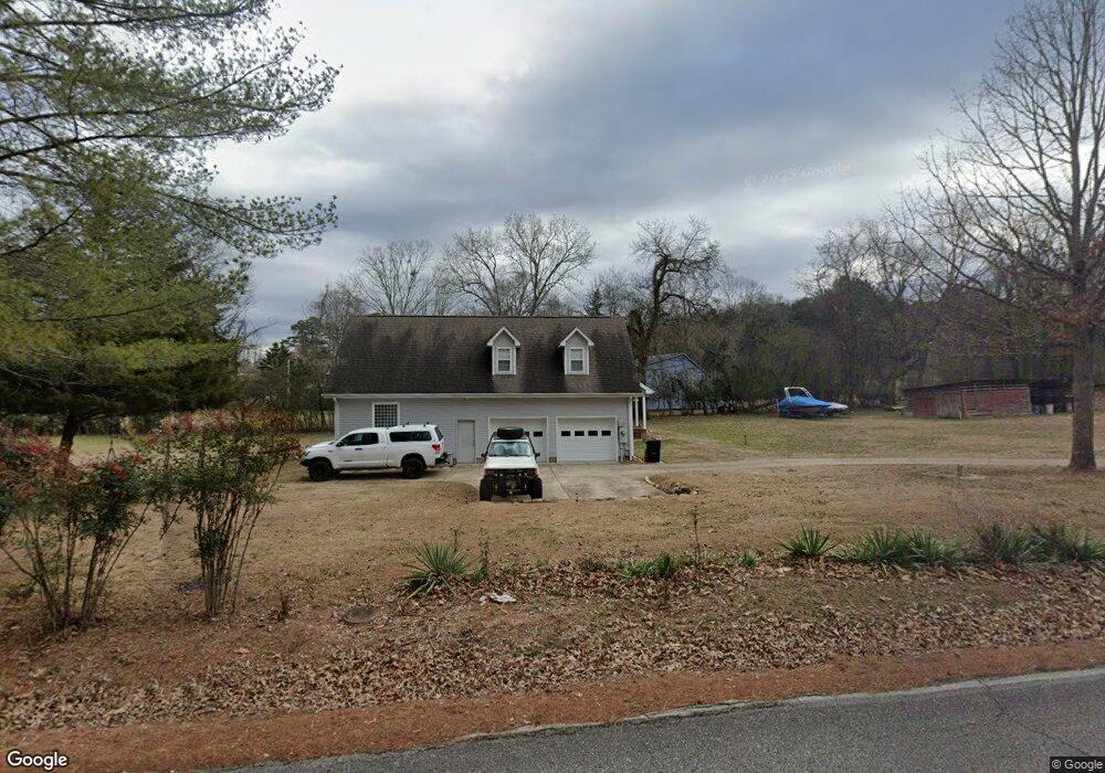
2533 Stonesage Rd Soddy Daisy, TN 37379
Estimated Value: $640,155 - $746,000
2
Beds
1
Bath
564
Sq Ft
$1,209/Sq Ft
Est. Value
About This Home
This home is located at 2533 Stonesage Rd, Soddy Daisy, TN 37379 and is currently estimated at $681,789, approximately $1,208 per square foot. 2533 Stonesage Rd is a home located in Hamilton County with nearby schools including Loftis Middle School.
Ownership History
Date
Name
Owned For
Owner Type
Purchase Details
Closed on
Jun 30, 2021
Sold by
Henderson June M and Estate Of Harold Allan Spletze
Bought by
Spletzer Adam T and Spletzer Susan V
Current Estimated Value
Home Financials for this Owner
Home Financials are based on the most recent Mortgage that was taken out on this home.
Original Mortgage
$200,000
Outstanding Balance
$181,469
Interest Rate
2.9%
Mortgage Type
New Conventional
Estimated Equity
$500,320
Purchase Details
Closed on
Dec 13, 2006
Sold by
Spletzer Mary and Revocable Trust Of Mary Spletz
Bought by
Spletzer Harold A and Spletzer Mary T
Purchase Details
Closed on
Jul 29, 1999
Sold by
Spletzer Harold A and Spletzer Mary T
Bought by
Spletzer Mary
Purchase Details
Closed on
Jun 1, 1996
Sold by
Mcafee Irma Jeanette
Bought by
Mcafee Charles Grant
Purchase Details
Closed on
May 23, 1966
Sold by
Mcafee Charles Grant
Bought by
Spletzer Harold A and Spletzer Mary T
Create a Home Valuation Report for This Property
The Home Valuation Report is an in-depth analysis detailing your home's value as well as a comparison with similar homes in the area
Home Values in the Area
Average Home Value in this Area
Purchase History
| Date | Buyer | Sale Price | Title Company |
|---|---|---|---|
| Spletzer Adam T | $450,000 | Northshore T&E Llc | |
| Spletzer Harold A | -- | None Available | |
| Spletzer Mary | -- | -- | |
| Mcafee Charles Grant | -- | -- | |
| Spletzer Harold A | $89,700 | -- |
Source: Public Records
Mortgage History
| Date | Status | Borrower | Loan Amount |
|---|---|---|---|
| Open | Spletzer Adam T | $200,000 |
Source: Public Records
Tax History Compared to Growth
Tax History
| Year | Tax Paid | Tax Assessment Tax Assessment Total Assessment is a certain percentage of the fair market value that is determined by local assessors to be the total taxable value of land and additions on the property. | Land | Improvement |
|---|---|---|---|---|
| 2024 | $2,858 | $127,725 | $0 | $0 |
| 2023 | $2,867 | $127,725 | $0 | $0 |
| 2022 | $2,867 | $127,725 | $0 | $0 |
| 2021 | $2,867 | $127,725 | $0 | $0 |
| 2020 | $2,933 | $105,725 | $0 | $0 |
| 2019 | $2,933 | $105,725 | $0 | $0 |
| 2018 | $2,933 | $105,725 | $0 | $0 |
| 2017 | $2,933 | $105,725 | $0 | $0 |
| 2016 | $2,801 | $0 | $0 | $0 |
| 2015 | $2,801 | $100,975 | $0 | $0 |
| 2014 | $2,801 | $0 | $0 | $0 |
Source: Public Records
Map
Nearby Homes
- 2727 Thicket Rd
- 2338 Stonesage Rd
- 2110 Autumn River Dr
- 10947 High River Dr
- 11015 High River Dr
- 5671 Willow Point Ln
- 0 Dogwood Dr Unit 1507843
- 11036 High River Dr
- 5665 Willow Point Ln
- 6508 Dogwood Dr
- 10105 Hixson Pike
- 2033 Angler Dr
- 10041 Rolling Wind Dr
- 10166 Hunters Hollow Dr
- 10160 Hunters Hollow Dr
- 1724 Magnum Ln
- 9955 Rolling Wind Dr
- 9680 Birchwood Pike
- 9901 Breeze Hill Ln
- 2522 W Wind Dr
- 2611 Thicket Rd
- 2536 Stonesage Rd
- 2615 Thicket Rd
- 2604 Thicket Rd
- 2528 Stonesage Rd
- 2612 Thicket Rd
- 2621 Thicket Rd
- 0 Thicket Rd
- 2602 Stonesage Rd
- 2618 Thicket Rd
- 2615 Stonesage Rd
- 2629 Stonesage Rd
- 2622 Thicket Rd
- 2627 Thicket Rd
- 2610 Stonesage Rd
- 2508 Stonesage Rd
- 2705 Stonesage Rd
- 2509 Stonesage Rd
- 2626 Thicket Rd
- 10703 Pgrove Place