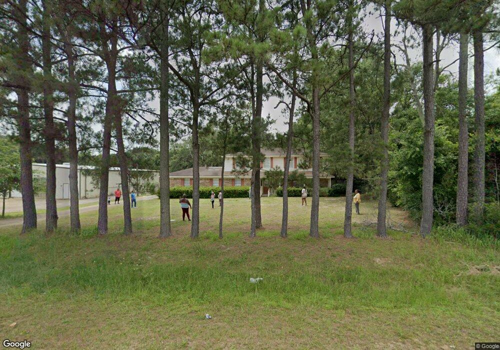
2534 Leroy Stevens Rd Mobile, AL 36695
D'Iberville NeighborhoodEstimated Value: $269,850 - $342,000
6
Beds
4
Baths
3,113
Sq Ft
$97/Sq Ft
Est. Value
About This Home
This home is located at 2534 Leroy Stevens Rd, Mobile, AL 36695 and is currently estimated at $303,213, approximately $97 per square foot. 2534 Leroy Stevens Rd is a home located in Mobile County with nearby schools including O'rourke Elementary School, Bernice J Causey Middle School, and Baker High School.
Ownership History
Date
Name
Owned For
Owner Type
Purchase Details
Closed on
Jul 17, 2023
Sold by
Petway David
Bought by
Petway David and Bell Alana
Current Estimated Value
Purchase Details
Closed on
Mar 23, 2017
Sold by
Petway David M and Harris Thomas S
Bought by
Petway David M
Home Financials for this Owner
Home Financials are based on the most recent Mortgage that was taken out on this home.
Original Mortgage
$31,250
Interest Rate
4.17%
Mortgage Type
Unknown
Purchase Details
Closed on
Apr 13, 2001
Sold by
Volunteers Of America Of Alabama Inc
Bought by
Harris Thomas S and Petway David M
Home Financials for this Owner
Home Financials are based on the most recent Mortgage that was taken out on this home.
Original Mortgage
$125,045
Interest Rate
6.99%
Create a Home Valuation Report for This Property
The Home Valuation Report is an in-depth analysis detailing your home's value as well as a comparison with similar homes in the area
Home Values in the Area
Average Home Value in this Area
Purchase History
| Date | Buyer | Sale Price | Title Company |
|---|---|---|---|
| Petway David | $82,000 | None Listed On Document | |
| Petway David M | -- | None Available | |
| Harris Thomas S | -- | Surety Land Title Inc |
Source: Public Records
Mortgage History
| Date | Status | Borrower | Loan Amount |
|---|---|---|---|
| Previous Owner | Petway David M | $31,250 | |
| Previous Owner | Harris Thomas S | $125,045 |
Source: Public Records
Tax History Compared to Growth
Tax History
| Year | Tax Paid | Tax Assessment Tax Assessment Total Assessment is a certain percentage of the fair market value that is determined by local assessors to be the total taxable value of land and additions on the property. | Land | Improvement |
|---|---|---|---|---|
| 2024 | $1,754 | $36,160 | $5,000 | $31,160 |
| 2023 | $1,754 | $32,720 | $5,000 | $27,720 |
| 2022 | $1,403 | $28,920 | $5,000 | $23,920 |
| 2021 | $1,398 | $28,820 | $2,000 | $26,820 |
| 2020 | $1,398 | $28,820 | $2,000 | $26,820 |
| 2019 | $1,345 | $27,740 | $2,400 | $25,340 |
| 2018 | $1,345 | $27,740 | $0 | $0 |
| 2017 | $1,281 | $26,420 | $0 | $0 |
| 2016 | $1,314 | $27,100 | $0 | $0 |
| 2013 | $1,346 | $27,440 | $0 | $0 |
Source: Public Records
Map
Nearby Homes
- 0 Leroy Stevens Rd Unit 7607102
- 0 Leroy Stevens Rd Unit 7607129
- 0 Leroy Stevens Rd Unit 7582878
- 8255 Twin Lakes Dr
- 0 Walter Ct Unit 7008922
- 0 Walter Ct Unit 7008918
- 0 Walter Ct Unit 7008907
- 8100 Danielle Dr
- 2451 Pontchartrain Dr
- 2316 Leroy Stevens Rd
- 8451 Placid Dr
- 2151 Carrington Dr
- 2200 O'Rourke Dr
- 2575 Rosebud Dr
- 8240 Taddish Dr N
- 2744 Rosebud Dr E
- 8601 Cottage Hill Rd
- 2155 Brittany Dr
- 2154 O'Rourke Dr
- 2364 Randlett Trace
- 2540 Leroy Stevens Rd
- 2537 Tahoe Dr
- 2545 Tahoe Dr
- 2525 Tahoe Dr
- 2559 Tahoe Dr
- 2570 Leroy Stevens Rd
- 2569 Tahoe Dr
- 2517 Tahoe Dr
- 2580 Leroy Stevens Rd
- 2538 Tahoe Dr
- 2554 Tahoe Dr
- 2581 Tahoe Dr
- 2590 Leroy Stevens Rd
- 2560 Tahoe Dr Unit 2
- 2511 Tahoe Dr
- 2600 Leroy Stevens Rd
- 2572 Tahoe Dr
- 2601 Tahoe Dr
- 2532 Tahoe Dr
- 0 Leroy Stevens Rd Unit 636045