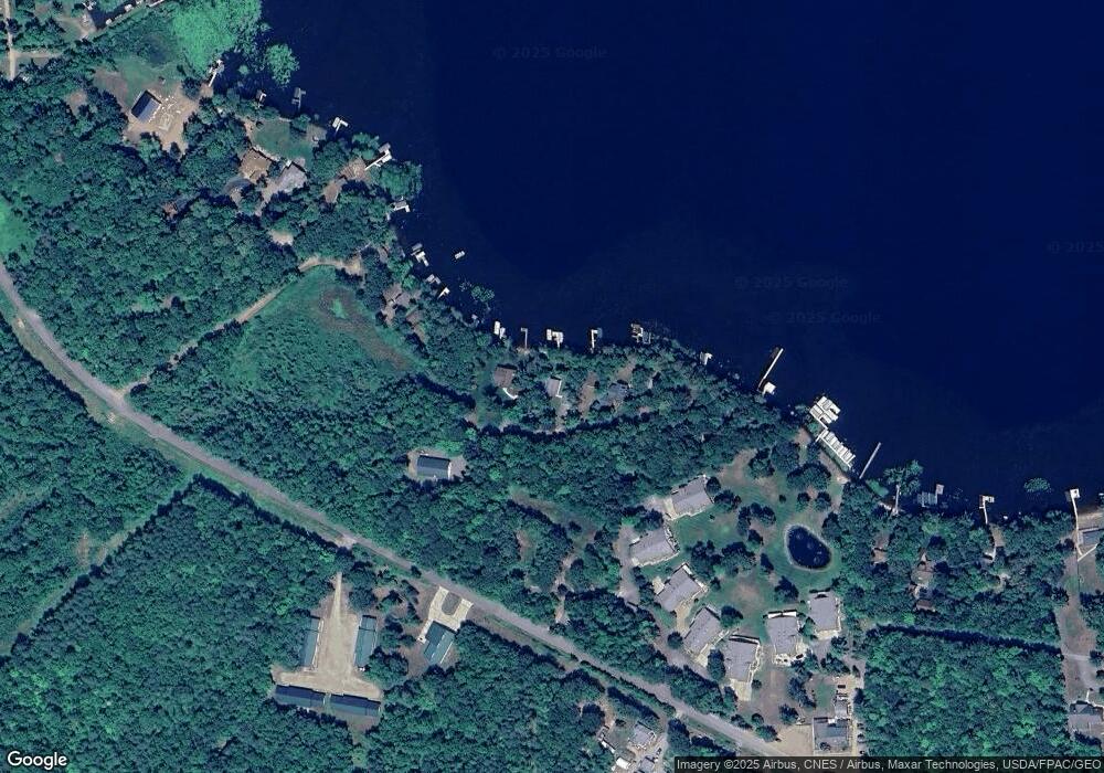
25370 Bluff Side Rd Deerwood, MN 56444
Estimated Value: $499,836 - $848,000
4
Beds
2
Baths
960
Sq Ft
$687/Sq Ft
Est. Value
About This Home
This home is located at 25370 Bluff Side Rd, Deerwood, MN 56444 and is currently estimated at $659,459, approximately $686 per square foot. 25370 Bluff Side Rd is a home located in Crow Wing County with nearby schools including Cuyuna Range Elementary School and Crosby-Ironton Secondary School.
Ownership History
Date
Name
Owned For
Owner Type
Purchase Details
Closed on
Aug 26, 2016
Bought by
Mundt David and Mundt Ellen
Current Estimated Value
Home Financials for this Owner
Home Financials are based on the most recent Mortgage that was taken out on this home.
Original Mortgage
$269,500
Outstanding Balance
$215,197
Interest Rate
3.42%
Estimated Equity
$444,262
Create a Home Valuation Report for This Property
The Home Valuation Report is an in-depth analysis detailing your home's value as well as a comparison with similar homes in the area
Home Values in the Area
Average Home Value in this Area
Purchase History
| Date | Buyer | Sale Price | Title Company |
|---|---|---|---|
| Mundt David | $385,000 | -- |
Source: Public Records
Mortgage History
| Date | Status | Borrower | Loan Amount |
|---|---|---|---|
| Open | Mundt David | $269,500 |
Source: Public Records
Tax History Compared to Growth
Tax History
| Year | Tax Paid | Tax Assessment Tax Assessment Total Assessment is a certain percentage of the fair market value that is determined by local assessors to be the total taxable value of land and additions on the property. | Land | Improvement |
|---|---|---|---|---|
| 2025 | $1,734 | $426,200 | $296,700 | $129,500 |
| 2024 | $1,734 | $356,500 | $234,600 | $121,900 |
| 2023 | $1,840 | $373,800 | $252,100 | $121,700 |
| 2022 | $1,780 | $338,600 | $211,300 | $127,300 |
| 2021 | $1,720 | $252,800 | $176,800 | $76,000 |
| 2020 | $1,750 | $235,600 | $163,700 | $71,900 |
| 2019 | $1,678 | $235,300 | $163,700 | $71,600 |
| 2018 | $1,674 | $223,000 | $155,000 | $68,000 |
| 2017 | $1,724 | $222,300 | $155,000 | $67,300 |
| 2016 | $1,728 | $223,200 | $160,100 | $63,100 |
| 2015 | $1,460 | $193,400 | $132,000 | $61,400 |
| 2014 | $715 | $186,100 | $123,900 | $62,200 |
Source: Public Records
Map
Nearby Homes
- 14777 Katrine Dr
- 14364 Hummingbird Trail
- XXX Wilson Lake Dr
- 15019 Woodland Beach Ln
- 136XX Maple Ln
- 12817 County Road 10
- 24504 Mn-18
- 24504 Minnesota 18
- 15921 Eaglewood Dr
- 27162 Greenwood Isle Cir
- 10910 County Road 10
- 24555 Emstad Rd
- 25663 Circle Dr
- 25637 Circle Dr
- 17251 Minnesota 6
- 22251 State Highway 18
- 24909 Sandy Ln
- 17433 Old Highway 6 Unit 14
- 25124 Tame Fish Lake Rd Unit 550
- 25150 Tame Fish Lake Rd Unit 552
- 25356 Bluff Side Rd
- 25388 Bluff Side Rd
- 25310 Bluff Side Rd
- 25414 Bluff Side Rd
- 25430 Bluff Side Rd
- 25288 Bluff Side Rd
- 13903 13903 Southbay Shores
- 25282 Bluff Side Rd
- 13909 Southbay Shores
- 13909 Southbay Shores Unit 6
- 13915 Southbay Shores
- 13868 Southbay Shores
- 25442 Bluff Side Rd
- 25262 Bluff Side Rd
- 13903 Southbay Shores
- 13842 Southbay Shores
- 13824 Southbay Shores
- 25250 Bluff Side Rd
- 13899 Katrine Dr
- 13804 Southbay Shores
