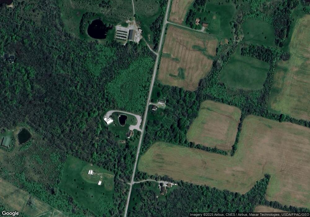
25372 Coder Holloway Rd Raymond, OH 43067
Estimated Value: $351,000 - $556,000
4
Beds
2
Baths
1,752
Sq Ft
$251/Sq Ft
Est. Value
About This Home
This home is located at 25372 Coder Holloway Rd, Raymond, OH 43067 and is currently estimated at $439,216, approximately $250 per square foot. 25372 Coder Holloway Rd is a home located in Union County with nearby schools including Raymond Elementary School, Creekview Intermediate Elementary School, and Bunsold Middle School.
Ownership History
Date
Name
Owned For
Owner Type
Purchase Details
Closed on
Apr 26, 2019
Sold by
David E Schness Trust
Bought by
Schnees Thomas R
Current Estimated Value
Purchase Details
Closed on
Nov 26, 2018
Sold by
Schnees David E
Bought by
Schnees David E and David E Schnees Trust
Purchase Details
Closed on
Mar 21, 2018
Sold by
Schnees Thomas R
Bought by
Schnees David E
Purchase Details
Closed on
Sep 21, 2005
Sold by
Daniels Douglas W and Daniels Tracy L
Bought by
Schnees David E
Home Financials for this Owner
Home Financials are based on the most recent Mortgage that was taken out on this home.
Original Mortgage
$224,000
Interest Rate
6.01%
Mortgage Type
Fannie Mae Freddie Mac
Create a Home Valuation Report for This Property
The Home Valuation Report is an in-depth analysis detailing your home's value as well as a comparison with similar homes in the area
Purchase History
| Date | Buyer | Sale Price | Title Company |
|---|---|---|---|
| Schnees Thomas R | $112,700 | None Available | |
| Schnees David E | -- | None Available | |
| Schnees David E | -- | -- | |
| Schnees David E | $280,000 | Heart Of Ohio Title |
Source: Public Records
Mortgage History
| Date | Status | Borrower | Loan Amount |
|---|---|---|---|
| Previous Owner | Schnees David E | $224,000 |
Source: Public Records
Tax History
| Year | Tax Paid | Tax Assessment Tax Assessment Total Assessment is a certain percentage of the fair market value that is determined by local assessors to be the total taxable value of land and additions on the property. | Land | Improvement |
|---|---|---|---|---|
| 2024 | $4,275 | $58,790 | $27,070 | $31,720 |
| 2023 | $2,710 | $58,790 | $27,070 | $31,720 |
| 2022 | $2,669 | $58,790 | $27,070 | $31,720 |
| 2021 | $2,641 | $104,790 | $77,850 | $26,940 |
| 2020 | $2,529 | $104,790 | $77,850 | $26,940 |
| 2019 | $2,562 | $104,790 | $77,850 | $26,940 |
| 2018 | $2,903 | $91,600 | $72,340 | $19,260 |
| 2017 | $2,741 | $91,600 | $72,340 | $19,260 |
| 2016 | $2,731 | $91,600 | $72,340 | $19,260 |
| 2015 | $2,621 | $79,920 | $65,330 | $14,590 |
| 2014 | $2,621 | $79,920 | $65,330 | $14,590 |
| 2013 | $2,471 | $79,920 | $65,330 | $14,590 |
Source: Public Records
Map
Nearby Homes
- 0 Main St
- 23564 Shirk Ave
- 23051 Bear Swamp Rd
- 22437 State Route 739
- 22015 Liberty West Rd
- 262 S Main St
- 20689 State Route 47
- 28370 Ohio 739
- 271 N Dean St
- 0 Johnson Rd Unit 226000479
- 0 Johnson Rd Unit 225027964
- 23750 Drake-Skidmore Rd
- 18902 State Route 347
- 28384 Bitler Rd
- 0 Benton Rd Unit 226004840
- 25875 Ohio 31
- 1322 Forest Edge Dr
- 19400 Bear Swamp Rd
- 30650 State Route 739
- 830 Lorenzo Ct
- 25325 Coder Holloway Rd
- 25516 Coder Holloway Rd
- 25210 Coder Holloway Rd
- 25210 Coder-Holloway Rd
- 25225 Coder Holloway Rd
- 25140 Coder Holloway Rd
- 25575 Coder Holloway Rd
- 23350 Hoover Bault Rd
- 23300 Hoover Bault Rd
- 23240 Hoover Bault Rd
- 23240 Hoover-Bault Rd
- 23282 Hoover Bault Rd
- 23200 Hoover Bault Rd
- 23200 Hoover-Bault Rd
- 23275 Hoover Bault Rd
- 23395 Hoover Bault Rd
- 23233 Hoover Bault Rd
- 23100 Hoover Bault Rd
- 23080 Hoover Bault Rd
- 23117 Hoover Bault Rd
Your Personal Tour Guide
Ask me questions while you tour the home.
