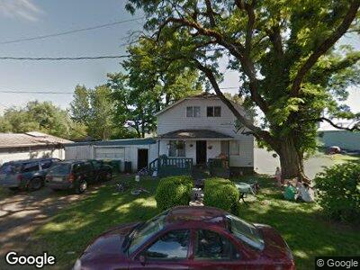
2538 10th Ave Forest Grove, OR 97116
Estimated Value: $140,234 - $157,000
3
Beds
1
Bath
1,404
Sq Ft
$106/Sq Ft
Est. Value
About This Home
This home is located at 2538 10th Ave, Forest Grove, OR 97116 and is currently estimated at $148,617, approximately $105 per square foot. 2538 10th Ave is a home located in Washington County with nearby schools including Joseph Gale Elementary School, Neil Armstrong Middle School, and Tom McCall Upper Elementary School.
Ownership History
Date
Name
Owned For
Owner Type
Purchase Details
Closed on
Mar 20, 2019
Sold by
Vanderzanden Bruce and Vanderzanden Peggy
Bought by
Jeff S Adventures Llc
Current Estimated Value
Home Financials for this Owner
Home Financials are based on the most recent Mortgage that was taken out on this home.
Original Mortgage
$95,000
Outstanding Balance
$85,182
Interest Rate
4.4%
Mortgage Type
New Conventional
Estimated Equity
$208,874
Purchase Details
Closed on
Dec 5, 2018
Sold by
Vanderzanden Peggy
Bought by
Vanderzanden Bruce and Vanderzanden Peggy
Purchase Details
Closed on
Jan 10, 2007
Sold by
Vanderzanden Harold C and Vanderzanden Sharon D
Bought by
Vanderzanden Bruce and Vanderzanden Peggy
Home Financials for this Owner
Home Financials are based on the most recent Mortgage that was taken out on this home.
Original Mortgage
$75,000
Interest Rate
6%
Mortgage Type
Seller Take Back
Create a Home Valuation Report for This Property
The Home Valuation Report is an in-depth analysis detailing your home's value as well as a comparison with similar homes in the area
Home Values in the Area
Average Home Value in this Area
Purchase History
| Date | Buyer | Sale Price | Title Company |
|---|---|---|---|
| Jeff S Adventures Llc | $100,000 | Wfg Title | |
| Vanderzanden Bruce | -- | Wfg Title | |
| Vanderzanden Bruce | $75,000 | Ticor Title |
Source: Public Records
Mortgage History
| Date | Status | Borrower | Loan Amount |
|---|---|---|---|
| Open | Jeff S Adventures Llc | $95,000 | |
| Previous Owner | Vanderzanden Bruce | $75,000 |
Source: Public Records
Tax History Compared to Growth
Tax History
| Year | Tax Paid | Tax Assessment Tax Assessment Total Assessment is a certain percentage of the fair market value that is determined by local assessors to be the total taxable value of land and additions on the property. | Land | Improvement |
|---|---|---|---|---|
| 2025 | $953 | $51,940 | -- | -- |
| 2024 | $1,624 | $50,430 | -- | -- |
| 2023 | $1,624 | $86,500 | $0 | $0 |
| 2022 | $1,420 | $86,500 | $0 | $0 |
| 2021 | $1,402 | $81,550 | $0 | $0 |
| 2020 | $1,394 | $79,180 | $0 | $0 |
| 2019 | $1,363 | $76,880 | $0 | $0 |
| 2018 | $1,322 | $74,650 | $0 | $0 |
| 2017 | $1,281 | $72,480 | $0 | $0 |
| 2016 | $1,245 | $70,370 | $0 | $0 |
| 2015 | $1,197 | $68,330 | $0 | $0 |
| 2014 | -- | $66,340 | $0 | $0 |
Source: Public Records
Map
Nearby Homes
- 2204 11th Ave
- 2403 15th Ave
- 2627 15th Ave
- 2214 16th Ave
- 2530 17th Ave
- 1703 Elm St
- 1717 Elm St
- 2827 17th Ave
- 1648 Ash St
- 3128 Brittany Dr
- 2913 18th Ave
- 2824 19th Ave
- 2025 Elm St Unit 6A
- 1832 18th Ave
- 2828 22nd Ave Unit 10
- 2117 A St
- 2239 Hawthorne St Unit 15
- 1914 D St
- 0 C St Unit 24232816
- 0 C St Unit Lot 1