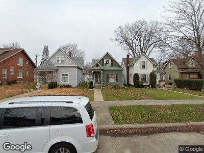
254 Euclid St Mount Clemens, MI 48043
Estimated Value: $181,753 - $213,000
--
Bed
--
Bath
1,446
Sq Ft
$139/Sq Ft
Est. Value
About This Home
This home is located at 254 Euclid St, Mount Clemens, MI 48043 and is currently estimated at $200,938, approximately $138 per square foot. 254 Euclid St is a home located in Macomb County with nearby schools including Mount Clemens High School, Prevail Academy, and St Mary Catholic School.
Ownership History
Date
Name
Owned For
Owner Type
Purchase Details
Closed on
Feb 14, 2022
Sold by
Henneberry Timothy J
Bought by
Henneberry Timothy J and Henneberry Stephanie
Current Estimated Value
Purchase Details
Closed on
Feb 17, 2005
Sold by
Martinez Stempihar Romelia and Stempihar Richard
Bought by
Henneberry Timothy J
Home Financials for this Owner
Home Financials are based on the most recent Mortgage that was taken out on this home.
Original Mortgage
$137,902
Interest Rate
5.71%
Mortgage Type
VA
Purchase Details
Closed on
Nov 11, 1994
Sold by
Ronnie L Lozon
Bought by
Stempihar Richard and Stempihar Romelia
Home Financials for this Owner
Home Financials are based on the most recent Mortgage that was taken out on this home.
Original Mortgage
$55,050
Interest Rate
8.91%
Mortgage Type
VA
Create a Home Valuation Report for This Property
The Home Valuation Report is an in-depth analysis detailing your home's value as well as a comparison with similar homes in the area
Home Values in the Area
Average Home Value in this Area
Purchase History
| Date | Buyer | Sale Price | Title Company |
|---|---|---|---|
| Henneberry Timothy J | -- | Rosenberg Lpa Llc | |
| Henneberry Timothy J | $135,000 | Metropolitan Title Company | |
| Stempihar Richard | $54,000 | -- |
Source: Public Records
Mortgage History
| Date | Status | Borrower | Loan Amount |
|---|---|---|---|
| Previous Owner | Henneberry Timothy J | $123,650 | |
| Previous Owner | Henneberry Timothy J | $10,693 | |
| Previous Owner | Henneberry Timothy J | $137,902 | |
| Previous Owner | Stempihar Richard | $113,000 | |
| Previous Owner | Stempihar Richard | $55,050 |
Source: Public Records
Tax History Compared to Growth
Tax History
| Year | Tax Paid | Tax Assessment Tax Assessment Total Assessment is a certain percentage of the fair market value that is determined by local assessors to be the total taxable value of land and additions on the property. | Land | Improvement |
|---|---|---|---|---|
| 2024 | $1,976 | $78,700 | $0 | $0 |
| 2023 | $1,895 | $72,000 | $0 | $0 |
| 2022 | $1,822 | $63,300 | $0 | $0 |
| 2021 | $1,781 | $56,400 | $0 | $0 |
| 2020 | $1,694 | $53,600 | $0 | $0 |
| 2019 | $1,667 | $42,900 | $0 | $0 |
| 2018 | $1,636 | $35,100 | $0 | $0 |
| 2017 | $1,605 | $31,802 | $2,839 | $28,963 |
| 2016 | $1,599 | $31,802 | $0 | $0 |
| 2015 | $1,402 | $28,615 | $0 | $0 |
| 2013 | -- | $26,151 | $2,686 | $23,465 |
Source: Public Records
Map
Nearby Homes
- 225 Euclid St
- 311 Northbound Gratiot Ave
- 111 High St
- 39 Stapleton St
- 17 Leonore St
- 147 Euclid St
- 168 Market St
- 58 Yeamans St
- 205 Elizabeth St
- 96 Jones St
- 90 Clinton St Unit 90
- 28 Ferrin Place
- 32 Ferrin Place
- 144 Court St
- 245 N Broadway St
- 101 Hubbard St
- 23313 Stone Castle Dr
- 0 La Croix St
- 23113 Egnew Dr
- 21 Dickinson St Unit K