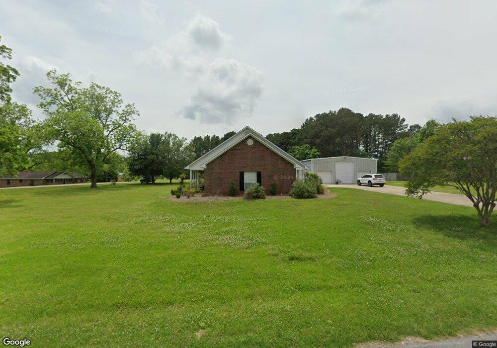
254 Lonesome Pines Rd Laurel, MS 39443
Estimated Value: $175,933 - $294,000
2
Beds
2
Baths
1,642
Sq Ft
$136/Sq Ft
Est. Value
About This Home
This home is located at 254 Lonesome Pines Rd, Laurel, MS 39443 and is currently estimated at $223,733, approximately $136 per square foot. 254 Lonesome Pines Rd is a home located in Jones County.
Ownership History
Date
Name
Owned For
Owner Type
Purchase Details
Closed on
Mar 29, 2021
Sold by
Eddy Charlie D and Eddy Roy G
Bought by
Varnell Johnny Phillip
Current Estimated Value
Home Financials for this Owner
Home Financials are based on the most recent Mortgage that was taken out on this home.
Original Mortgage
$154,156
Outstanding Balance
$138,347
Interest Rate
2.9%
Mortgage Type
FHA
Estimated Equity
$85,386
Purchase Details
Closed on
May 31, 2013
Sold by
Shows Howard C and Shows Barbara
Bought by
Eddy Charlie D and Eddy Roy G
Home Financials for this Owner
Home Financials are based on the most recent Mortgage that was taken out on this home.
Original Mortgage
$117,725
Interest Rate
3.37%
Create a Home Valuation Report for This Property
The Home Valuation Report is an in-depth analysis detailing your home's value as well as a comparison with similar homes in the area
Home Values in the Area
Average Home Value in this Area
Purchase History
| Date | Buyer | Sale Price | Title Company |
|---|---|---|---|
| Varnell Johnny Phillip | -- | -- | |
| Eddy Charlie D | -- | -- |
Source: Public Records
Mortgage History
| Date | Status | Borrower | Loan Amount |
|---|---|---|---|
| Open | Varnell Johnny Phillip | $154,156 | |
| Previous Owner | Eddy Charlie D | $117,725 |
Source: Public Records
Tax History Compared to Growth
Tax History
| Year | Tax Paid | Tax Assessment Tax Assessment Total Assessment is a certain percentage of the fair market value that is determined by local assessors to be the total taxable value of land and additions on the property. | Land | Improvement |
|---|---|---|---|---|
| 2025 | $972 | $10,696 | $0 | $0 |
| 2024 | $972 | $10,046 | $0 | $0 |
| 2023 | $972 | $10,046 | $0 | $0 |
| 2022 | $1,000 | $10,046 | $0 | $0 |
| 2021 | $1,155 | $10,046 | $0 | $0 |
| 2020 | $1,189 | $10,127 | $0 | $0 |
| 2019 | $1,194 | $10,127 | $0 | $0 |
| 2018 | $1,194 | $10,127 | $0 | $0 |
| 2017 | $1,193 | $10,127 | $0 | $0 |
| 2016 | $1,346 | $9,545 | $0 | $0 |
| 2015 | -- | $9,545 | $0 | $0 |
| 2014 | -- | $9,545 | $0 | $0 |
Source: Public Records
Map
Nearby Homes
- 0 Calma Dr
- 13 Iris Ln
- 0 Old Soso Rd
- 253 Maxey Rd
- 29 Mississippi 28
- 239 Pat Holifield Rd
- 0 Cactus Dr
- 1013 Service Rd
- Meador Rd
- 10 Westerly Dr
- 5 Westerly Dr
- 4 Katyford Dr
- 693 Joe Perrett Rd
- 423 Shady School Rd
- 3 Brianleigh Dr
- 7 & 9 Amyden Ct
- 301 Indian Springs Church Rd
- Lot 806 Joshbury Cir
- Lot 805 Joshbury Cir
- 18 Joshbury Cir
- 0 Lonesome Pines Rd
- 181 Springhill Rd
- 248 Lonesome Pines Rd
- 177 Springhill Rd
- 180 Springhill Rd
- 242 Lonesome Pines Rd
- 199 Springhill Rd
- 241 Lonesome Pines Rd
- 272 Lonesome Pines Rd
- 236 Lonesome Pines Rd
- 207 Springhill Rd
- 165 Springhill Rd
- 22 Harris Estate Rd
- 26 Harris Estate Rd
- 148 Springhill Rd
- 220 Lonesome Pines Rd
- 5 Harris Estate Rd
- 288 Lonesome Pines Rd
- 5 Harris Estates
- 11 Old Soso Rd