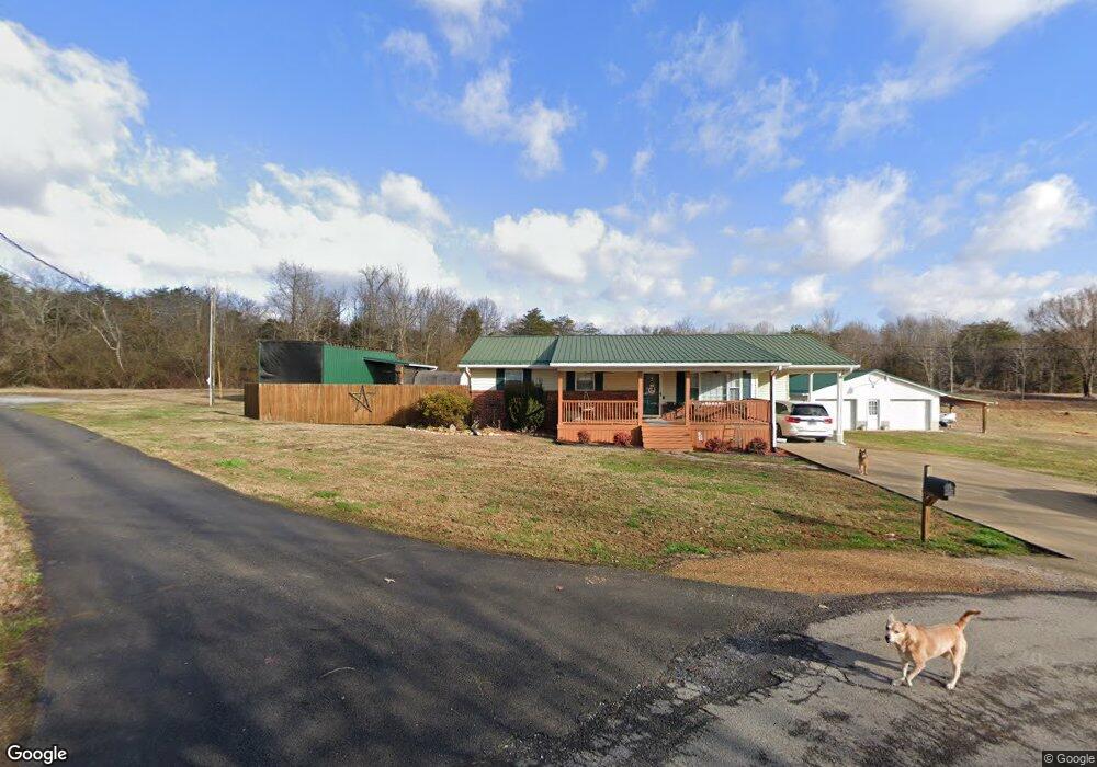
254 Shady Lane Ave Rogersville, TN 37857
Estimated Value: $193,718 - $292,000
--
Bed
2
Baths
1,176
Sq Ft
$205/Sq Ft
Est. Value
About This Home
This home is located at 254 Shady Lane Ave, Rogersville, TN 37857 and is currently estimated at $241,180, approximately $205 per square foot. 254 Shady Lane Ave is a home located in Hawkins County with nearby schools including Joseph Rogers Primary School, Hawkins Elementary School, and Rogersville Middle School.
Ownership History
Date
Name
Owned For
Owner Type
Purchase Details
Closed on
Aug 28, 1992
Bought by
Dykes Terry L and Dykes Susan B
Current Estimated Value
Purchase Details
Closed on
Jul 31, 1989
Bought by
Lawson Jeffery M and Lawson Ada N
Purchase Details
Closed on
Dec 21, 1988
Bought by
Taliaferro Tina K
Purchase Details
Closed on
Oct 30, 1985
Bought by
Taliaferro David A and Taliaferro Tina K
Purchase Details
Closed on
Oct 1, 1984
Purchase Details
Closed on
Jul 17, 1973
Create a Home Valuation Report for This Property
The Home Valuation Report is an in-depth analysis detailing your home's value as well as a comparison with similar homes in the area
Home Values in the Area
Average Home Value in this Area
Purchase History
| Date | Buyer | Sale Price | Title Company |
|---|---|---|---|
| Dykes Terry L | $44,500 | -- | |
| Lawson Jeffery M | $37,500 | -- | |
| Taliaferro Tina K | -- | -- | |
| Taliaferro David A | -- | -- | |
| -- | -- | -- | |
| -- | -- | -- |
Source: Public Records
Mortgage History
| Date | Status | Borrower | Loan Amount |
|---|---|---|---|
| Closed | Not Available | $17,086 |
Source: Public Records
Tax History Compared to Growth
Tax History
| Year | Tax Paid | Tax Assessment Tax Assessment Total Assessment is a certain percentage of the fair market value that is determined by local assessors to be the total taxable value of land and additions on the property. | Land | Improvement |
|---|---|---|---|---|
| 2024 | $948 | $37,125 | $3,950 | $33,175 |
| 2023 | $839 | $37,125 | $0 | $0 |
| 2022 | $802 | $34,600 | $3,950 | $30,650 |
| 2021 | $742 | $34,225 | $3,950 | $30,275 |
| 2020 | $666 | $34,225 | $3,950 | $30,275 |
| 2019 | $644 | $26,300 | $3,450 | $22,850 |
| 2018 | $644 | $25,425 | $3,450 | $21,975 |
| 2017 | $632 | $24,975 | $3,450 | $21,525 |
| 2016 | $632 | $24,975 | $3,450 | $21,525 |
| 2015 | $616 | $24,975 | $3,450 | $21,525 |
| 2014 | $648 | $26,300 | $3,975 | $22,325 |
Source: Public Records
Map
Nearby Homes
- 156 Reynolds Hills Dr
- Lot 4 Highway 70s
- Lot 3 Highway 70s
- Lot 2 Highway 70s
- Lot 1 Highway 70s
- 111 Poplar Dr
- 403 Morningside Dr
- 142 Old State Highway 70
- Tbd Flora Rd
- 157 Chuck Rd
- Flora Rd
- Tbd2 Chestnut Town Rd
- Tbd Chestnut Town Rd
- Tbd Kite Rd
- 2586 Highway 66 S
- 140 Roberts Rd
- 229 235 Henard Rd
- Chestnutt Town Rd
- 213 Big Springs Rd
- 1279 Old State Highway 70
- 256 Shady Lane Ave
- 111 Woodland Ave
- 0 Woodland Ave
- 000 Woodland Ave
- 235 Shady Lane Ave
- 202 Greenwood St
- 206 Greenwood St
- 210 Greenwood St
- 136 Greenwood St
- 236 Shady Lane Ave
- 132 Greenwood St
- 214 Greenwood St
- 126 Greenwood St
- 218 Greenwood St
- 233 Shady Lane Ave
- 205 Greenwood St
- 137 Greenwood St
- 211 Greenwood St
- 127 Greenwood St
- 118 Greenwood St