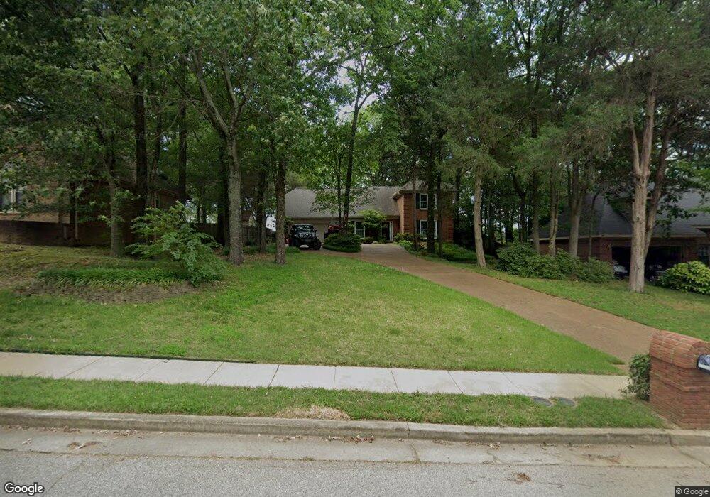
254 Walnut Trace Dr Cordova, TN 38018
Cordova NeighborhoodEstimated Value: $325,949 - $355,000
4
Beds
3
Baths
3,492
Sq Ft
$97/Sq Ft
Est. Value
About This Home
This home is located at 254 Walnut Trace Dr, Cordova, TN 38018 and is currently estimated at $339,987, approximately $97 per square foot. 254 Walnut Trace Dr is a home located in Shelby County with nearby schools including Cordova Elementary School, Cordova Middle School, and Cordova High School.
Ownership History
Date
Name
Owned For
Owner Type
Purchase Details
Closed on
Aug 10, 1998
Sold by
Cranston Robert W and Cranston Martha H
Bought by
Mitchell David S and Mitchell Tana D
Current Estimated Value
Home Financials for this Owner
Home Financials are based on the most recent Mortgage that was taken out on this home.
Original Mortgage
$167,675
Outstanding Balance
$33,136
Interest Rate
6.91%
Estimated Equity
$306,851
Create a Home Valuation Report for This Property
The Home Valuation Report is an in-depth analysis detailing your home's value as well as a comparison with similar homes in the area
Home Values in the Area
Average Home Value in this Area
Purchase History
| Date | Buyer | Sale Price | Title Company |
|---|---|---|---|
| Mitchell David S | $176,500 | -- | |
| Mitchell David S | $176,500 | -- |
Source: Public Records
Mortgage History
| Date | Status | Borrower | Loan Amount |
|---|---|---|---|
| Open | Mitchell David S | $167,675 | |
| Closed | Mitchell David S | $167,675 |
Source: Public Records
Tax History Compared to Growth
Tax History
| Year | Tax Paid | Tax Assessment Tax Assessment Total Assessment is a certain percentage of the fair market value that is determined by local assessors to be the total taxable value of land and additions on the property. | Land | Improvement |
|---|---|---|---|---|
| 2025 | $2,343 | $80,300 | $16,500 | $63,800 |
| 2024 | $2,343 | $69,125 | $9,150 | $59,975 |
| 2023 | $4,211 | $69,125 | $9,150 | $59,975 |
| 2022 | $4,211 | $69,125 | $9,150 | $59,975 |
| 2021 | $4,260 | $69,125 | $9,150 | $59,975 |
| 2020 | $3,590 | $49,550 | $9,150 | $40,400 |
| 2019 | $3,590 | $49,550 | $9,150 | $40,400 |
| 2018 | $3,590 | $49,550 | $9,150 | $40,400 |
| 2017 | $2,037 | $49,550 | $9,150 | $40,400 |
| 2016 | $1,865 | $42,675 | $0 | $0 |
| 2014 | $1,865 | $42,675 | $0 | $0 |
Source: Public Records
Map
Nearby Homes
- 11 W Viking Dr
- 8570 May Orchard Ln
- 263 Shadow Grove Cove
- 35 Oslo Cove
- 334 Brook Ridge Dr
- 00 Walnut Grove Rd
- 370 Lida Ln
- 31 Red Thorn Cove
- 470 Walnut Point Cove
- 432 Bruins Trace
- 8228 Planters Grove Dr
- 174 Leif Cove W
- 0 Chelsea Meadow Lot 40 Cove Unit 10005859
- 179 Mysen Cir
- 63 Vine Grove Ln
- 8433 Arendal Cove
- 8480 Bergen Cove
- 548 Wesley Woods Dr
- 8497 Bergen Cove
- 441 Griffon Dr
- 246 Walnut Trace Dr
- 262 Walnut Trace Dr
- 8451 E Askersund Cove
- 238 Walnut Trace Dr
- 253 Walnut Trace Dr
- 230 Walnut Trace Dr
- 8452 E Askersund Cove
- 8446 E Askersund Cove
- 8420 Walnut Tree Dr
- 8459 E Askersund Cove
- 281 Walnut Trace Dr
- 8417 W Askersund Cove
- 8410 Walnut Tree Dr
- 8460 E Askersund Cove
- 290 Walnut Trace Dr
- 8417 Walnut Tree Dr
- 8465 E Askersund Cove
- 8402 Walnut Tree Dr
- 293 Walnut Trace Dr
- 210 Walnut Trace Dr