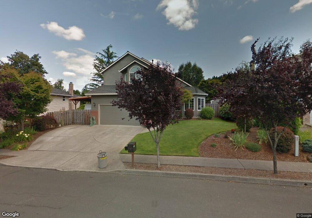
2540 SW Willowbrook Ave Gresham, OR 97080
Southwest Gresham NeighborhoodEstimated Value: $498,000 - $553,000
3
Beds
3
Baths
1,962
Sq Ft
$268/Sq Ft
Est. Value
About This Home
This home is located at 2540 SW Willowbrook Ave, Gresham, OR 97080 and is currently estimated at $526,737, approximately $268 per square foot. 2540 SW Willowbrook Ave is a home located in Multnomah County with nearby schools including Dexter McCarty Middle School, Gresham High School, and Multisensory Learning Academy.
Ownership History
Date
Name
Owned For
Owner Type
Purchase Details
Closed on
Oct 14, 1997
Sold by
Pieser James S
Bought by
Smith Ronald C
Current Estimated Value
Home Financials for this Owner
Home Financials are based on the most recent Mortgage that was taken out on this home.
Original Mortgage
$85,000
Outstanding Balance
$13,196
Interest Rate
7.49%
Mortgage Type
Purchase Money Mortgage
Estimated Equity
$513,541
Purchase Details
Closed on
Jan 11, 1995
Sold by
Pieser James S
Bought by
Pieser James S
Create a Home Valuation Report for This Property
The Home Valuation Report is an in-depth analysis detailing your home's value as well as a comparison with similar homes in the area
Home Values in the Area
Average Home Value in this Area
Purchase History
| Date | Buyer | Sale Price | Title Company |
|---|---|---|---|
| Smith Ronald C | $170,000 | Stewart Title | |
| Pieser James S | -- | -- |
Source: Public Records
Mortgage History
| Date | Status | Borrower | Loan Amount |
|---|---|---|---|
| Open | Smith Ronald C | $85,000 |
Source: Public Records
Tax History
| Year | Tax Paid | Tax Assessment Tax Assessment Total Assessment is a certain percentage of the fair market value that is determined by local assessors to be the total taxable value of land and additions on the property. | Land | Improvement |
|---|---|---|---|---|
| 2025 | $6,466 | $317,760 | -- | -- |
| 2024 | $6,190 | $308,510 | -- | -- |
| 2023 | $5,639 | $299,530 | $0 | $0 |
| 2022 | $5,482 | $290,810 | $0 | $0 |
| 2021 | $5,344 | $282,340 | $0 | $0 |
| 2020 | $5,028 | $274,120 | $0 | $0 |
| 2019 | $4,896 | $266,140 | $0 | $0 |
| 2018 | $4,669 | $258,390 | $0 | $0 |
| 2017 | $4,479 | $250,870 | $0 | $0 |
| 2016 | $3,949 | $243,570 | $0 | $0 |
Source: Public Records
Map
Nearby Homes
- 2520 SW Towle Ave
- 1645 SW 27th St
- 2160 SW 26th St
- 1441 SW 23rd Ct
- 1421 SW Binford Lake Pkwy
- 1278 SW 27th Ct
- 3120 SW Orchard Place
- 2294 SW Wallula Ln
- 0 SW Battaglia Ave
- 1320 SW 31st St
- 1963 SW Myers Place
- 2715 SW 31st St
- 1960 SW 13th Ct
- 2398 SW Tegart Ave
- 3079 SW 22nd St
- 3506 SW Battaglia Ave
- 3512 SW Battaglia Ave
- 3536 SW Battaglia Ave
- 3510 SW Binford Ave
- 3542 SW Binford Ave
- 2562 SW Willowbrook Ave
- 2518 SW Willowbrook Ave
- 2513 SW Orchard Ct
- 2557 SW Orchard Ct
- 2505 SW Orchard Ct
- 2624 SW Willowbrook Ave
- 2496 SW Willowbrook Ave
- 2533 SW Willowbrook Ave
- 2555 SW Willowbrook Ave
- 2619 SW Orchard Ct
- 2491 SW Orchard Ave
- 2505 SW Willowbrook Ave
- 2474 SW Willowbrook Ave
- 2656 SW Willowbrook Ave
- 2469 SW Orchard Ave
- 1915 SW 25th St
- 1904 SW 25th St
- 2651 SW Orchard Ct
- 2530 SW Orchard Ct
- 1928 SW 24th Ct
Your Personal Tour Guide
Ask me questions while you tour the home.