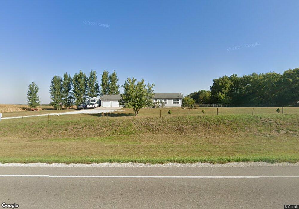
2541 55th St Vinton, IA 52349
Estimated Value: $273,000 - $363,000
3
Beds
3
Baths
1,792
Sq Ft
$185/Sq Ft
Est. Value
About This Home
This home is located at 2541 55th St, Vinton, IA 52349 and is currently estimated at $331,333, approximately $184 per square foot. 2541 55th St is a home located in Benton County with nearby schools including Tilford Elementary School, Shellsburg Elementary School, and Vinton-Shellsburg Middle School.
Ownership History
Date
Name
Owned For
Owner Type
Purchase Details
Closed on
Feb 15, 2006
Sold by
Walters Roger D and Walters Donetta M
Bought by
Lovell Kenneth C and Lovell Michelle L
Current Estimated Value
Home Financials for this Owner
Home Financials are based on the most recent Mortgage that was taken out on this home.
Original Mortgage
$192,600
Interest Rate
6.2%
Mortgage Type
Construction
Create a Home Valuation Report for This Property
The Home Valuation Report is an in-depth analysis detailing your home's value as well as a comparison with similar homes in the area
Home Values in the Area
Average Home Value in this Area
Purchase History
| Date | Buyer | Sale Price | Title Company |
|---|---|---|---|
| Lovell Kenneth C | $26,000 | None Available |
Source: Public Records
Mortgage History
| Date | Status | Borrower | Loan Amount |
|---|---|---|---|
| Closed | Lovell Kenneth C | $192,600 |
Source: Public Records
Tax History Compared to Growth
Tax History
| Year | Tax Paid | Tax Assessment Tax Assessment Total Assessment is a certain percentage of the fair market value that is determined by local assessors to be the total taxable value of land and additions on the property. | Land | Improvement |
|---|---|---|---|---|
| 2025 | $3,692 | $309,100 | $49,000 | $260,100 |
| 2024 | $3,692 | $287,300 | $41,500 | $245,800 |
| 2023 | $3,342 | $287,300 | $41,500 | $245,800 |
| 2022 | $3,314 | $225,600 | $33,200 | $192,400 |
| 2021 | $3,314 | $225,600 | $33,200 | $192,400 |
| 2020 | $3,028 | $216,200 | $38,000 | $178,200 |
| 2019 | $2,930 | $216,200 | $38,000 | $178,200 |
| 2018 | $2,852 | $206,500 | $35,500 | $171,000 |
| 2017 | $2,678 | $206,500 | $35,500 | $171,000 |
| 2016 | $2,464 | $190,600 | $32,300 | $158,300 |
| 2015 | $2,464 | $180,800 | $32,300 | $148,500 |
| 2014 | $2,714 | $195,800 | $0 | $0 |
Source: Public Records
Map
Nearby Homes
- 2492 55th St
- 54th St
- TBD 54th St
- PARCEL "A" LOCA 55th St
- 2575 58th St Unit 1
- 5454 22nd Ave Unit Lot 24
- 5454 22nd Ave Unit 65 & 66
- 2576 58th Street Ln
- 5141 25th Ave
- 206 N 8th Ave
- 203 N 9th Ave
- 912 E 2nd St
- 202 S 9th Ave
- 5589 22nd Avenue Trail
- 314 E 4th St
- 806 E 5th St
- 606 11th Ave
- 1116 E 6th St
- 107 Blue Jay Ave
- 304 Viking Dr
- 2546 55th St
- 2545 55th St
- 2532 55th St
- 2526 55th St
- 2510 55th St
- 5495 26th Ave
- 2491 55th St
- 2491 55th St Unit Lot 4
- 2491 55th St Unit Lot 6
- 2491 55th St Unit 11
- 2491 55th St Unit Lot 8
- 2491 55th St Unit Lot 13
- 5496 26th Ave
- 5460 26th Ave
- 2481 55th St
- 0 55th St
- 5541 26th Ave
- 5507 24th Avenue Dr
- 5505 24th Avenue Dr
- 1000 24th Ave Dr