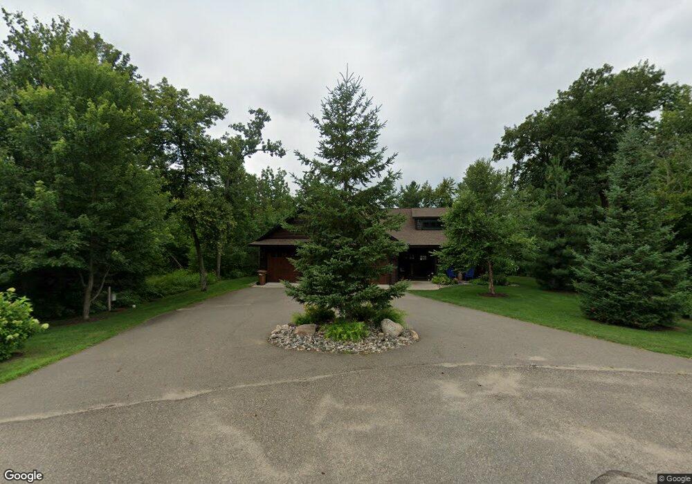
25415 Nisswa Cir Nisswa, MN 56468
Estimated Value: $1,119,000 - $1,657,000
3
Beds
3
Baths
2,164
Sq Ft
$618/Sq Ft
Est. Value
About This Home
This home is located at 25415 Nisswa Cir, Nisswa, MN 56468 and is currently estimated at $1,337,295, approximately $617 per square foot. 25415 Nisswa Cir is a home located in Crow Wing County with nearby schools including Nisswa Elementary School, Forestview Middle School, and Brainerd Senior High School.
Ownership History
Date
Name
Owned For
Owner Type
Purchase Details
Closed on
Sep 15, 2017
Sold by
King William P and King Catherine M
Bought by
Foss Brent and Foss Dawn
Current Estimated Value
Purchase Details
Closed on
May 5, 2015
Bought by
King William and King Catherine
Home Financials for this Owner
Home Financials are based on the most recent Mortgage that was taken out on this home.
Original Mortgage
$310,000
Interest Rate
3.77%
Create a Home Valuation Report for This Property
The Home Valuation Report is an in-depth analysis detailing your home's value as well as a comparison with similar homes in the area
Home Values in the Area
Average Home Value in this Area
Purchase History
| Date | Buyer | Sale Price | Title Company |
|---|---|---|---|
| Foss Brent | $764,300 | -- | |
| King William | $310,000 | -- |
Source: Public Records
Mortgage History
| Date | Status | Borrower | Loan Amount |
|---|---|---|---|
| Previous Owner | King William | $310,000 |
Source: Public Records
Tax History Compared to Growth
Tax History
| Year | Tax Paid | Tax Assessment Tax Assessment Total Assessment is a certain percentage of the fair market value that is determined by local assessors to be the total taxable value of land and additions on the property. | Land | Improvement |
|---|---|---|---|---|
| 2025 | $9,068 | $1,161,200 | $546,700 | $614,500 |
| 2024 | $9,068 | $1,017,900 | $479,100 | $538,800 |
| 2023 | $10,058 | $1,095,400 | $486,000 | $609,400 |
| 2022 | $8,428 | $1,060,800 | $447,500 | $613,300 |
| 2021 | $7,950 | $732,800 | $352,500 | $380,300 |
| 2020 | $7,842 | $676,600 | $333,500 | $343,100 |
| 2019 | $6,234 | $661,600 | $305,000 | $356,600 |
| 2018 | $5,452 | $553,700 | $289,800 | $263,900 |
| 2017 | $5,190 | $525,500 | $270,500 | $255,000 |
| 2016 | $2,436 | $192,700 | $192,700 | $0 |
| 2015 | $2,304 | $178,400 | $178,400 | $0 |
| 2014 | $976 | $156,000 | $156,000 | $0 |
Source: Public Records
Map
Nearby Homes
- 5390 Pine Haven Rd
- L5 B1 Pine Ridge Ct
- L3 B1 Pine Haven Place
- L11 B1 Pine Ridge Ct
- L6 B2 Oak Ridge Ct
- L5 B2 Oak Ridge Ct
- 25447 Twinleaf Cir
- 25448 Oslo Way
- 26197 Mitchell Ct
- 4334 Roy Lake Dr
- TBD Roy Lake Dr
- 24576 Wild Wings Way
- 25305 E Clark Lake Rd
- 24702 White Pine Dr
- 24197 White Pine Dr
- 25522 Roy Ln
- TBD E Clark Lake Rd
- 23904 Summer Haven Ln
- 948 Bass Lake Rd
- 26210 Edna Ln
- XXX Lot 5 Nisswa Cir
- XXX Lot 4 Nisswa Cir
- 25461 Nisswa Cir
- Lot 6 Nisswa Cir
- Lot 5 Nisswa Cir
- Lot 7 Nisswa Cir
- Lot 10 Nisswa Cir
- Lot 8 Nisswa Cir
- Lot 4 Nisswa Cir
- 5370 Merril Ave
- 25537 Nisswa Cir
- 5380 Merril Ave
- 25485 Main St
- 25485 Main St
- 25477 Main St
- 25503 Main St
- 25527 Main St
- Lot 6, Blo Cove Trail
- Lot 6, Block 1 Cove Trail
- 25545 Main St