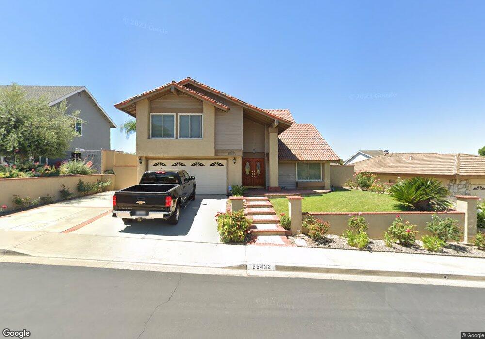
25432 Shawnee Dr Lake Forest, CA 92630
Estimated Value: $1,335,896 - $1,428,000
4
Beds
3
Baths
2,474
Sq Ft
$553/Sq Ft
Est. Value
About This Home
This home is located at 25432 Shawnee Dr, Lake Forest, CA 92630 and is currently estimated at $1,367,224, approximately $552 per square foot. 25432 Shawnee Dr is a home located in Orange County with nearby schools including La Madera Elementary School, Serrano Intermediate School, and El Toro High School.
Ownership History
Date
Name
Owned For
Owner Type
Purchase Details
Closed on
Sep 25, 2020
Sold by
Levy Jonathan K and The Levy Family Trust
Bought by
Percell Dennis M and Percell Leslie A
Current Estimated Value
Home Financials for this Owner
Home Financials are based on the most recent Mortgage that was taken out on this home.
Original Mortgage
$695,200
Interest Rate
2.8%
Mortgage Type
New Conventional
Purchase Details
Closed on
Feb 14, 2005
Sold by
Levy Jonathan K
Bought by
Levy Jonathan K and Levy Family Trust
Purchase Details
Closed on
Jan 4, 1999
Sold by
Levy Jonathan K
Bought by
Levy Jonathan K
Home Financials for this Owner
Home Financials are based on the most recent Mortgage that was taken out on this home.
Original Mortgage
$129,500
Interest Rate
6.82%
Purchase Details
Closed on
Dec 7, 1994
Sold by
Levy Valerie A
Bought by
Levy Jonathan K
Create a Home Valuation Report for This Property
The Home Valuation Report is an in-depth analysis detailing your home's value as well as a comparison with similar homes in the area
Home Values in the Area
Average Home Value in this Area
Purchase History
| Date | Buyer | Sale Price | Title Company |
|---|---|---|---|
| Percell Dennis M | $869,000 | First American Title Company | |
| Levy Jonathan K | -- | -- | |
| Levy Jonathan K | -- | American Title Co | |
| Levy Jonathan K | -- | -- |
Source: Public Records
Mortgage History
| Date | Status | Borrower | Loan Amount |
|---|---|---|---|
| Previous Owner | Percell Dennis M | $695,200 | |
| Previous Owner | Levy Jonathan K | $129,500 |
Source: Public Records
Tax History Compared to Growth
Tax History
| Year | Tax Paid | Tax Assessment Tax Assessment Total Assessment is a certain percentage of the fair market value that is determined by local assessors to be the total taxable value of land and additions on the property. | Land | Improvement |
|---|---|---|---|---|
| 2025 | $9,709 | $940,632 | $753,540 | $187,092 |
| 2024 | $9,709 | $922,189 | $738,765 | $183,424 |
| 2023 | $9,480 | $904,107 | $724,279 | $179,828 |
| 2022 | $9,311 | $886,380 | $710,078 | $176,302 |
| 2021 | $9,126 | $869,000 | $696,154 | $172,846 |
| 2020 | $4,443 | $432,101 | $206,677 | $225,424 |
| 2019 | $4,353 | $423,629 | $202,625 | $221,004 |
| 2018 | $4,270 | $415,323 | $198,652 | $216,671 |
| 2017 | $4,184 | $407,180 | $194,757 | $212,423 |
| 2016 | $4,113 | $399,197 | $190,939 | $208,258 |
| 2015 | $4,062 | $393,201 | $188,071 | $205,130 |
| 2014 | $3,973 | $385,499 | $184,387 | $201,112 |
Source: Public Records
Map
Nearby Homes
- 25495 Morningstar Rd
- 25671 Le Parc Unit 85
- 25671 Le Parc Unit 82
- 25631 Mont Pointe Unit 7D
- 25761 Le Parc Unit 82
- 25761 Le Parc Unit 89
- 25712 Le Parc Unit 7
- 25154 Mammoth Cir
- 25152 Mammoth Cir
- 25614 Mont Pointe Unit 3D
- 25644 Mont Pointe Unit 1A
- 22201 Center Pointe Unit 2D
- 22461 Silver Spur
- 24975 Heartwood Cir
- 25011 Mammoth Cir
- 25912 Densmore Dr
- 21472 Firwood Unit 9
- 24966 Valley Rim Terrace
- 25162 Chestnutwood Unit 47
- 25971 Donegal Ln
- 25442 Shawnee Dr
- 25422 Shawnee Dr
- 25411 Navajo Dr
- 25401 Navajo Dr
- 21961 Hopi Ln
- 25412 Shawnee Dr
- 25452 Shawnee Dr
- 25421 Navajo Dr
- 25391 Navajo Dr
- 21922 Ute Way
- 25425 Navajo Dr
- 25381 Navajo Dr
- 25402 Shawnee Dr
- 25462 Shawnee Dr
- 21951 Hopi Ln
- 21912 Ute Way
- 25451 Shawnee Dr
- 25431 Navajo Dr
- 25371 Navajo Dr
- 22002 Comanche Rd